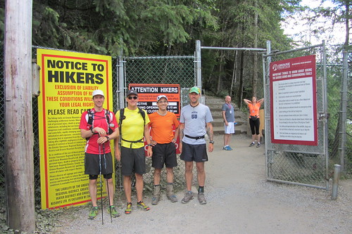
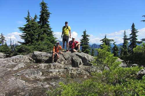
L to R: Spencer Sheinin; Matt Colpitts; Bill Dagg; Andy Healey
Starter photo - 28 July 2013
Report:
I don't know if it was because of the new "bagger" format or some other reasons (it'd be good to hear people's thoughts) but, with a low registration count, some last-minute cancellations, and one no-show, we had a small turn-out of only 3 registrants and myself for this year's, 10th edition, of Bill's Great Peak Ascent. On the plus side, the four who did participate were all relatively evenly paced so it meant we could tackle the peaks together.
Andy, Matt, Spencer and myself left the Grouse Parking Lot somewhere around 7:45 am. The weather conditions were perfect -- sunny and comfortable. The trip up the BCMC was the typical grunt but uneventful with not too many others on the trail as it was still fairly early (in spite of a surprisingly full parking lot at the bottom for the time of day). Everyone took it relatively easy as we all knew we had plenty of climbing yet to do, reaching the Chalet Bug Fest in about 55 minutes.
Not wanting to linger too much in the bug clouds, we headed fairly directly to the peak of Grouse after a quick water top-up at the Chalet. We quickly made our way through the deserted Grouse Resort area away from the Chalet to the base of the peak and the big warning sign about the dangerous route (a road!) to the peak. In spite of the warning, we decided to risk it and bagged our first peak in 1:09.
Grouse Mountain
Quick photos and mutual congrats and we were off towards Dam Mountain. Instead of going back down the "treacherous" road, we opted for Andy's suggestion to take a path on the left immediately before the "Eye in the Sky". This proved to be a great choice with some nice steep trail descents that dropped us out right before the "Dam Mountain, 800m" trail sign, cutting out a lot of boring road running.
Up the switchbacks we headed and, on the 3rd meeting with the green water pipe, headed straight uphill towards Dam. As I'd discovered earlier in the week, for some reason, all of the trail signs beyond that first Dam Mountain one at the bottom have been removed. I imagine Parks removes them for the winter but it's well past the time that I would have expected them to be returned. At any rate, we knew where we were going so it wasn't a concern -- for us (more on this in a minute). A quick ascent past the mud field and heli-pad brought us to the peak of Dam Mountain in 1:32.
Dam Mountain
More congrats. More quick photos. Second peak all to ourselves. Off to Little Goat. After a fun descent to the Alpine Trail junction and very quickly back onto the Ridge Trail (again, no sign posts), we quickly reached the peak of Little Goat, the easiest peak on route, in 1:46. While standing around congratulating ourselves and taking the obligatory photos, we heard a couple of female "Hello? Hello? We're trying to get to Goat Mountain." voices coming from somewhere not too far below us. Damsels in distress!! To the rescue! We told them to stay put and we'd be there shortly.
After no more than a couple of minutes, we found them (Christine? & Heather -- one of them recognized me from Pacific Road Runners) on the trail heading up towards Little Goat -- away from Goat. With all of the sign posts absent, it seems they'd made a left when they should have made a right and were slightly off course. Telling them we too were on our way to Goat, we got them back onto the correct trail and to the Goat - Crown junction. Figuring we'd drop them, we headed off to the peak of Goat. Turns out they weren't any slouches themselves as they pretty much made to the peak (via a slightly shorter route) at the same time. Total time to Goat ~2:10.
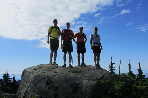
Goat Mountain
Having the ladies at the peak turned out to be to our advantage as it made a group shot easy. For reasons known only to her, Heather decided both front and back shots were important. So, in case you were wondering about the photos … We had a few quick snacks while the ladies retreated to one of the several other areas on the peak because, in their words "We didn't want to share our muffins." Huh? What? Being gentlemen, we decided to leave that one alone and headed off.
By this time, everyone was feeling good and ready from some more adventurous running. Instead of heading back on the Alpine Trail to the Grouse Resort area, we opted for a more direct but much less traveled route between Thunderbird ridge and Mount Fromme via Pipeline Pass. Andy had done this route before (in the opposite direction) and I'd been eyeballing it on the North Shore Trail Map and figured we'd never get better conditions that this to give it a go.
The route off of Thunderbird Ridge starts with a steep decent on an overgrown but still easy-to-follow trail down to Barrier Creek. According to Andy, this is the direction to go as the climb in the opposite direction is significant . Anyway, going down was great fun. After the creek crossing, there's a small boulder field you have to make your way through and then a not too steep climb up the valley on the back side of Fromme following the course of an old pipeline still visible from time-to-time underfoot.
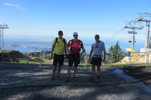
At the top of the pass, Andy, now running out of time, took the right fork out to Mountain Highway while the remaining 3 of us headed left up the now steeper route on the north side of Fromme. This eventually brought us out to a side-trail to Senate Peak (North Fromme), clearly only a couple of minutes off of the main route. We quickly made our way to the rocky peak for a well-earned break. If you've never gone to Senate peak, I highly recommend it. It's at most 10 minutes north of the main, slightly higher, south peak but the views on a good day are far better. This includes a really good perspective on Mountain Highway heading up the side of Grouse you don't normally get.
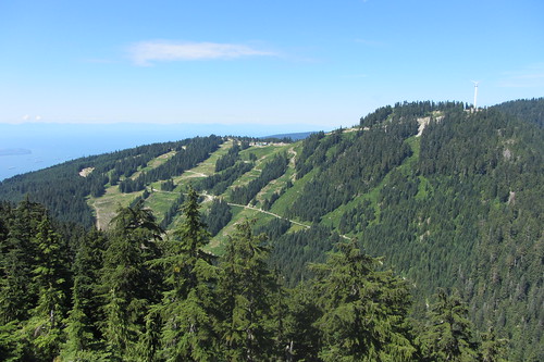
Mountain Highway and Grouse Mountain from Senate Peak (N. Fromme)
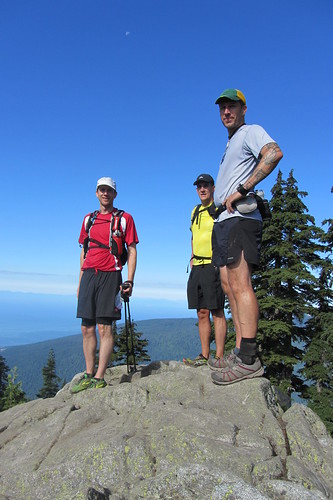
Leaving Senate we made a quick down and up to the true peak of Fromme for a total travelling time (excluding stops) of 3:50. This completed our 5 peak sweep!
Mount Fromme
After a fast and smooth descent on Bill's Trail (not mine) to Mountain Highway immediately south of the Quarry, we parted company as Spencer and Matt wanted to get some more distance in for Matt's Cascade Crest training while I headed the more direct route down Per Gynt, Executioner, Dreamweaver and the BP returning back to the Grouse Parking lot for a total running time of 5:23 (including time stopped while I cursed my 2nd wasp sting of the week -- around Mackay Creek).
Thanks to all the participants. A great way to spend a sunny summer day. Hopefully, next year we'll get even more to enjoy the adventure!
Bill Dagg
Post Event Survey. Please give us your feedback via this brief survey:
http://www.clubfatass.com/events/BillsGreatPeak/posteventsurvey
Photos: A slideshow of images will be posted posted below. If you have photos of the run that you would like to share, please upload them to Flickr, add to the CFA Flickr group and tag with BillsGreatPeak2013 BillsGreatPeak ClubFatAssEvents ClubFatAssEvents2013. They will automatically appear in the slideshow. If you need help please refer to http://www.clubfatass.com/help/general#include_photos and the Flickr help pages.
Results:
|
Participant |
Grouse |
Dam |
Little Goat |
Goat |
Fromme |
Total |
Points |
|
Double Platinum |
|
Matt Colpitts |
1:09 |
1:32 |
1:46 |
2:10 |
3:50 |
?1 |
2 |
|
Bill Dagg |
1:09 |
1:32 |
1:46 |
2:10 |
3:50 |
5:232 |
3** |
|
Spencer Sheinin |
1:09 |
1:32 |
1:46 |
2:10 |
3:50 |
?1 |
2 |
|
Platinum |
|
Andy Healey |
1:09 |
1:32 |
1:46 |
2:10 |
-- |
?3 |
2 |
1 Return via Mountain Hwy & BP
2 Return via Per Gynt, Executioner, Dreamweaver & BP
3 Return via Pipeline Pass, Mountain Highway & ???
No shows (with no notice):
Paul Schrimpf: -1 pt
* garbage point
** event host point


Comments
Thanks!
Thanks for organising this one, Bill. Good times were had.
I took the same route back as you; Per Gynt, Executioner, Dreamweaver & BP, but I wimped out and took the powerline back to the parking lot. I have no idea what my time was.
Coming up from a Hanes Valley loop this morning (first rainy day in a month... who needs stunning, sweeping vistas anyway) I noticed that all the signposts are now up. Should lessen the damsels in distress numbers until next year.