Submitted by Craig Moore on 28 August, 2010 - 18:58.
nice tape, very handy. And I hope all those people keep not going to West Crown because it is such a nice place to sit for while in peace. And really quite a nice route even including the bushwacking.
Submitted by David Crerar on 28 August, 2010 - 17:41.
Up the two peaks of Fromme via Mosquito Creek creek bed and Mosquito Creek Trail and Erik the Red, and down via Bill's Trail: a dy-no-mite day of solitary bagging.
I took the Gondola up (in the interest of saving time, and daylight) with a friend tonight, and we hit Dam and Little Goat.
I'd already done Dam, so that's just a Little Goat for me.
Great sunset views to on side, and a rising full moon to the other. Beautiful.
Also, I don't know if it's too late, or whether or not it's considered, but I heard that Black Mountain is counted if you did the Knee Knacker. If that's so, please add that too, as I did.
Submitted by David Crerar on 19 August, 2010 - 06:08.
One for first place finisher (who is the opposite gender of the first-place finisher) [reigning bagger: Carolyn King] and one for most-bagging sub-16-year-old [reigning bagger: Harry Crerar].
They are beautiful and shiny.
This rounds out the prizes to four quaichs, the others being:
The Munro Quaich (for the greatest bagger of the year) [reigning bagger: Ken Legg] &
The Twisted Quaich (for enthusiasm, for bringing the most new baggers into the Bagger Challenge, and/or for the most outrageous act of folly during the contest) [reigning bagger: Ean Jackson]
Submitted by Ean Jackson on 19 August, 2010 - 11:50.
e.g. a slightly-whacky, trans-genedered, 15 year old who bags all 50 could hypothetically take home 4 quaichs. Were that to be the case, would cola or cranberry juice be served in the quaichs of victory at the Bagger's Banquet?
Submitted by Ean Jackson on 19 August, 2010 - 11:55.
I'm with the Baggermeister on that one. Gotha is a worthy prize and it is achievable by those who are vertigo-challenged. Given your gender, however, it would be challenging for you to pee into Deeks Lake from the summit.
Claiming the tourist bag that is Grouse Mountain Peak - up via the Grind with my son and nephew (who smoked me up the trail but then continued via the chair lift while I walked up...)
Submitted by David Crerar on 16 August, 2010 - 21:46.
As we approach the end of summer and the eight-week countdown to the end of another bagging season, please note the shortening hour. Sundown:
Aug 21, 2010
8:17 PM
Sep 3, 2010
7:51 PM
Sep 10, 2010
7:36 PM
Sep 17, 2010
7:21 PM
Sep 24, 2010
7:06 PM
Oct 1, 2010
6:51 PM
Oct 8, 2010
6:36 PM
Always bag with a headlamp. No bagger has ever ever ever been caught short in the dark on the mountains, in a state of bagging-frenzy: you don't want to be the first.
Good point David. We did a post-work bag of St. Marks tonight planning to be out in the dark (had intended to carry on to Unnecessary until I got sick on the top of St. Marks! :). It was quite dim on the trail when we finished up about 8:45. By 9:15 the trails would have been totally dark.
Submitted by David Crerar on 14 August, 2010 - 21:12.
Gotha, overlooking Deeks Lake, has two peaks of almost exactly the same height. Most maps indicate that the southern (far) peak is the true peak.
To get to the true peak, one must go along the ridge, and then dip slightly down and to the right (towards the lake), before climbing back up to the southern peak.
Past the southern peak, take a few steps down and south for a stunning view of Mt Brunswick and Brunswick Lake, etc.
The southern peak may be past one's comfort level. It is generally safe, but you pass near a near-sheer drop into Deek Lake.
So: northern (near) Gotha Peak will count as a bag. Bagging purists who bag the southern true Gotha Peak can get an "!" beside their GOT bag, which will count like a waterbag (i.e. a tiebreaker).
Submitted by David Crerar on 14 August, 2010 - 21:06.
Ean and I became the first Bagger baggers of Coburg today: report to follow.
It will likely be removed from the Challenge next year. No trail, and a few scary bits: we were out of our comfort level.
Definitely do not attempt unless you are an experienced mountaineer and are safe and comfortable with very steep cliffs. One could very plausibly die here.
On that happy note, the views were spectacular but pretty similar to what you would get from Gotha.
Guy and I did a low visibility triple micro shopping bag.
To experience the full luxury of a shopping bag, we took the gondola up Grouse and stopped in for a civilized natural break at the top before heading out into the wild. We walked up past the tourist attractions and soon found ourselves at the top of Dam. We carried on to Little Goat and then Goat.
We had intended to go on to Crown and Sleeping Beauty, but the 12 m visibility made it less than inspiring. I also thought it would be questionable sportsmanship to overtake Ean in the standings on a day he was out running 100 miles in the rain. (Would that be like attacking in the Tour when your main competition drops his chain? or is that just bike racing, but I digress). We noticed the trail markings were incredibly poor. Many were knocked over, broken off, or simply illegible. We took photos of many off the trail markers in need of replacement and will be sending them to the GVRD for their consideration.
Before heading back down the gondola, I enjoyed shopping for a new running outfit (as per pic above). Of course no shopping bag would be complete without a latte and cinnamon bun :) David, please put the three peaks down for me and Guy, and Guy also did Lynn recently if you can add that too. Happy bagging all!
My next goal is to learn how to make the text wrap around these pics. Sorry I'm taking up so much space.
Despite some trail confusion (will report more on that later to help other baggers avoid our mistakes) Pat Barry, Erik Jackson and Paul and Sibylle Tinsel made it up to Strachan Mountain today. The air was hazy and the blackflies plentyful, but the beautiful alpine flowers, blooming heather and the smell of pine needles made up for it! One bag point for each of us, please.
Submitted by Rick Arikado on 3 August, 2010 - 10:20.
HOL-STR double-bag
Start in Cypress parking lot
Hollyburn & Strachan
Finish in Cypress parking lot
Just over 3 hours running/hiking time, add as req'd for stops.
Access to water: you should have enough with you, tarns look like they should have a minimum a boil water advisory.
Bailout points: in between the two peaks there are numerous small trails heading west to the ski runs.
Mobile coverage: sketchy coverage from Rogers most of the way, picked up signal on way down ski run
Details: From the parking lot head east on the Baden-Powell. Once you are in the trees and on the single track of the BP heading towards Hollyburn Ridge, watch for the first intersection to your left, just less than a kilometer from the parking lot. Coords N49.39583 W123.19405 There is a wooden sign indicating the BP Trail and no immediate sign for the trail heading east and steeply up. Head up and shorthy you will find a sign indicating you are on the way to Hollyburn peak. This trail is not maintained and actually has a warning sign at the top that you may see on your way to Strachan but is probably far quicker than going all the way down the BP to the Hollyburn ridge ski runs and working your way up to the peak from the south. Some deadfall, but not bad.
About 1.5K up this trail you will get to the col north of Hollyburn peak at N49.40351 W123.18765. This is the trail intersection where you head south to Hollyburn or north to the plane crash site and Strachan beyond. I headed south first to bag HOL. There were three people up top having lunch on the rocks, quite surprised to see me appear from the direction I did. Talked to them for a bit, they seemed interested in ClubFatArse ...I made sure they had the spelling correct to look up the website when they got home.
Back down same trail to the north-west to the intersection, then off the the plane crash site at N49.40625 W123.19511. From there it was pretty much due north and up to get to the first and then second (actual) summit of Strachan.
Return trip was the same trail back down to the crash site. Ran into ultra-bagger Tundra and Ken on their way up, just above the crash site. About 50 meters south of the crash site, I turned west and broke out onto one of the ski hill service roads. Headed down for a quick return to the parking lot.
Total time out 3 1/2 hours including stops, just over 10K in distance and 977 meters climbed.
Submitted by David Crerar on 2 August, 2010 - 19:16.
Dam Grouse Little Goat
By Pippa Crerar, aged six-and-a-half
All mountains are big and small. Today we hiked up three mountains. The first mountain was Little Goat Mountain. It was my little sister’s first peak that she climbed on her own pins. She is two years old. We then climbed on some rocks that we called Sheer Cliff Mountain, which wasn’t really a sheer cliff, so we could hike down it.
On the hike we saw lots of bear poo. My little sister gave some good hiking advice: “If you close your eyes, the bear won’t come.”
Then we went to Dam Mountain. We had a good view of The Camel. We had a fun slide down the rocky peak. My sister climbed Dam Mountain on her own, too. Along the way I pretended to be a leprechaun. I sat on a rock, and gave her Sports beans.
Then we hiked up Grouse Mountain. We saw lots of people on the new zip-line. We also saw a grouse: it was a stuffy and made a noise like a quail. We also went up the new windmill called “The Eye of the Wind”. It was really scary. It had a glass floor and you could look straight down. There were lots of good views of mountains. We got ice cream. Then we hiked down Grouse Mountain.
Submitted by David Crerar on 1 August, 2010 - 20:49.
Camping on the peak of Black Mountain offers glorious day and night views, as well as neighbouring Northwest Salamanders in Cabin Lake. The north peak of Black Mountain (aka Yew Lake Viewpoint) is also pretty gorgeous. A basic rule: camping must involve Toblerone and Nutella.
Submitted by Craig Moore on 21 July, 2010 - 10:57.
If you are planning a mid-week trip to Gambier Island between July 5 and August 19, 2010, you may be disappointed. There is logging taking place up the road from New Brighton to Mt. Killam and Mt. Liddell. You will find the road closed from 6:00 am to 4:00 pm Monday to Friday but it will be open after hours and on weekends. Check with the woodlot owner (Billy) by calling him at 604-886-2871. If you approach the island from the north or east during the week you will be fine getting into the area as long as you go back out the same way.
Submitted by Rick Arikado on 19 July, 2010 - 10:41.
What to do with only a few hours on a taper weekend? With Lynn still on my 2010 to-do bag list it was a no-brainer. A quick jaunt up & down Lynn, total time including drive from home and back near Cambie & 7th Ave was 3 hours. Because I hit the top right around noon, there was a big crowd all sitting in the sun on the rocks at the viewpoint below the summit. It appeared very few of them had continued to the actual summit based on all the cobwebs I broke.
I was tempted to continue to the South Needle, particularily when the trail there is so well marked at the junction just below Lynn's summit. Even printed instructions to get to the South Needle posted in a ziplock bag with copies to take. Had I dragged my FatAss out of bed earlier there would have been plenty of time to either include a Needle or two or turn Lynn into a waterbag by running down to Harbourview Park at the mouth of Lynn before heading up, but I did neither.
so Craig and Heather and I went up Mt. Fromme yesterday evening, it was all very exciting and I'm sure there will be photos and a trip report soon. But I'm very new to this elite group, and i'm just wondering who/how to notify to make sure my peak is duly recorded????
Craig is correct. David is out of town. His wife responded in an email to your post, here is what she said:
Hi there! Julia here, David's wife. You have done the right thing - just send your conquests to David and he keeps the list of standings up-to-date. However, at the moment, he is running a 100-miler in the US and won't be able to log in & do CFA stuff until probably Monday, realistically.
So, you won't see your FRO recorded (for Mt. Fromme) for a few days.
I expect there will be a bunch of people bagging peaks this weekend - David will have some catching up to do!
Submitted by Craig Moore on 16 July, 2010 - 09:17.
I sent a note to David (who is away in another country at the moment running a very long distance). He'll post our accomplishment upon return. I suggest you post your own report and keep Bagging. All good words are welcome here, and fuzzy photos too I hope ;) Thanks again for the journey to the top yesterday (please don't tell anyone I tripped for a solid 4 pointer on the way down).
Submitted by Craig Moore on 14 July, 2010 - 23:07.
Hey it was just a recon mission since I ne'er been up there before. Besides, I been sittin' on my fat ass for 1/2 a week on holidays and had some energy to burn so what the heck. I can tell you there is still up to 4 feet of snow up there and ain't no one goin' anywhere fast 'cept on the way down, woooohooooo! Nice views I must say. And I didn't need any flying machines to get me out 'cause there were enough mosquitos I could tie 'em together and fly away. No Bag done, just First and Second Pump as it turns out. But now I know where to go and how to git there.
Thanks for the "recon" and snow report Craig. It's going to be a tough bagging season, with the lingering snowpack. Snow slogs that involve carrying skis the first 3/4 of the way are just icky, I suspect I'll be waiting until Sept before I can do much more. BTW: how has a North Shore raised boy like yourself never been up Seymour?
Submitted by Craig Moore on 15 July, 2010 - 06:49.
I've been out to Dog Mtn a few times in the past but just never beyond there. And I hardly ever skied on Seymour since we only skied Grouse in the olden days. I really must get out more. Thank goodness for the Bagger Challenge.
Submitted by neil ambrose on 14 July, 2010 - 22:05.
Hey...Great to hear the Craig is down! We gave him a special Scottish gift for taking such good care of Kitty while we were doing the West Highland Way. I know he was having a tasting yesterday and thought OMG ;-) he has had more and headed up Seymour!! I think he is secretly training for STORMY 50 miler...
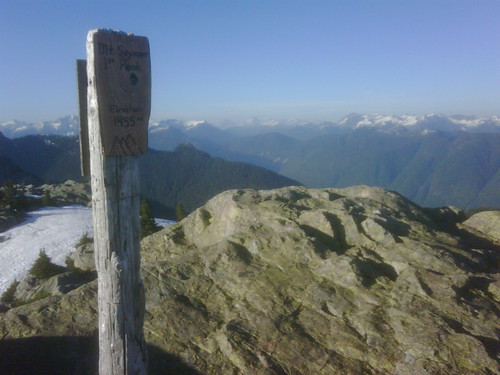
Craig just called from the top of some freakin peak in the Fannin range. He reckons it's Mount Seymour, but wanted to make sure... Altitude on a sign said 1455m (our website sets Seymour at 1449m). Can anybody please shed some light on this?
Submitted by Rick Arikado on 14 July, 2010 - 20:15.
I don't know if I can shed any light - I hope he has a light with him.
Summit of Mount Seymour is at N49.39324 W122.94429 Bivouac.com says 1449m.
Topomap contours are every 20 meters, so it is somewhere between 1440m and 1460m. First and Second Pump are to the south, each approx1435. Mystery Peak is further south and shorter yet. www.env.gov.bc.ca/bcparks/explore/parkpgs/mt_seymour/mtseymour.pdf He should be able to tell by the fact that last part of the trail to summit of Seymour is a deadend, you have to backtrack south away from the peak to an intersection where you go around Mount Seymour: northeast to Elsay Lake or northwest to Runner's Peak.
Submitted by Ean Jackson on 14 July, 2010 - 20:22.
Hey Runrik,
That brings back happy memories, eh?
You in for a clean sweep of the Indian Arm trail in a few weeks? Correct me if I'm wrong, but a clean sweep would be 10 peaks and a new world record if one made it back without the use of a helicopter.


Comments
West Crown...
...is a great unsung peak, isn't it? Did you see my lime-green flagging tape?
very true.
nice tape, very handy. And I hope all those people keep not going to West Crown because it is such a nice place to sit for while in peace. And really quite a nice route even including the bushwacking.
FRO
Where do you get the head-gear?
Speaking of sandbaggers, I thought you had to work?
all work and no play makes me a duller boy
.
How's the view from down there?
Crown - West Crown - Goat on the most beautiful day and night of the year.
Little Goat. And Black?
I took the Gondola up (in the interest of saving time, and daylight) with a friend tonight, and we hit Dam and Little Goat.
I'd already done Dam, so that's just a Little Goat for me.
Great sunset views to on side, and a rising full moon to the other. Beautiful.
Also, I don't know if it's too late, or whether or not it's considered, but I heard that Black Mountain is counted if you did the Knee Knacker. If that's so, please add that too, as I did.
Thanks!
Neck and neck...
...up peak by peak. We have a real race for the quaich under way.
Saturday
I'm dying to see Ean's baggage from yesterday....
zero
zero
New Quaichs have arrived from the Homeland
They are beautiful and shiny.
This rounds out the prizes to four quaichs, the others being:
The Munro Quaich (for the greatest bagger of the year) [reigning bagger: Ken Legg] &
The Twisted Quaich (for enthusiasm, for bringing the most new baggers into the Bagger Challenge, and/or for the most outrageous act of folly during the contest) [reigning bagger: Ean Jackson]
Can you win more than 1 quaich?
e.g. a slightly-whacky, trans-genedered, 15 year old who bags all 50 could hypothetically take home 4 quaichs. Were that to be the case, would cola or cranberry juice be served in the quaichs of victory at the Bagger's Banquet?
Why do you ask?
...you are much older than 15, based on the age group you claimed to be in for your latest ultra.
Woot, woot. What a great
Woot, woot. What a great challenge you started, David. So much fun, even if I will never climb Coburg or Gotha ;-)
Coburg: that shows how wise
Coburg: that shows how wise you are.
Gotha: the north peak is wholly do-able and well worth it! The view is drool-worthy.
Gotha
I'm with the Baggermeister on that one. Gotha is a worthy prize and it is achievable by those who are vertigo-challenged. Given your gender, however, it would be challenging for you to pee into Deeks Lake from the summit.
Anything you can do, I can do (better??)
Sibylle, I think we should organize a Baguettes-only ascent of Gotha to prove to Ean we too can hit the target. Might need to pack our Shenises!
This is hilarious, but might
This is hilarious, but might offend some of you. Only click if you want to see a few shenises in action: http://jezebel.com/313439/the-shenis-or-what-happens-when-girls-pee-standing-up
Gasp, what if I have to pee
Gasp, what if I have to pee ;-)
I gotha coburg a limerick
There once was a lochan named Deeks
Whose ringed mountains each bagger seeks
Two ladies, with glee,
Assume haunches to pee
Which is funny, 'til somebody peeks.
Claiming the tourist bag that
Claiming the tourist bag that is Grouse Mountain Peak - up via the Grind with my son and nephew (who smoked me up the trail but then continued via the chair lift while I walked up...)
Sundown, you better take care
Always bag with a headlamp. No bagger has ever ever ever been caught short in the dark on the mountains, in a state of bagging-frenzy: you don't want to be the first.
"Like Brave Mountaineers We Were Never Much Bothered By Time"
Good point David. We did a post-work bag of St. Marks tonight planning to be out in the dark (had intended to carry on to Unnecessary until I got sick on the top of St. Marks! :). It was quite dim on the trail when we finished up about 8:45. By 9:15 the trails would have been totally dark.
"Up the steps we'll hear [you] climb"
Well done!-- you are both light of foot.
Gotha
Gotha, overlooking Deeks Lake, has two peaks of almost exactly the same height. Most maps indicate that the southern (far) peak is the true peak.
To get to the true peak, one must go along the ridge, and then dip slightly down and to the right (towards the lake), before climbing back up to the southern peak.
Past the southern peak, take a few steps down and south for a stunning view of Mt Brunswick and Brunswick Lake, etc.
The southern peak may be past one's comfort level. It is generally safe, but you pass near a near-sheer drop into Deek Lake.
So: northern (near) Gotha Peak will count as a bag. Bagging purists who bag the southern true Gotha Peak can get an "!" beside their GOT bag, which will count like a waterbag (i.e. a tiebreaker).
A little video about the
A little video about the Royal Sweep of Gotha, Coburg and Windsor from the Brokeback Mountain Heli Team:
Coburg
Ean and I became the first Bagger baggers of Coburg today: report to follow.
It will likely be removed from the Challenge next year. No trail, and a few scary bits: we were out of our comfort level.
Definitely do not attempt unless you are an experienced mountaineer and are safe and comfortable with very steep cliffs. One could very plausibly die here.
On that happy note, the views were spectacular but pretty similar to what you would get from Gotha.
This is gettin' a little embarrassing...
but Guy and I did another shopping bag - Fromme this time. Thanks Ean for introducing me to the shopping bag, who knew bagging could be so civilized.
Multi Micro Shopping Bag
Guy and I did a low visibility triple micro shopping bag.
To experience the full luxury of a shopping bag, we took the gondola up Grouse and stopped in for a civilized natural break at the top before heading out into the wild. We walked up past the tourist attractions and soon found ourselves at the top of Dam. We carried on to Little Goat and then Goat.
We had intended to go on to Crown and Sleeping Beauty, but the 12 m visibility made it less than inspiring. I also thought it would be questionable sportsmanship to overtake Ean in the standings on a day he was out running 100 miles in the rain. (Would that be like attacking in the Tour when your main competition drops his chain? or is that just bike racing, but I digress). We noticed the trail markings were incredibly poor. Many were knocked over, broken off, or simply illegible. We took photos of many off the trail markers in need of replacement and will be sending them to the GVRD for their consideration.
Before heading back down the gondola, I enjoyed shopping for a new running outfit (as per pic above). Of course no shopping bag would be complete without a latte and cinnamon bun :) David, please put the three peaks down for me and Guy, and Guy also did Lynn recently if you can add that too. Happy bagging all!
My next goal is to learn how to make the text wrap around these pics. Sorry I'm taking up so much space.
Olympic Trail Confusion...
Despite some trail confusion (will report more on that later to help other baggers avoid our mistakes) Pat Barry, Erik Jackson and Paul and Sibylle Tinsel made it up to Strachan Mountain today. The air was hazy and the blackflies plentyful, but the beautiful alpine flowers, blooming heather and the smell of pine needles made up for it! One bag point for each of us, please.
HOL-STR double bag
HOL-STR double-bag
Start in Cypress parking lot
Hollyburn & Strachan
Finish in Cypress parking lot
Just over 3 hours running/hiking time, add as req'd for stops.
Access to water: you should have enough with you, tarns look like they should have a minimum a boil water advisory.
Bailout points: in between the two peaks there are numerous small trails heading west to the ski runs.
Mobile coverage: sketchy coverage from Rogers most of the way, picked up signal on way down ski run
Details: From the parking lot head east on the Baden-Powell. Once you are in the trees and on the single track of the BP heading towards Hollyburn Ridge, watch for the first intersection to your left, just less than a kilometer from the parking lot. Coords N49.39583 W123.19405 There is a wooden sign indicating the BP Trail and no immediate sign for the trail heading east and steeply up. Head up and shorthy you will find a sign indicating you are on the way to Hollyburn peak. This trail is not maintained and actually has a warning sign at the top that you may see on your way to Strachan but is probably far quicker than going all the way down the BP to the Hollyburn ridge ski runs and working your way up to the peak from the south. Some deadfall, but not bad.
About 1.5K up this trail you will get to the col north of Hollyburn peak at N49.40351 W123.18765. This is the trail intersection where you head south to Hollyburn or north to the plane crash site and Strachan beyond. I headed south first to bag HOL. There were three people up top having lunch on the rocks, quite surprised to see me appear from the direction I did. Talked to them for a bit, they seemed interested in ClubFatArse ...I made sure they had the spelling correct to look up the website when they got home.
Back down same trail to the north-west to the intersection, then off the the plane crash site at N49.40625 W123.19511. From there it was pretty much due north and up to get to the first and then second (actual) summit of Strachan.
Return trip was the same trail back down to the crash site. Ran into ultra-bagger Tundra and Ken on their way up, just above the crash site. About 50 meters south of the crash site, I turned west and broke out onto one of the ski hill service roads. Headed down for a quick return to the parking lot.
Total time out 3 1/2 hours including stops, just over 10K in distance and 977 meters climbed.
Dam Grouse Little Goat
Where Black is the colour, and three is the number
Camping on the peak of Black Mountain offers glorious day and night views, as well as neighbouring Northwest Salamanders in Cabin Lake. The north peak of Black Mountain (aka Yew Lake Viewpoint) is also pretty gorgeous. A basic rule: camping must involve Toblerone and Nutella.
Black
What a great idea to take the family camping on Black. Never thought of that. Looks like a great sunset that night too.
3 peaks done
Eileen and I took advantage of the proximity of a few peaks on a day - today - when we didn't have much time for bagging.
We made it to Grouse (the real peak), Dam, and Goat. Ran out of time so couldn't stop at Little Goat on the way back. Ah well.
Thanks to Eileen for a great day!
Gambier logging reduces access ...
If you are planning a mid-week trip to Gambier Island between July 5 and August 19, 2010, you may be disappointed. There is logging taking place up the road from New Brighton to Mt. Killam and Mt. Liddell. You will find the road closed from 6:00 am to 4:00 pm Monday to Friday but it will be open after hours and on weekends. Check with the woodlot owner (Billy) by calling him at 604-886-2871. If you approach the island from the north or east during the week you will be fine getting into the area as long as you go back out the same way.
Lynn micro-bag
What to do with only a few hours on a taper weekend? With Lynn still on my 2010 to-do bag list it was a no-brainer. A quick jaunt up & down Lynn, total time including drive from home and back near Cambie & 7th Ave was 3 hours. Because I hit the top right around noon, there was a big crowd all sitting in the sun on the rocks at the viewpoint below the summit. It appeared very few of them had continued to the actual summit based on all the cobwebs I broke.
I was tempted to continue to the South Needle, particularily when the trail there is so well marked at the junction just below Lynn's summit. Even printed instructions to get to the South Needle posted in a ziplock bag with copies to take. Had I dragged my FatAss out of bed earlier there would have been plenty of time to either include a Needle or two or turn Lynn into a waterbag by running down to Harbourview Park at the mouth of Lynn before heading up, but I did neither.
One hour from Lynn to Needles
Dho! Would have earned you another notch on your bagger belt.
my very first peak bagged - what do I do now?
so Craig and Heather and I went up Mt. Fromme yesterday evening, it was all very exciting and I'm sure there will be photos and a trip report soon. But I'm very new to this elite group, and i'm just wondering who/how to notify to make sure my peak is duly recorded????
Hi Liza, Craig is correct.
Hi Liza,
Craig is correct. David is out of town. His wife responded in an email to your post, here is what she said:
keeping Bagging is the answer.
I sent a note to David (who is away in another country at the moment running a very long distance). He'll post our accomplishment upon return. I suggest you post your own report and keep Bagging. All good words are welcome here, and fuzzy photos too I hope ;) Thanks again for the journey to the top yesterday (please don't tell anyone I tripped for a solid 4 pointer on the way down).
you're all too ... thoughtful, thank you.
Hey it was just a recon mission since I ne'er been up there before. Besides, I been sittin' on my fat ass for 1/2 a week on holidays and had some energy to burn so what the heck. I can tell you there is still up to 4 feet of snow up there and ain't no one goin' anywhere fast 'cept on the way down, woooohooooo! Nice views I must say. And I didn't need any flying machines to get me out 'cause there were enough mosquitos I could tie 'em together and fly away. No Bag done, just First and Second Pump as it turns out. But now I know where to go and how to git there.
snow
Thanks for the "recon" and snow report Craig. It's going to be a tough bagging season, with the lingering snowpack. Snow slogs that involve carrying skis the first 3/4 of the way are just icky, I suspect I'll be waiting until Sept before I can do much more. BTW: how has a North Shore raised boy like yourself never been up Seymour?
Killaine, here is Craig's
Killaine, here is Craig's photo from the peak (Craig, you need to figure out how to upload these ;-)
that's a good question
I've been out to Dog Mtn a few times in the past but just never beyond there. And I hardly ever skied on Seymour since we only skied Grouse in the olden days. I really must get out more. Thank goodness for the Bagger Challenge.
For your next adventure....
apparently base-jumping off The Stawamus Chief is really fun.
Glad to have you safely back in civilisation. The Fannin Range is an insane place.
I Thought it Might be the Cragganmor!!
Hey...Great to hear the Craig is down! We gave him a special Scottish gift for taking such good care of Kitty while we were doing the West Highland Way. I know he was having a tasting yesterday and thought OMG ;-) he has had more and headed up Seymour!! I think he is secretly training for STORMY 50 miler...
Cheers!
Carolyn
Phone Call from the Mountains
Craig just called from the top of some freakin peak in the Fannin range. He reckons it's Mount Seymour, but wanted to make sure... Altitude on a sign said 1455m (our website sets Seymour at 1449m). Can anybody please shed some light on this?
Topo says 1440
I don't know if I can shed any light - I hope he has a light with him.
Summit of Mount Seymour is at N49.39324 W122.94429 Bivouac.com says 1449m.
Topomap contours are every 20 meters, so it is somewhere between 1440m and 1460m. First and Second Pump are to the south, each approx1435. Mystery Peak is further south and shorter yet. www.env.gov.bc.ca/bcparks/explore/parkpgs/mt_seymour/mtseymour.pdf He should be able to tell by the fact that last part of the trail to summit of Seymour is a deadend, you have to backtrack south away from the peak to an intersection where you go around Mount Seymour: northeast to Elsay Lake or northwest to Runner's Peak.
Ah, Runner's Peak!
Hey Runrik,
That brings back happy memories, eh?
You in for a clean sweep of the Indian Arm trail in a few weeks? Correct me if I'm wrong, but a clean sweep would be 10 peaks and a new world record if one made it back without the use of a helicopter.