name: Dam Mtn via Eric the Red trail
start: Grouse parking lot
peaks: Dam Mtn
finish: Grouse parking lot
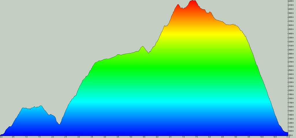
estimated time: 3 ½ to 5 hours
access to water: Mosquito Creek, Grouse Lodge
bailout points: Mountain Highway, Grouse gondola
mobile coverage: varies, I couldn't get signal @ Dam summit but did down in the col where Kennedy Lake comes into view
proposed by: uh ... me
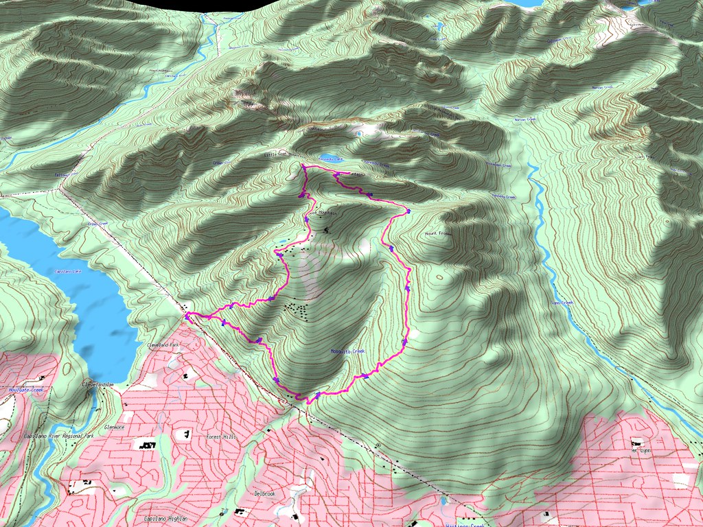
details: From Grouse parking lot head east on BP Trail to Mosquito Creek. Cross bridge and take Old Mountain Hwy trail the second left after the bridge. Take care to not get tricked into taking the wider trails running more or less north-south and stick with the marked single track that goes up & slightly to the right.
Note the makeshift shelter at coords N49.35864 W123.07256
Stay with the up-bound trail at the intersection unless you want to detour to see Kwai Bridge. It turns out this is Bitches Brew not Executioner as I thought last week. A black diamond sign for Executioner can be seen off to your right just before Mountain Highway. Veer left (west) at this point to exit onto the trail that parallels Mountain Highway. Turn right and then left again onto Per Gynt just before you actually come out onto Mountain Hwy. Take Per Gynt up to the next crossing of Mountain Hwy at N49.36559 W123.06323
Turn left onto Mountain Hwy and stick with it north to the big turn at the end of the valley where it crosses Mosquito Creek. Look for trail marked with ribbons and orange markers heading to the north at the bend in the road. N49.38588 W123.06473
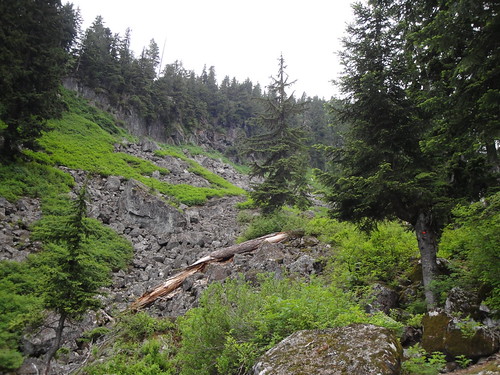
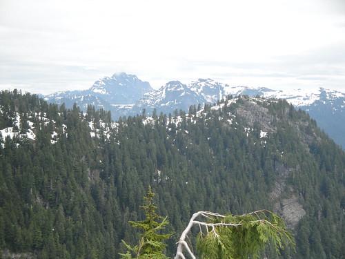
You will come to a trail intersection shortly at N49.38767 W123.06152. Take a right for Mount Fromme or left to Dam Mountain via Eric the Red Trail. Very quickly you will get a nice view across the valley of the south fork of Kennedy Creek. The view is into the upper Lynn Valley towards the Coliseum and the Needles. The trail turns northwest and drops to a boulder field and creek crossing, then climbs steeply up the south side of Dam Mountain. The trail is quite overgrown in places, bugs are voracious and there are some large deadfalls hiding the trail beyond.
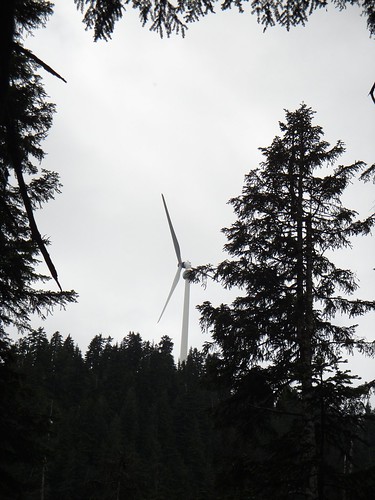
Soldier on and you soon be hear screams coming from the new Grouse zipline. The sounds carry a long way, you won't be there for a while. Soon the new landmark of the Grouse windmill comes into view again.
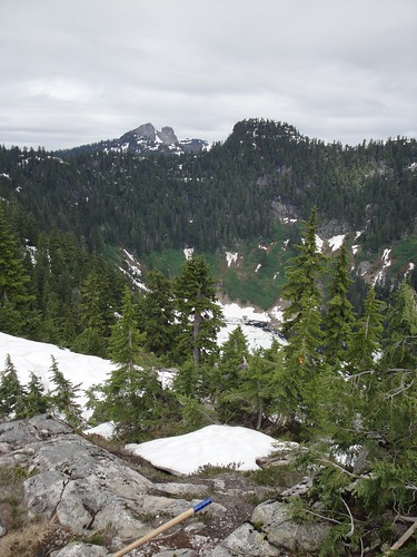
Just before the summit I was back to trekking across snow like last week. Other than the very top you will be in snow for a while unless you wait for a lot more melt.
Views are great to the east and the north.
A quick check to see I had no cell service and on the move again, I was late for a check-in call. A couple was picnicking out on the end of Thunderbird Ridge to the east of Dam summit. They had come from the opposite direction from my route, meaning it was quite easy to follow the trail back towards Grouse. At the intersection that leads south to Grouse or north to Little Goat, Goat and Crown, I thought about bagging Little Goat while I was there. I actually went north for a bit before deciding that the BSO (bagger’s significant other) deserved her check-in call. The Goats will have to wait for a day when I won’t be chancing frostbitten toes in the wet snow getting there. Back at the trail junction I was surprised to see I had full signal strength.
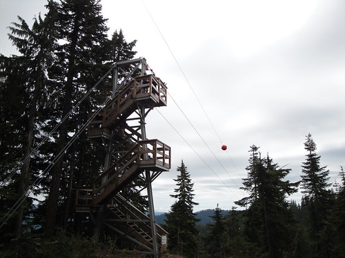
The trail around the bottom of the zipline tower gets a little tough to find as they block off access for the non-paying and unwashed. Then it was onto the road that runs around the west side of Grouse Peak, over to the lodge and down the BCMC Trail to finish the run.


Comments
these Arikado reports....
...set the standard. Brilliant GPS wizardry.