View Mount Collins in a larger map
Where: Mount Collins is the third-largest point of land (412 meters) on Bowen Island. It is located on the north east corner of the island.
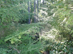
What: A bushwhack. No view to speak of. Our GPS indicated the "peak" to be a small clump of scrubby pines with a bizarre tangle of netting and chicken wire with some partially-buried trash in green garbage bags underfoot.
Route type: Varied. Some wide, gravel trails. A bit of road. Some old logging road and a bushwhack.
Difficulty: Intermediate to expert. This based on the fact that there is no trail to the peak.
Getting there: The easiest and cheapest way to get to Bowen Island is by ferry from Horseshoe Bay in West Vancouver, BC, Canada. The ferry ride takes about 20 minutes.
Trip time: Budget 3 hours out and back from the ferry dock at Snug Cove. This assumes a moderate running pace, where running is possible, and some contingency for getting lost.
Safety: Recommend you bring your Baggers Companion. Cellular coverage is spotty. Fairly dense tree canopy, so GPS also hit-and-miss.
Route Overview: The trail to Mt. Collins is less traveled. There are apparently several possible ways to get there. We opted to access the peak via Honeymoon Lake because it appeared to allow the most running. Here's our route:
- from the ferry, take your first right at the library, then go left onto the Crippen Regional Park trail after about 50M
- nice gravel trail for about 3K. Follow signs to Killarney Lake. Follow left (west) side of the lake then go up to the road. Turn right (north west)
- stay on Mt. Gardner Road about 500M then go right onto Woods Road toward Grafton Bay.
- after about 500M, look for an overgrown logging road on your right. Jump over the ditch and heed the "no trespassing" sign
- follow this road up about 1K up to Honeymoon Lake. Note that the lake is a watershed.
- begin bushwhack. Go right (east) along the lake then up for about 2K. The "peak" is not obvious. Hopefully, you have a GPS. You have arrived if you find a spiderweb of netting.
- return via same route.
Submitted by: Davis Crerar and Ean Jackson.
More information:

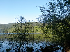
Honeymoon Lake... a fine place to consumate ones' nuptuals.

Any thoughts on why the peak of Mt. Collins is marked with old fishing nets, chicken wire and trash?

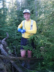
Success! Baggermeister David bags his first peak of 2010.
Comments
Blarney: Killarney
That's Killarney, not Honeymoon, in pic above.
Will the "Real" Peak Please Step Forward
The debate as to the true peak of Collins continues...
Is it the scrubby, piney place Crerar's GPS indicated was the high point? The place with the netting and trash bags underfoot without a view or other redeeming value?
Is it the bump with a bit of a view and a cairn that Killaine rightly claims is the more likely candidate?
Clearly, a mountain may have many high points... but only one is the highest. To wit: neighboring Mount Gardiner that has a "tourist" peak with a great view and an actual peak that has no view, no cairn and no significance at all other than it is higher.
Which of the Collins peaks will be considered the "money" peak for the 2010 North Shore Bagger Challenge?
not to be conciliatory...
...but we may be talking about the same place. To see the netting, we had to plough through an unwelcoming grove of thick trees. Our view from the peak matches Mr Ballantyne's photo.
not to be contradictory...
but do we know Mr. Ballantyne went to the correct peak? :)
seriously though, we have the GPS coordinates from each of the potential peaks so will check them against the map data and see if we can definitively determine The Peak.
Exhibits "A" & "B": Collins mystery solved.
Scope out this view (the Jackson-Crerar yellow-line GPS route viewed on Google Earth): our (west, right) peak is clearly the higher of the two, although the denuded east (left) peak is more 'peak-like'. The west (right) peak is also where Garmin GPS maps place the peak.
Our GPS reading for peak showed 413m, the registered altitude:
506 14/05/2010 4:43:45 PM 413 m 1 ft 0:00:02 0.5 mph 224° true N49 24.387 W123 20.039
In any case, it sounds like Team Sharman-Trotter bagged both: the Piney Garbage Dump (Jackson-Crerar Peak) and the Denuded Knob (Sharman-Trotter Peak), so BCO is theirs, too.
Good Evidence, but Conclusive??
We also thought the position of the little lake just below the peak was another clue, but can't say we thought of too much about it. We have UTM coordinates for both peaks recorded but didn't bother looking at the altitude. Can try checking those against the map just out of interest. I have access to a lot of data so may do some further inquiry just for fun. I notice the BC Gov't calls it 411 metres. What source of info/data are you using?
On another note, isn't calling yourself "Bagger Crerar" a little premature? :)
we can thank...
....bivouac.com for most of the altitude references: bivouac.com/MtnPg.asp
And that moniker is entirely foisted on me by others. My wife has forbidden me from winning it (not that I always obey her...)
oh, you are confident!
Although it will be a woman that stops you from winning it, it won't be your wife. My dog insists he will eat his meat from a silver bowl next year.
Fightin' Words, eh Tundra
Tundra the Ultradog has reportedly already been eating from said silver bowl... and that bitch, Roxy, has been sniffing around, too. I foresee a dogfight in the near future!
Don't think so....
Interesting to read your take on Collins. We explored two possible peaks, one likely to be the one you described (scrubby pine) and the other which we thought was a touch higher and was marked with a cairn. We felt the one with the cairn to be the real peak, seemed a touch higher, more distinct and had a marker typical of a peak. I think you folks may not yet have been to the peak of Collins.....!! Will try to confirm our suspicion with our maps and data.