1. NEW BAGS: Added Crown N1, which has a height of 1408m, and a prominence of 158m. It's located at the west end of the ridge the ends to the NE at Mt Perrault; access is gained from the Hanes Valley Trail. We're eyeing some within-criteria peaks between CRO and PER, as well as the distant back-door bags of Bivouac and Eldee, but these are likely horrible and dangerous. The administrators reserve the right to add further peaks at their sole discretion at any time.
2. GROUP BAGS: we hope to run a few "guided tour" Flash Events throughout the summer. The remote and rewarding playground of Mt Capilano will be a likely destination.
LOCATION: North Shore Mountains
WHAT: See how many North Shore peaks you can run up and bag in a summer. All but the island mountains qualify as munros (in excess of 3000 feet) under the Scottish peak-bagging system.
DATES:
Mainland peaks: June 23, 2013 to October 24, 2013 at 6:30pm
Howe Sound island peaks and Spring Bag front-row peaks (ONLY): April 1, 2012 to October 24, 2013 at 6:30pm
WHERE: non-technical or less-technical (Class 3 or easier) North Shore mountains (listed below). The peak must have its own name AND it must have a prominence of at least 50 metres (i.e. to climb to the next peak one must first descend at least 50 metres).
RESULTS: Post a comment setting out your mountainous conquests (or email "David Crerar" via the CFA Message email service on this site (see left column)), with the dates, and I will post ongoing standings. Please also feel free to post your trip reports in your CFA blog (log in and go to www.clubfatass.com/node/add/bog).
YOUR STORIES: CFA and your fellow Baggers love to hear about your Bagger Adventures. To share your stories, we recommend you blog about them in your CFA member blog. Log in, then go here to get started. You can read about the 2012 adventures posted so far here.
PHOTOS: Please post your photos, too. Add to the CFA Flickr Pool (instructions here. It's easy!), tag your photos: ClubFatAss ClubFatAssEvents ClubFatAssEvents2012 BaggerChallenge2012 BaggerChallenge (with a space separating each tag on the flickr template)
2013 Photos
Photo Archives
STAR BAGS: certain extraordinary methods of bagging will earn the bagger a coveted double-star after the peak, which stars will count as tie-breakers in totals. There are three kinds of star-bags, all of equal weight:
a. WATERBAGS: An ascent up a single peak linking sea level to summit counts as a waterbag. Only one peak per sea level ascent. e.g.: Dip toe in ocean at Ambleside Beach. Run up Capilano Trails and Nancy Greene Way and Grouse Grind. Summit Grouse, Goat, and Crown = 1 waterbag, not three. So long as culmulative height of peak is accompished in single trip, a start is earned.
b. TRUE BAGS: as the true peaks of Crown and Gotha are semi-exposed, and there is a false summit very close, attaining the false peak will get you the point, and attaining the true peak will be starred.
c. GIFT BAGS: during a bag, doing an hour or so of trail maintenance (through trail flagging, sawing of limbs and suckers, and other trail maintenance) will be starred.
SPRING BAGS:in addition to the Howe Sound Island peaks, we've opened up the "front row" of more easily-accessible peaks to the April starting date, for anyone who wants to try a snowshoe bag. ONLY TRY IN CLEAR WEATHER and ALWAYS CHECK THE AVALANCHE REPORTS and BRING THE PROPER EQUIPMENT and BE CAUTIOUS!: BLA, HOL, STR, GRO, DAM, FRO, SLY, LYN, SEY, SUI, DEP.
WINNING TIE-BREAKER MECHANISM: In the case of a tie for first place:
1. non-core peaks (i.e. those not on the North Shore and not listed) will not be counted;
2. if still a tie, the bagger with the most starbags (i.e. 1. water bags (i.e. peaks ascended from sea level to peak: see below) 2. true bags (i.e. true summits of GOT and CRO), 3. gift bags (i.e. trail work)) will win;
3. if still a tie, the bagger with the most unique bags (i.e. peaks that no one else visited) will win;
4. if still a tie, the bagger with the most write-ups and comments posted on the CFA Flickr website will win;
5. if still a tie, the bagger with the most photos posted on the CFA Flickr website will win;
6. if still a tie, the bagger with the most obscure/difficult bags (at the completely arbitrary discretion of the host) will win.
PRIZES: The winner will be the proud bearer of the CFA Bagger Munro Quaich cup for the year: the appropriate cup from which to drink a winter whisky and contemplate how awesome you are. There will be an auxiliary prize for the person who draws the most other people into the cult of peak-bagging. For other prizes, see below.
BAGGERS' BANQUET: To cap off the bagging season, we will either have a get-together at a pub, or else a barbeque for all bagger participants and their significant others. The Bagger Quaich will be awarded.
Date: Friday, October 25, 2013. 6pm - 10pm.
Place: t.b.a.
NO SANDBAGGING: all claims to bagging a peak must be submitted as promptly as possible (in most cases, within 3 days) of the actual climb. Climbs of more than two weeks old will be stale-dated for baggers already in the contest. Old bags by new baggers will be considered on a case-by-case fairness basis at the sole discretion of the administrator: late bags by new baggers late in the season will likely not be counted.
ARCHIVES
2012 Munro Quaich: Bill Maurer: 57 (i.e. ALL) peaks
2012 Pippa Quaich: Carolyn King: 21 peaks
2012 Harry Quaich: Harry Crerar: 15 peaks
2012 Tundra Quaich: Tundra the Ultra Dog: 18 peaks
2012 Twisted Quaich: Team Dagg and Team Healey-Thorpe
ENTRY: There is no fee and you don't need to be a member of Club Fat Ass to participate in a Flash event, however whining is not allowed. That being said, many of the peaks listed should only be attempted by those with the experience and fitness level of a typical Club Fat Ass member (i.e. ample mountain running experience over long distances).
IMPORTANT SAFETY CONSIDERATIONS: All of these adventures are potentially dangerous.
You are responsible for your own well being and safety and should be self sufficient.
Here are two useful lists of "MUST HAVE" survival items that all participants should carry:
Mountains marked with a !!! are scramble ascents or otherwise exposed or otherwise remote and undeveloped and should only be attempted by experienced climbers wearing helmets, etc. Don't try these routes in anything but perfect weather.
Use great caution when rocks are wet -- slipping is the cause of most accidents on North Shore mountains.
Always run/hike with a buddy.
CFA reserves the right to remove anyone from the Challenge for doing reckless, dangerous, destructive, or foolish actions.
PARTICIPATE AT YOUR OWN RISK: YOU ARE WAIVING LEGAL ACTION: By participating in this event you agree to be wholly responsible for your own well-being and agree not to sue anyone associated with this event or Club Fat Ass or any person in relation to this activity. By participating in this event you agree to the terms of the Release of All Claims.
THE 58 NORTH SHORE PEAKS (ranges from west to east)
Altitude listed first, in brackets (metres)
# = Top-12 highest peak
P= Prominence (distance one must first descend before climbing next peak)
[[[ = NOT AN OFFICIAL PEAK in the Bagger Challenge, due to real exposure. Should only be attempted by experienced and competent alpinists. Attaining one of these peaks will nonetheless count as a bagger point.]]]
Peak notes (in round brackets at end)
peaks in italics indicate those baggable from April 1st.
for greater certainty peak ("pk") location among several possible summits (North,South, East, West)
*** as the true peaks are semi-exposed, and there is a false summit very close, attaining the false peak will get you the point, and attaining the true peak will be starred and count as a starbag (i.e. a tie-breaker).
e.g. the proper peak of Crown is a hair-raising wedge of rock with an impressive drop on 3/4 sides; attaining the (unscary) platform just below this true summit will get you a point).
e.g.2 the proper peak of Gotha is the south peak, which is a semi-hair-raising traverse above a semi-sheer drop into Deaks Lakes way below; attaining the northern peak, with nearly identical height, will get you a point.
Resources and hyperlinks
103 = Bryceland & Macaree, 103 Hikes in Southwest British Columbia
MG = Matt Gunn, Scrambles in Southwest British Columbia
DH = Dawn Hanna, Best Hikes and Walks of Southwestern British Columbia
12= trip reports and maps
AB= peak photos
Note: the links to trip reports won't work unless your page is set to "50 comments per page" (the default setting)
Difficulty and Quality Rating {purple; in fancy brackets}
Difficulty: Hard; medium; easy
K = best hikes for kids
!!! = Dangerous: exposed or real risk of falling rock
!!!!!!!!! = Very dangerous; experienced mountaineers only
&& = trail at times faint or nonexistent; need route-finding skills
Quality: 1-5, with 1 being the best and 5 the worst
For a guided tour of the Bagger Peaks on Google Earth please click download the file attached below and open with Google Earth (and try the 3D flight simulator option under "tools"!)
For a full size Bagger map click on the image below:
Tied places will be listed with the following priority:
1. most water bags;
2. most unique bags (i.e. peaks that no one else visited);
3. most obscure/difficult bags;
4. most write-ups and comments and Bagger Challenge blog entries posted on the CFA website;
5. most photos posted on the CFA Flickr website.
Bagger Challenge - 2009 Results
2009 CFA Bagger Quaich Champion (non-canine division): Kenneth Legg
2009 CFA Baguette Champion (Bagger Champion, female division): Carolyn King
2009 Preteen Bagger Champion: Harry Crerar
2009 Canine Division Bagger Champion: Tundra the Ultra Dog
FINAL STANDINGS (October 22nd) [of 44 peaks in total] [Peaks and totals in square brackets = total 2009 bags from official list (including those outside Baggers Challenge time period]
EJPowderhound Jackson: 3(2): STR, LYN, Fat Ass Peak
Glenn Dorey: 2: ART, LEA
Doug Keir:2: LYN, GRO
Kathryn Webb: 2: LYN, GRO
Simon Cowell: 2: BRU, BLA
Donald Golob: 2: HOL, STR
Jojocheesepig Jackson: 2(1): STR, Fat Ass Peak
Rob McDonald: 1: DEA
Olav Brusletto: 1: NEE
Jill Warland: 1: BLA
Marilyn Tschirhart: 1: GAR
Ron Tschirhart:1: GAR
Peter Rietveld: 1: GAR
Bagger Challenge 2009
1 Jul 2009 00:00
22 Oct 2009 20:30
Location:
North Shore Mountains
WHAT: See how many North Shore peaks you can run up and bag in a summer. All but the island mountains qualify as munros (in excess of 3000 feet) under the Scottish peak-bagging system.
DATE: Between July 1 and October 22, 2009.
WHERE: non-technical or less-technical (Class 3 or easier) North Shore mountains (listed below). Although I can't list them all, I'll record peaks in Fraser Valley, and Squamish to Whistler peaks (although if push comes to shove, and there is a tie, the listed peaks will be counted). Official totals below are in brackets.
RESULTS: Email me your mountainous conquests, with the dates, and I will post ongoing standings. As I’m lazy, wait until you have three or four bagged before sending them in.
Please post your photos, too, via the CFA Flickr site: http://www.clubfatass.com/photogalleries (instructions here:www.clubfatass.com/help/image It's easy!). Please tag your photos: ClubFatAss ClubFatAssEvents BaggerChallenge2009 (space separating each tag on the flickr template)
WINNING TIE-BREAKER MECHANISM:
In the case of a tie for first place:
1. non-core peaks (i.e. those not on the North Shore and not listed) will not be counted;
2. if still a tie, the bagger with the most photos posted on the CFA Flickr website will win;
3. if still a tie, the bagger with the most unique bags (i.e. peaks that no one else visited) will win;
4. if still a tie, the bagger with the most obscure/difficult bags (at the completely arbitrary discretion of the host) will win.
NO SANDBAGGING: all claims to bagging a peak must be submitted as promptly as possible (in most cases, within 3 days) of the actually climb (perhaps more if you have to stay overnight), and climbs of more than two weeks old will be stale-dated. Amnesty for submitting late peaks: October 4th
PRIZE: The winner will be the proud bearer of the CFA Bagger Quaich cup for the year: the appropriate cup from which to drink a winter whisky and contemplate how awesome you are.
There will be an auxiliary prize for the person who draws the most other people into the cult of peak-bagging.
BAGGERS' BANQUET: To cap off the bagging season, we will be hosting a barbeque for all bagger participants and their significant others. Bagger burgers (meaty and veggy) will be served. The Bagger Quaich will be awarded (unless the host wins, in which case there will be awkward silence on this topic).
Date:Friday, October 23rd. From 6pm.
Place:1368 West 21st Street (near Capilano Elementary School, in Pemberton Heights).
RSVP jeldac "at" shaw "dot" ca
Entry: There is no fee and you don't need to be a member of Club Fat Ass to participate in a Flash event, however whining is not allowed. That being said, many of the peaks listed should only be attempted by those with the experience and fitness level of a typical Club Fat Ass member (i.e. ample mountain running experience over long distances).
No registration is required but please send your report of bagged peaks (wait until you have 3) to David (as a member you can click on David's user name and message him; if you are not a member please use the comment function below).
Important safety considerations: All of these adventures are potentially dangerous.
Mountains marked with a ** are scramble ascents or otherwise exposed or otherwise remote and undeveloped and should only be attempted by experienced climbers wearing helmets, etc. Don't try these routes in anything but perfect weather.
Use great caution when rocks are wet -- slipping is the cause of most accidents on North Shore mountains.
Always run/hike with a buddy.
You are responsible for your own well being and safety and should be self sufficient.
Here are two useful lists of "MUST HAVE" survival items that all participants should carry:
Release of All Claims. By participating in this event you agree to be wholly responsible for your own well-being and agree not to sue anyone associated with this event or Club Fat Ass or any person in relation to this activity. By participating in this event you agree to the terms of the Release of All Claims.
QUALIFYING MOUNTAINS (ranges from west to east) Howe Sound Islands
Mt. Liddell (Gambier Island) (904m) (LID)
Mt. Killam (Gambier Island) (844m) (KIL)
Mt. Artaban (Gambier Island) (615m) (ART)
Mt. Gardner (Bowen Island) (727m) (GAR)
Leading Peak (Anvil Island) (765m) (LEA)
Lions/Howe Sound Crest Trail Area (&&& = new route HSCT passes right over these peaks: old route drops down east towards Hanging & Enchanted Lakes, bypassing James Peak) maps.google.ca/maps/ms
St. Mark’s Mountain (1355m) (MAR) &&&
Unnecessary Mountain (1548 m) (UNN) &&&
West Lion (1654m) ** (LIO)
James Peak (1466m) (JAS) &&&
David Peak (1480m) (DAV) &&&
Mount Harvey (1652m) (HAR)
Brunswick Mountain (1788m) (BRU)
Hat Mountain(1644 m) (HAT)
Wettin Peak (1538m) ** (WET)
Mount Hanover (1748 m) ** (HAN)
Mount Windsor (1689 m) (WIN)
Deeks Peak (1672 m) (DEE)
Gotha Peak (1641m) ** (GOT)
Capilano Mountain (1685 m) (CAP)
Cypress Group
Black Mountain (1217m) (BLA)
Hollyburn Mountain (1325m) (HOL)
Mount Strachan (1454m) (STR)
Grouse Area
Mount Fromme (1185m) (FRO)
Grouse Mountain (1231m) (GRO)
Dam Mountain (1349m) (DAM)
Goat Mountain (1401m) (GOA)
Little Goat Mountain (1323m) (LIL)
Crown Mountain (1504m) (CRO)
West Crown / Sleeping Beauty Mountain (1400m) (WCR)
Lynn/Cathedral Range
Lynn Peak (1015m) (LYN)
The Needles (1258m) ** (NEE) (nb South Needle at 1163m qualifies for a bag -- see below)
Coliseum Mountain (1441m) (COL)
Mount Burwell (1541m) (BUR)
Cathedral Mountain (1737m) ** (CAT)
Fannin Range
Mount Seymour (1449m) (SEY)
Runner Peak (1370 m) ** (RUN)
Mount Elsay (1419m) (ELS)
Rector Peak (1270m) ** (REC)
Curate Peak (1266m) ** (CUR)
Vicar Peak (1247m) ** (VIC)
Mount Bishop (1509m) ** (BIS)
Deacon Peak (1495m) ** (DEA)
Presbyter Peak (1487m) ** (PRE)
Mount Dickens (1288m) ** (DIC)
FINAL STANDINGS (October 22nd) [of 44 peaks in total] [Peaks and totals in square brackets = total 2009 bags from official list (including those outside Baggers Challenge time period]
EJPowderhound Jackson: 3(2): STR, LYN, Fat Ass Peak
Glenn Dorey: 2: ART, LEA
Doug Keir:2: LYN, GRO
Kathryn Webb: 2: LYN, GRO
Simon Cowell: 2: BRU, BLA
Donald Golob: 2: HOL, STR
Jojocheesepig Jackson: 2(1): STR, Fat Ass Peak
Rob McDonald: 1: DEA
Olav Brusletto: 1: NEE
Jill Warland: 1: BLA
Marilyn Tschirhart: 1: GAR
Ron Tschirhart:1: GAR
Peter Rietveld: 1: GAR
10 Points for Effort - Zero Points for the Bagger Challenge
Mid September, the family had planned and hoped to camp at the Frosty trail race and enjoy a last late season camping trip...but circumstances saw us throwing a birthday party for a freshly minted teenager and hauling dirt for the never ending backyard project...
No wonder that when this weekend promised glorious sunshine and dry skies, we were plotting an escape into the back country, tent and kids in tow. Since we are all a bit wound up with the amazing Bagger Challenge, why not try to hike with the family, camp out overnight AND bag some peaks? I had some reservations about being left alone with the rug rats in the cold mountains, while ActionJackson and a few other Fat Asses would be bagging peaks, but I couldn't say no to a weekend away.
Friday night, Wendy Montgomery confirmed that she'll join us and we quickly figured out a menu and a packing plan to avoid hauling up two of everything. I was in charge of dinner, Wendy took on chocolate and coffee. Which worked out great, since my stash of chocolate miraculously disappeared.
The Happy Bus left shortly after 9:00am Saturday morning. In retrospect, that was a tad late, but after a busy week, we all felt we deserved to sleep in a bit. By 10:00 we were on our way from Porteau Road up the Howe Sound Crest Trail towards Deeks Lake. By 10:15 Neil and Caroline Ambrose confirmed that they would be catching up to us and keep Wendy company while bagging Hat and some other mountains. Jackson had committed to climb Hat with us but then had his eyes on Hanover Mountain. But I am getting ahead of myself.
The trail follows a rough gravel road steep up into the mountains. We were moving at a good clip, but my heavy pack soon slowed me down. EJPowderhound didn't like the gravel road and kept me company, but as soon as our path turned into a rough little trail he sped up too and left me in the dust. I was cursing not to have loaded some more gear into the kids packs...mine was definitely too much for me.
After what seemed an eternity of steep uphill along a rushing river (Deeks Creek), countless waterfalls and millions of mushrooms, the trail emerged at Deeks Lake and into some sunshine. I was hoping that my crowd would have waited for me, but I only heard a brief, "there you are" in the distance and continued alone along the lake. My water bladder nozzle was leaking and stopping the cold water from dripping on me was becoming very aggravating. I tried to enjoy the marvelous views of the mountain ranges around Deeks Lake but was too caught up feeling miserable and lonely.
Finally, Ean was waiting at what would otherwise have prompted me to sit down and cry...a log jam river crossing...and the logs were very slippery. Luckily, Ean was kind enough to relieve me of my pack, so that I could elegantly bum slide across and quietly mumble something about turning around. Things looked up from here though. I am not fond of lone hikes and company soon revived my spirits...didn't even flinch when we had to climb up a slippery rock face with the help of some frayed rope. The views got better by the minute and soon we saw beautiful, turquoise blue Brunswick Lake appear through the trees.
We made camp just up from the lake near a tiny emergency shelter. Ean, Erik, Caroline, Neil and Wendy decided to make a dash for Hat Peak. But considering my slow speed and the fact that we were at the snow line, my daughter and I decided to hold the fort and stay put. We had hot soup ready for the cold climbers when they returned from their semi successful mission (I let Caroline elaborate on that). Caroline and Neil said their good byes and returned to their car.
A feast of Mac'n Cheese, peperoni's, chicken and chocolate filled our bellies. We even got a good fire going thanks to some fire starter and the macaroni boxes. We saw the first stars and a full moon but by 8:00pm we were tucked into our sleeping bags. Wendy, JoJo and Erik complained that they were cold, but Ean and I were toasty in our down bags.
It was hard to get going in the morning. Every thing was frozen solid and only a cup of hot coffee finally got us in gear. Wendy and Ean decided to attempt humble looking Wettin Peak to the west of our idyllic spot. EJPowderhound and JoJo and I packed up and then explored the shoreline. Down at the water the sun was blazing and tempted EJPowderhound and me to a brisk dip in the ice cold water. Brr, very refreshing.
Early afternoon, and the two baggers returned full of adventure and bum sliding stories. Our return trip was relatively uneventful: blue skies, more views, a lot of downhill...oh, and the kids didn't even notice that they carried a bit more downhill than they had uphill - it certainly made a difference for me
Around lunch time today, I found myself alone, in a nearly vertical chute of snow, frozen moss and loose rock inching my way up a godforsaken bump on an obscure ridge-line.
Some background: Wettin Peak is below Brunswick Peak, between Hat Mountain and Deeks Lake. There's no known trail to it, or at least, no trail I've been able to find information on. It’s not an imposing peak at all, rather a rise on a ridge-line below Hat Mountain. But it's a named peak in the Baggers Challenge. All of the other peaks in the area were either well buried in snow and inaccessible to a dude in shorts and running shoes, or I'd bagged them already. So my friend Wendy and I set off on a little bushwhacking expedition we figured would be as simple as pie.
It was sunny, but unseasonably cold at about -2C. The forest was alpine old growth, so apart from fallen logs and other debris, it was relatively easy to pick our way about 1/2 way up the side of the mountain. It then got steeper and steeper as we made our way up a narrow gully. Wendy had the common sense to turn around, but given the intense competition in the Baggers Challenge, I needed this peak if I were to have a realistic crack at winning the coveted Quaich. I continued upward.
Wendy was now about 300m below me. If I dared look down between my legs, I might have seen her looking up at me thinking, "if one of those stubby little pieces of blueberry bush he's trying to grab gives way, he'll probably not even bounce once before he lands directly on my head!"
Everything was so simple. No worries about mortgages, which party to go to next weekend or what would I have for dinner tomorrow. There was one thing on my mind: if the root broke, would I fall backwards and slide over the cliff below head-first, or would I have time to flip over and self-arrest before reaching the edge?
My thoughts turned to George Mallory. Mallory, if you recall, may have been the first person to ascend Mount Everest way back in 1924. What would Mallory have done if he were in the same pickle I was in? The similarities are amazing. We were both bagging peaks. The stakes were high. We'd probably been separated from our climbing partners and we were most probably well out of our comfort zones. Mallory may have bagged Everest. Then again, he may not have. His freeze-dried bones were found a few hundred meters below the summit in 1999.
OK, OK. Wettin Peak is not Mount Everest. Mallory didn't have an FRS radio and a cell phone with him, nor did he have Tim Jones and the North Shore Rescue team to haul his broken carcass off the mountain... but you get my drift.
So I asked Mallory what he thought I should do. " Damned if you do. Damned if you don't. Forge on!", he said. So from that point, there was no going back. I tried kicking the sides of my shoes into the frozen dirt for a foothold and reaching over and up for the next root or rock to grab. I jammed my knees into rocks to leverage myself upward a few more inches. My daughter radioed from below, "Everything OK?" "Sure," I replied, "Almost to the peak."
After about a half-hour more of grinding up that mess, pulling myself through a tangle of bushes at the top of the chute and traversing a wide meadow of deep snow, I arrived at the Wettin summit: a little rocky outcropping without as much as a bit of orange surveyor tape to mark its presence.
I asked Mallory if he thought it was worth it. "A peak is not truly bagged unless you survive to celebrate your achievement," he said. Something to chew on as I headed back down through the snow to the chute of doom.
Needless to say, I made it out of there and back in one piece. Was it fate, blind luck or the ghost of Mallory that prompted me to drop down a different chute?
Seven Days of Baggery Makes One Weak
I think I have Bagger's Fever. The symptoms have been particularly acute this past week:
insomnia. inability to sleep nights knowing my pals might be bagging while I am sleeping
anxiety. There are peaks out there I have never bagged and that I must bag before I die. Better yet, on or before 22 October 09
weight loss. Inability to eat enough to replace lost calories
intestinal distress. Visceral desire to be playing outdoors while weather is fantastic. Too many blueberries. Too many gels.
It has been an eventful week. Certainly the most prolific and exciting week of bagging I have ever experienced! A short account and links to photos follow. First, however, some background and clarification of terms I might reference, in case you were wondering which planet I'm from:
Bagger. A participant in the Bagger Challenge. Someone who is actively bagging mountain peaks in and around the lower mainland of British Columbia. (Females are baguettes?)
Baggage. The peaks bagged by a bagger.
Bushwhacking. What a bagger does when (s)he is not on a trail.
Bagger's Shins. What baggers get when bushwhacking.
Bagger's Itch. My psychological affliction. Also malaise caused by acquiring too many pine needles in shorts while bushwhacking.
Double Bagging. Bagging the same peak twice during an annual Bagger Challenge.
A preamble to my week: I had hoped to run my 100th ultramarathon at the Frosty Mountain 50K last Saturday. For a bunch of good reasons, I didn't make the start. I shouldn't have felt bad about not going, but I did. So I was a bit bummed at the start of the week. Friends Peter Rietfeld and Wil Rougahles from the Netherlands arrived on their bikes after a ride from Calgary on Sunday afternoon. We drank a lot of beer and burned some meat on the BBQ.
Monday. Peter, a former Dutch national champion ultramarathoner, wants to do the Vancouver hash. On on! It's in Stanley Park. Peter and I lead the pack and find the BS (beer stop) before the beer arrives. My pal's dogs get sprayed by a skunk. Peter, Wil and I return home and sample some good old Canadian Sleemans beer.
Tuesday. It's Peter's birthday. Wil sleeps in. I take Peter to Bowan Island and we bag Mount Gardiner on an exceptionally beautiful fall morning. Celebrate with more Sleeman's upon our return. Go to SFU to teach a business class. Have some beers on the deck of the Highland Pub with my guest speaker and a bunch of students after class. Delightfully warm evening. Arrive home to email from the current leader of the Bagger Challenge. Take the bait and agree to pick him up around 07:00.
Wednesday. Pack according to Bagger's Essential Companion, but in haste, forget the knife and lighter. Off and running direction Indian Arm Trail at 07:15. Hammer our way to Runner Peak. Take the "easy" route up the ice, then a cliff. (Read it and weep, RunRik!) Continue on to bag Mt. Elsay and a slew of religious peaks (Rector, Curate, Vicor, Bishop, Presbyter.) Not a worry in the world... except how to get back to the car by 19:00! Decide the quickest way home is to take a water taxi from the Wigwam Inn at the head of Indian Arm. Do a bit of bushwhacking (OK, about 800m of it!) and lose some time. Continue the bushwhack part way up one of the Dickens. Now dark. No cell reception. Bag Dickens #1, then #2, then #3, then it's midnight and the start of another day.
Thursday. Continue to run along a ridge to nowhere. No exit to Wigwam Inn to be found. Given we're en route for Squamish, decide to double back. Route-finding a nightmare with headlamps in the dark. Decide to hunker-down around 02:00. Make a comfy bed of cedar boughs and tuck in under a space blanket. A lot colder than the night before on SFU pub patio! (CENSORED.) Decide to head down to Seymour reservoir at 04:00. Try the cell at Dickens #2 (renamed Brokeback Mountain) just before dawn. Works! Learn that loved ones have called NS Search and Rescue around midnight. Chopper arrives at 07:00 and takes us back to car, both home by 08:15: total time of 24 hrs, of which 22 hours on the run. Eat all leftovers from BBQ I missed last night. Catch up on email, make some calls and haul a couple dozen wheelbarrows of dirt into my backyard. Bagged 10 peaks in past 24 hours, so pass on the opportunity to go for an evening run.
Friday. Have to make some money and get some work done in the back yard. Feel guilty for not bagging anything.
Saturday. Up at 05:00 to meet Paul at 06:00 for some baggage on the Howe Sound Crest Trail. Guestimated five hour run ends up being 12 hours. Bad case of Bagger's Shins on top of raw scars from 2 days prior. More breathtaking views. Miss another BBQ.
Sunday. Double bag Mount Strachan, this time with Wendy and my family. Eat more blueberries. Harassed by other baggers out bagging the Indian Arm trail, Gambier, etc. Retrieve the magic rock from its hiding place on Cypress Mountain and put it in my back yard. Haul a few more wheelbarrows of dirt into back yard. Eat a hearty feast of boletes in garlic butter with homemade bread. Celebrate life with a few pints of hefeweizen and 1/2 price pizzas at the Taylor's Crossing pub. Another crappy day in paradise, but can't sleep knowing that:
the monsoons will soon come and there are peaks yet to be bagged
Tundra the Wonder Dog may have overtaken me in the Baggers Challenge
The Bagging of Runners Peak
Sunday 2 August 2009... a date that will go down in the record books for my buddy Rick and me.
It started innocently enough. With just under a week to go before the STORMY ultras, we thought we'd get in a final shakedown run and bag a peak or two for credit in the 2009 Bagger Challenge.
Rick came by to pick me up at 8:30. As I debated whether to go with one handheld or my Nathan bra-pack, we sketched out a 2 hour itinerary on Mount Seymour. The skies were cloudless. It had been a week of record-breaking high temperatures, but the forecast for the day was high 20C degrees... pleasant in comparison. How to maximize the number of peaks we could bag in a 2-3 hour run? I opted for the hydration pack, stuffed a couple of granola bars and a gel in with my whistle and a vest and off we went.
Some history: About 5 years ago, it came to be known that the Indian Arm Trail had never been bagged by a runner (e.g. run from start to finish.) At the time, Rick and I were on a rampage of bagging some of the longer hikes in the lower mainland such as Lynn Lake and Colosseum and being first baggers of the Indian Arm Trail had appeal. One similarly fine Sunday morning in August, Rick, Dommer and I ran to the back of Mount Seymour to scout how "runnable" the Indian Arm Trail was. After about 250m on the trail, we concluded that it was not "runnable" at all and gave up. (Note: Murray Comley since fast-packed the thing in 2 days and almost got his ass kicked.)
Some geography: there is a very popular hiking trail that goes from the Mount Seymour parking area to Mount Seymour via Mystery Peak, First Pump and Second Pump. Total return distance is about 10K. Just beyond Mount Seymour is Runner Peak and then Mount Elsay. From Seymour you can almost touch Runner Peak.
As runners, we figured it was appropriate to bag Runner Peak... and so it became our destination as we jogged out of the parking lot.
Now, Rick and I don't take the Bagger Challenge lightly. Rick was careful to document our route on his GPS and I took photos with my new bombproof Olympus camera at the summit marker of each peak we bagged. Since Rick had programmed in the coordinates of several geocaches, we also shook a few bushes and turned over a few stones en route. By 10:30, we arrived at the summit of Mount Seymour.
The views were breathtaking. You could see the entire lower mainland of BC. Towards Whistler, the sky was hazy from forest fires. Someone with a good arm could almost throw a rock and hit the summit of Runner Peak and Mount Elsay wasn't far beyond. As we left the main trail, there was talk of bagging them both.
Literally and figuratively, things went downhill from there. The trail was more of a gopher path that dropped precipitously down the side of the mountain. While there was an occasional bit of surveyor tape on the ground or a stone marker, they were very hard to spot. We spent a good bit of time route finding.
We passed though bugland as quickly as possible, but still our noses, ears and eyes were quickly filled with no-see-ums and mosquitoes... not a good place to break a leg! The trail briefly contoured Mount Seymour, then dove down again, eventually bottoming out on a snowfield between Seymour and Runner peaks before climbing steeply back up again.
Eventually, we concluded that there was no trail to the top of Runner Peak and that we'd have to bushwack. What were we expecting? There was no trail on our map or the GPS. Our run was now well into its 3rd hour and we were cutting trail.
Needless to say, our slog up the peak was slow and more than a tad treacherous. We crawled on all fours and pulled ourselves up the side of the spire by holding onto the roots of bushes. But we made it. Then discovered that Runner Peak was made up of several peaks and the one we were on appeared to be the lowest of the bunch.
Neither Rick nor I wanted to go down what we just climbed up, so we went down a saddle and climbed the next peak. It was rough going, to say the least. You sure didn't want to fall up there. No place to land a helicopter. It would take a coon's age to haul someone out if Search and Rescue needed to be called-in.
After achieving our goal, we ventured down a skree slope. It eventually became a steep field of prickle bushes that narrowed into the void. Carefully holding onto roots, we went as far down as we could before the slope became so steep we couldn't go any farther without falling. Bad plan. We bushwacked back up and tried another slope. Equally bad plan. Water, food and time running out, we opted to exit the way we came up. Good plan, though bad for the ego and for our battered and bloodied legs.
The gopher trail looked like a super highway in comparison to what we'd come from, but was not any easier to follow on the way back. Rick followed a piece of tape. It had probably fallen off a bush and been carried down the slope in a rain storm. Needless to say, it was a "falsie" and we almost got our asses kicked yet again. Now 5 hours into it, we were beginning to think we might not make it home for dinner. It was way hotter than the weatherperson on the radio said it would be this fine afternoon. I began to wonder whether I'd be drinking a cool beer or my own pee first.
Back at the snowfield, Rick stuffed his bottles with snow as I looked for runoff to fill my pack with. I could hear a waterfall in the distance, but couldn't get at the water under the surface. I imagined cold beer waiting for us in Rick's car... but I didn't pack any, so there would be no reward at the end of the "run". We started a very long, steep climb back to Mount Seymour.
By the time we reached Rick's car, we'd been on the trail for about 8 hours. We had no water left. The concession at the parking lot was closed and the vending machine out of order. Damn! 'Made it to the Safeway before either of us passed out... that ice-cold coke tasted a lot better than the alternative that had crossed my mind only a short time ago, thank you.
So, for those of you hoping to add Runner Peak to your baggage list, take heed... and be sure to bring a few pals and some climbing rope!
Last night, I was inspired by stories of barfing runners.
First, I read with great interest David Crerar's chronicle of the places where he has puked on the 50K Knee Knacker course. Second, it was hot last night and I wasn't expecting to get much sleep. I had a cool one and hit the hay around midnight with a copy of Dean Karnazes's book Ultramarathon Man: Confessions of an All-Night Runner. I got as far as chapter 5 where Dean describes how he gorfed all over the interior of his brand new Lexus after his first 50 mile run. In the book, Dean was running the 50-miler to get in a qualifying run for the Western States 100. This brought back fond memories of 2007, when I was pacing some elite ultrarunning pals at the WS100. All 3 finished their attempt at the 100-mile distance dry-heaving in the med tent at Michigan Bluffs after loosing their cookies all over the previous 50K of the Western States trail.
I've been injured for a long time. The old body has a lot of kilometers on the odometer and it's in the shop more than on the road for the last few years. That in mind, I still hope to get in about 100 more ultraraces before I fall apart for good. I've been running some tests these days to see how hard I can push it before I break. Stories like David's and Dean's remind me how fun it is to ultrarun!
Every Wednesday, my pal David Greer hikes the BCMC trail at 6:30 am. He's invited me to join him several times, but straight up, I don't love running on trails that are mobbed and where people get pissed at me if I run back downhill. But I was looking forward to catching up with David. So, I figured I'd weave a hike with David into an adventure run and so set my alarm for 6:00 am.
My house is a few kilometers and downhill from the base of Grouse where David was starting his hike at 6:30. Without him knowing about it, I decided to race him to the top. Didn't have a watch, but I figure it took me 40 minutes to run to David's start. It had been about 5 years since I'd been on the BCMC and I forgot how steep it was. He was alone and on a good pace. 'Almost puked up a lung before I caught him near the peak!
The view from the "Peak of Vancouver" was stunning. Cloudless blue skies. Ships in the harbor. Stanley Park and the skyscrapers of the west end and downtown. Even at 8:00 it was getting hot, so I filled my water bottle, wished David a good day, and set off on a little adventure run.
My immediate goal was to bag a peak or 2... and thereby creep up a notch or 2 in the Bagger Challenge. Not a soul to be seen as I made my way up to the south and then north peaks of Fromme Mountain. Bugs were getting bad. Dry as a fart and, by now, hot too. I found a nice little lake that I didn't know even existed. Considered going for a skinny dip, but named it Bug Lake instead and promsed to come back in the fall when the berries that surrounded the lake were ripe and the bugs dead.
Back on Mountain Highway (which, at this point is still a dirt access road for the ski resort), I heard a dumptruck rumbling downhill in first gear somewhere behind me. I decided to try and outrun it. This section of the road is fairly flat and fast and I was able to reach the stone quarry and duck off on Per Gynt trail before he caught me. (I wonder what he was thinking? Runner dude in a Hawaiian shirt. Alone. Way up in the stix. Running faster I can drive the truck. Where'd he disappear to?)
I was on a tear! First, I beat David to the top, then I beat the dumptruck. After ripping 15 times in the last year-and-a-half, my calf was still holding. I was running well. Then I went over on my ankle. Shit!
'Never puked on a run. But have gone over on my ankle more times than I can count. This was a bad one. Yes, I had a gel. No, I didn't have my cell phone or even my whistle. Was I to die of starvation? Of exposure? Or would I get eaten by a bear? I'd sure be lucky if anyone came up this trail in the next 3-4 days.
I swore and hopped around a bit. That seemed to help.
At the next junction, I opted for a bit of bushwacking. There's an old gravel road, decommissioned in the 1930's I think, that I'd always wanted to explore. It was completely overgrown, but between the chest-high prickle bushes that tore at my legs and aloha shirt, I could make out a bit of a trail.
Hummm. Fresh bear skat. Not sure if this was a good idea?
Found a neat old insulator and an antique kid's ski glove way back in the boonies somewhere in the Mosquito Creek watershed. (No bones, so guess the kid make it home safely.) Eventually, I made it back to the old skyline chairlift trail, just below where a US Navy plane crashed into the mountain about 50 years ago.
Unless you count the truck driver (who I didn't actually turn around to look at), I'd didn't see a soul until I reached Skyline Drive and the fringe of civilization.
Arrived home just before 10:30 am, sweaty, pine needles in my hair, dirt all over my legs, bloody legs and torn aloha shirt from the prickle bushes, sore ankle, but otherwise intact.
Can't wait to get to the next chapter in Karnaze's book where he gets stoked to do Badwater... something I've thought about running one fine, hot day.
Add your top-5, top-10 or other TOP lists. To do this, simply click here to write a blog post. You do need to be logged in as a current member of Club Fat Ass to have access to this feature. If you are not a member, but like to chime in with your list, please add it as a comment below.
And of course, we love to hear all Baggers weigh in with your opinion on the lists below!
Bagger Challenge Top 10 Peak Adventures
No doubt controversial, but these are the best, in my mind. They are biased towards adventures with good trail running components.
Brunswick
Burwell
Bishop
Strachan
Crown
Leading
Capilano
Windsor
Harvey
South Needle
Bagger Challenge: Top 15 most runnable bagging adventures
Seymour
Hollyburn
Black
Capilano
Gardner
Dam
Goat
St. Mark's
Leading
Strachan
South Needle
Crown
Lynn
Burwell
Windsor
Other views?
Best bagging adventures with kids
Combining views, sense of adventure, other highlights (lakes, tarns, berries), safety, reasonable distance and steepness and variety
Trail-tested by a kindergartener.
Hollyburn
Black
Seymour
Gardner
Strachan
Dam
Goat
Artaban
Little Goat
Grouse
Harry's Top-6 list of bagging adventures for kids
Trail-tested by a Third Grader
Strachan (views, icicles, and gray-jays that eat out of your hand)
This is a list of the 52 peaks in the 2010 North Shore Bagger Challenge.
To find out more about the peak and how to access it, just click on the name of the peak.
Note that trails and trail conditions are constantly changing. Please help the next person by sharing your toughts and observations about the peak with a comment or trip report.
Route overview: Black Mountain is located on the Baden Powell (BP) Trail above Horseshoe Bay in Cypress Provincial Park.
Trip distance: From the Cypress parking lot, roughly 3 km.
Trip time: From Lions Bay, anticipate 2.5 - 5 hours. Add an hour or so if you have to park a long way from trailhead in Lions Bay. From Cypress, plan for 2 - 4 hours. This assumes a moderate running pace and some contingency for getting lost.
Getting there: Drive to Cypress Mountain Provincial Park. Park in paid lot.
Route Details: Black is on the west side of the Cypress Bowl ski area on the Baden Powell (BP) Trail.
Take Howe Sound Crest Trail (HCST) past the lodge
Baden Powell (BP) trail forks left and uphill. Wide, dirt and gravel trail parallels ski lifts to the alpine area.
Singletrack on BP trail to the peak.
actual peak is a large rock outcropping about 3m to the east of the trail.
Neighboring peaks:
Bagger Challenge peaks St. Marks, Hollyburn and Mount Strachan are relatively close. Several other Howe Sound peaks are baggable within same day by a strong runner
Some sharp rocks in alpine. Water scarce in the alpine
Route overview: Brunswick Mountain can be approached from the Howe Sound Crest Trail (HCST) from either the north (Porteau Exit off #1) or the south (Lions Bay). From the HSCT, the well-marked dogleg to Brunswick climbs steeply uphill through some loose rock sections to a spectacular ridge. There are a series of points along a razor ridge with the money peak being characterized by a disused helicopeter pad.
Trip distance: From Porteau exit parking lot at Highway #1, roughly 20 km. From Lions Bay, exit off #1, roughly 20 km.
Trip time: From the parking lot at Highway #1, roughly 5-7 hours. Subtract 1-2 hours if you drive to the trailhead at Porteau Exit. Add an hour or so if you have to park a long way from trailhead in Lions Bay. This assumes a moderate running pace and some contingency for getting lost.
Safety:
Cellular coverage is poor to non-existent.
GPS spotty under tree cover
Emergency shelter at Brunswick Lake. Firehall in Lions Bay.
Name Origin: Named around 1859 by Captain Richards, in association with other Howe Sound names, after HMS Brunswick, 74 guns, 1,836 tons, under Captain John Harvey.
Headwaters for: Some small streams.
Getting there: From the north: Drive to the Porteau Road exit off Highway #1. There is a parking area for users of the Howe Sound Crest Trail. If your vehicle has 4-wheel drive, you may want to continue approximately 4 kilometers up the dirt road to the trailhead. From the south: Drive to the Lions Bay exit off Highway #1. Parking is a challenge. Best to drive to the trailhead and descend to where there is legal street parking. Warning: Locals don't like you being there and they ticket!
Route Details: The trail to the Brunswick Mountain is well traveled and a popular weekend excursion.
Porteau Exit to Saddle (3-4 hours)
From the parking lot, go right and uphill on a gravel road past a yellow gate.
Follow dirt and gravel road approximately 4 km uphill to a small clearing with a smaller dirt road to the left with HSCT marker. If you are driving, best to park vehicle here
well traveled singletrack trail continues steeply uphill with a series of 3 beautiful lakes to a red-roofed shelter below Brunswick Mountain
continue uphill along HCST to a ridge with large trail and sign to Brunswick
Lions Bay to Saddle (3-4 hours)
park where you can. Trailhead is clearly marked with a map and small kiosk
take gravel forest service road uphill approximately 3 km. Do not go left onto smaller trails into watershed
HSCT to Brunswick is clearly marked. At ridge, look for large trail uphill to right with sign to Brunswick Mountain
Brunswick ridge to peak (1/2 - 2 hours)
follow well-marked trail steeply uphill along a ridge. Watch for loose rock underfoot.
at the razor ridge, go right and uphill across a series of short, steep climbs and descents
the true peak is characterized by some old wooden beams that served as a helicopter pad. Enjoy the 360-degree views and vertical drop!
return via same route
Neighboring peaks:
Bagger Challenge peaks Fat Ass Peak, Hat Mountain, Wettin Peak are relatively close. Several other Howe Sound peaks are baggable within same day by a strong runner
Route overview: Widely varied. A bit of gravel road. Some decommissioned logging road. Some rough single track. Some scrambling. Trail is hard to follow in the alpine area.
Trip distance: Roughly 26 kilometers round-trip from gate at end of paved road. Shorter if you drive closer to Beth Lake trailhead.
Trip time: Budget 6 - 8 hours out and back from the gate at end of paved road. This assumes a moderate running pace, where running is possible, and some contingency for getting lost.
Safety:
Cellular coverage is poor to non-existent.
GPS is inconsistent until Beth Lake due to heavy tree canopy
No emergency shelters in the area
Given routefinding challenges in alpine, not recommended on a foggy day
History: Assumed to be named after Chief Joe Capilano of the Squamish nation.
Headwaters for: Capilano River.
Getting there: Take Highway 99 to the Furry Creek golf course. Once off the highway, take the paved Furry Creek Drive paralleling the highway on mountain side. From Vancouver direction, go straight past the entrance to the country club (Country Club Road.) As the paved road goes left to a tunnel under the highway, go right and uphill. From Squamish direction, take first Furry Creek exit then tunnel under highway and uphill to end of pavement. There will be a dirt road and a yellow gate. A sign warns that the gate could be closed at any time. All trail measurements from here.
Route Details: The trail to Capilano Mountain is less traveled. There is only one clear route we recommend for baggers.
first question is, "How far do I drive?" If you don't have a 4 wheel drive vehicle, you are in any way worried about scratching your 4-wheel or you are worried about getting locked in if someone closes the gate, park your car in the guest lot at Oliver's Landing. (Take paved road under Hwy #99, go right towards water. It's about 1 kilometer from parking lot to the gate.)
Gate to the trail-head access road. Reset odometer. Follow the powerlines 3.9km uphill to cutoff. At 1.4km, you will come to a quarry. Go right. At 2.5km you will pass by a gate leading steeply downhill. Don't go here even if the gate is open. Cross 2 bridges (2.8km and 3.1km). At the fork in the road at 3.7km, stay left. At 4.3km, take the smaller road left. We noted 28.3 on the hydro tower near this fork.
Power lines to trailhead. This is a narrow dirt road that goes from being drivable to almost imperceptible singletrack through alders as you reach the trail to Beth Lake. If you are driving, go as far as you dare. We went 600m to a small parking area and recommend you park here, too. The road to our parking spot was OK, but alders were very close. From here, it's about 20 minutes at a moderate running pace to the Beth Lake trail. Pass a rock slide area, then cross 3 large creeks (don't count the small waterbars.) You will know you have arrived at the last creek because on the near side, this one has some big old logs that remain from a bridge. About 100m past the creek, look for surveyor tape and metal reflectors in the trees on your right.
Access road to Beth Lake. Nice trail with runnable sections takes you up to the lake. Watch for metal tags on the trees. Anticipate minor detours around blowdown.
Beth Lake to the tree line. Enjoy the view of this breathtaking amphitheater. At the edge of the lake, go right over a logjam and look for metal tags on the trees on the far side. Head slightly back downhill, then at the foot of the cliff, head sharply uphill on west side of lake. Some orange tape and some metal markers on the trees. You will reach a boulder field below the ridge in about 30 minutes. Trail marking in this section is very hard to follow as there are few places to hang tape. Generally stay left of the rocks up to the ridge.
Ridge line to the summit. Nice view of downtown Vancouver from the ridge! The trail continues left in and out of the trees for a short distance then it's open and rocky to the peak. From here, route-finding is a challenge. Look for small rock cairns to the summit. Pass by a couple of beautiful small lakes, many small ponds and probably some patches of snow. There's a bit of scrambling as you make your way up the final pitch, but nothing too challenging. View from the top is breathtaking!
Neighboring Peaks
given the distance and time considerations, there are no other peaks we recommend for this trip
Submitted by: Ean Jackson and David Crerar with help from Neil Ambrose
Do you have feedback on this route or more up-to-date information that might help the next person? If so, please use "Add new comment" below to share. Thank you!
Not recommended. Sharp rocks in alpine. Several very steep sections.
Route overview: The trail to Coburg Peak can be broken down into 5 sections: Highway #1 to trailhead, trailhead to Deeks Lake, Deeks Lake to the alpine, a leg to Gotha a leg from Gotha to Coburg. The first section can be driven with a 4-wheel drive vehicle. The second section is on the popular Howe Sound Crest Trail (HSCT) and is very well marked. The final sections are very infrequently traveled and not flagged.
Trip distance: From the parking lot at Highway #1, roughly 20 km.
Trip time: From the parking lot at Highway #1, roughly 5-7 hours. Subtract 1-2 hours if you drive to the trailhead. This assumes a moderate running pace and some contingency for getting lost.
Getting there: Drive to the Porteau Road exit off Highway #1. There is a parking area for users of the Howe Sound Crest Trail. If your vehicle has 4-wheel drive, you may want to continue approximately 4 kilometers up the dirt road to the trailhead.
Route Details: The trail to Gotha Peak is relatively well traveled to Deeks Lake. The remaining section is less traveled and flagged.
Highway to Trailhead (1-2 hours)
From the parking lot, go right and uphill on a gravel road past a yellow gate.
Follow dirt and gravel road approximately 4 km uphill to a small clearing with a smaller dirt road to the left with HSCT marker. If you are driving, best to park vehicle here
Trailhead to Deeks Lake (1-2 hours)
trail continues on a dirt road for about 1 km, then narrows. Pass a lookout of the valley on your right
well traveled singletrack trail continues steeply uphill with waterfall to the right
pause to soak in the view of surrounding peaks at Deeks Lake
Deeks Lake to Alpine (1-2 hours)
follow trail along south end of the lake past a few campsites then across a small boulder field to base of a steep climb. Watch for sign to Windsor Peak.
nice singletrack takes you steeply uphill through tall trees with minimal undergrowth.
At Peak 5400 sign, stay right. You will eventually arrive at an open alpine area in the saddle between Mount Windsor and Gotha Peak
Alpine to Coburg Peak via Gotha (2 - 3 hours)
Coburg is approximately in the middle of the peaks along the ridge above Deeks and Brunswick Lakes. It rises precipitiously from Brunswick Lake.
The route to the peak was not flagged at the time of this writing (fall 2010)
bushwhack through open fields of heather to the ridge following the instructions to the farther of the 2 peaks of Gotha.
while Coburg Peak is obvious as the next in line along the ridge, the route is neither clear nor easy. Follow the west side of the cliffy ridge to the final steep climb. While neither side is pretty, the west side (above Brunswick Lake) appears to be the path of least resistance up cliffy bits of loose rock and through root balls where at times, your best friend is a blueberry bush. Pray the roots hold!
the peak offers views in 360-degrees
return via same route. Note that it is possible to get down the east side of Coburg, cross the boulder field and pick your way over to Windsor, but it is not pretty
Neighboring peaks:
Bagger Challenge peaks Deeks Peak, Mount Windsor and Gotha Peaks are relatively close. Several other Howe Sound peaks are baggable within same day by a strong runner
Submitted by: Ean Jackson and David Crerar
More information:
not much out there
Do you have some feedback on this route or some more up-to-date information you'd like to share? If so, please use "Add new comment" below.
Route overview: David Peak is just off the Howe Sound Crest Trail (HCST). The closest trailhead is Lions Bay.
Trip distance: From Lions Bay, exit off #1, roughly 11 km.
Trip time: From Lions Bay, anticipate 2.5-5 hours. Add an hour or so if you have to park a long way from trailhead in Lions Bay. This assumes a moderate running pace and some contingency for getting lost.
Safety:
Cellular coverage is poor to non-existent.
GPS spotty under tree cover
Emergency shelter at Magnesia Meadows. Firehall in Lions Bay.
Getting there: From the south: Drive to the Lions Bay exit off Highway #1. Parking is a challenge. Best to drive to the trailhead and descend to where there is legal street parking. Warning: Locals don't like you being there and they ticket!
Route Details: David Peak is just off the Howe Sound Crest Trail (HSCT). There are 2 popular routes to David from the closest trailhead at Lions Bay: From the south via the Lions or from the north via Brunswick Mountain.
Lions Bay to West Lion (1.5-3 hours)
park where you can. Trailhead is clearly marked with a map and small kiosk
take gravel forest service road uphill approximately 3 km. Do not go left onto smaller trails into watershed
HSCT to the Lions is popular and clearly marked.
West Lion to David Peak (1- 1.5 hours)
from the base of the West Lion, follow HSCT west past James Peak
trail leading to the peak is sometimes hard to follow and beware loose shale near the peak
small cairn and great views
Porteau Exit to Harvey Ridge (3-5 hours)
From the parking lot, go right and uphill on a gravel road past a yellow gate.
Follow dirt and gravel road approximately 4 km uphill to a small clearing with a smaller dirt road to the left with HSCT marker. If you are driving, best to park vehicle here
well traveled singletrack trail continues steeply uphill with a series of 3 beautiful lakes to a red-roofed shelter below Brunswick Mountain
continue uphill along HCST to Brunswick Ridge then down through Magnesia Meadows to red-roofed shelter
continue south along HCST next to a small lake then up to a ridge.
Harvey Ridge to David Peak (1-2 hours)
follow well-trodden path through blueberry bushes around a wide, open clear-cut.
at ridge below David, be careful to *not* descend clearly-marked trail into next valley. Very small, poorly-marked trail goes southward and steeply up the north side of David.
Neighboring peaks:
Bagger Challenge peaks Mount Harvey, James Peak and West Lion are relatively close. Several other Howe Sound peaks are baggable within same day by a strong runner
Submitted by: Ean Jackson and David Crerar
More information:
not much out there!
Do you have some feedback on this route or some more up-to-date information you'd like to share? If so, please use "Add new comment" below.
History: Named after the most reverend and mountaineer A.U. de Pencier (1866-1949) the Anglican Archbishop of New Westminster.
Headwaters for: Seymour River.
Getting there: Take Seymour Parkway to Mount Seymour Road and the Mount Seymour ski area. Once in the ski resort parking lot, go to the far north end of the parking lot at the base of the Mystery chairlift. Note that it's pay parking.
Route Details: The trail to De Pencier Bluffs is surprisingly not well traveled. There are several ways to get to the peak. Here's our recommended route:
Parking lot to Mystery Lake. Find the trail to the east side of the Mystery Chair. It's quite well traveled and marked at the trailhead. Eroded, with lots of roots.
Mystery Lake to Chairlift mid-station. Follow the shore of Mystery Lake to the right and about 90-degrees from where you entered. The trail heads up a little valley that winds-up at the mid-station of the chairlift. Note: you can also take the gravel road up to this point if you are in a hurry.
Chairlift to Peak. Looking uphill under the chairlift, go 90-degrees to your right uphill through a field of heather along a very narrow, barely visible trail. When the trail comes to a cliff, go right. Continue uphill around a little lake. There's a bit of scrambling as you make your way up the final pitch, but nothing too challenging. View from the top is breathtaking on a clear day!
Peak to Chairlift. It is possible to take a different trail around the back side. As you come down from the peak, look for the trail to your left. Stay right. It will come out on the trail you took from Mystery Lake to the chairlift. Go right and up to the ski lift to take the road, or left on the trail to Mystery Lake.
Neighboring peaks:
Mount Seymour, Runner Peak
Submitted by: Ean Jackson and David Crerar
More information:
not much out there!
Do you have feedback on this route or more up-to-date information that might help the next person? If so, please use "Add new comment" below to share. Thank you!
Route overview: The trail to Deeks Peak can be broken down into 4 sections: Highway #1 to trailhead, trailhead to Deeks Lake, Deeks Lake to the alpine and lake to the summit. The first section can be driven with a 4-wheel drive vehicle. The second section is on the popular Howe Sound Crest Trail (HSCT) and is very well marked. The third section and final sections are less traveled and less well flagged.
Trip distance: From the parking lot at Highway #1, roughly 16 km.
Trip time: From the parking lot at Highway #1, roughly 4-6 hours. Subtract 1-2 hours if you drive to the trailhead. This assumes a moderate running pace and some contingency for getting lost.
Name Origin: Named after John F. Deeks, owner of the Deeks Gravel and Rock company that operated in the area in the early 1900s.
Headwaters for: Some small streams..
Getting there: Drive to the Porteau Road exit off Highway #1. There is a parking area for users of the Howe Sound Crest Trail. If your vehicle has 4-wheel drive, you may want to continue approximately 4 kilometers up the dirt road to the trailhead.
Route Details: The trail to Deeks Peak is relatively well traveled to Deeks Lake. The remaining section is less traveled and flagged.
Highway to Trailhead (1-2 hours)
From the parking lot, go right and uphill on a gravel road past a yellow gate.
Follow dirt and gravel road approximately 4 km uphill to a small clearing with a smaller dirt road to the left with HSCT marker. If you are driving, best to park vehicle here
Trailhead to Deeks Lake (1-2 hours)
trail continues on a dirt road for about 1 km, then narrows. Pass a lookout of the valley on your right
well traveled singletrack trail continues steeply uphill with waterfall to the right
pause to soak in the view of surrounding peaks at Deeks Lake
Deeks Lake to Alpine (1-2 hours)
follow trail along south end of the lake past a few campsites then across a small boulder field to base of a steep climb. Watch for sign to Windsor Peak.
nice singletrack takes you steeply uphill through tall trees with minimal undergrowth.
At Peak 5400 sign, stay left. You will eventually arrive at a small lake in the saddle between Deeks and Mount Windsor
Lake to Deeks Peak (1.5 - 3 hours)
the trail to the peak is poorly flagged. Follow left side of lake and look for tape to your left at far north-eastern end. Bushwhack through heather and low bushes until you find a narrow trail uphill
at ridge, go left and predominantly uphill. Climb and descend ridge until you come to a seemingly impassible cliff
stay left next to base of cliff face. Scramble over some boulders then continue on narrow trail up to the peak. There are a couple ways to reach the peak with the easiest way apparently being to approach from the back.
rocky peak with big rock cairn. Sign the guest book!
there is a route that continues along the ridge, down the neighboring valley and will eventually return to the highway, but it is very poorly marked. Recommend you return via the route you took
Neighboring peaks:
Bagger Challenge peaks Windsor Mountain, Gotha Peak are relatively close. Several other Howe Sound peaks are baggable within same day by a strong runner
Route overview: The trail to Fat Ass Peak can be broken down into 4 sections: Highway #1 to trailhead, trailhead to Deeks Lake, Deeks Lake to the ridge, the ridge to the peak. The first section can be driven with a 4-wheel drive vehicle. The second and third sections are on the popular Howe Sound Crest Trail (HSCT) and are very well marked. The final section to Hat is marked with the occasional bit of flagging and there is a thin trail.
Trip distance: From the parking lot at Highway #1, roughly 20 km.
Trip time: From the parking lot at Highway #1, roughly 5-7 hours. Subtract 1-2 hours if you drive to the trailhead. This assumes a moderate running pace and some contingency for getting lost.
Name Origin: This one will not please the purists: Named after Club Fat Ass by David Crerar in 2009.
Headwaters for: Some small streams.
Getting there: Drive to the Porteau Road exit off Highway #1. There is a parking area for users of the Howe Sound Crest Trail. If your vehicle has 4-wheel drive, you may want to continue approximately 4 kilometers up the dirt road to the trailhead.
Route Details: The trail to the Brunswick shelter is relatively well traveled. The remaining section is far less traveled and not flagged.
Highway to Trailhead (1-2 hours)
From the parking lot, go right and uphill on a gravel road past a yellow gate.
Follow dirt and gravel road approximately 4 km uphill to a small clearing with a smaller dirt road to the left with HSCT marker. If you are driving, best to park vehicle here
Trailhead to Deeks Lake (1-2 hours)
trail continues on a dirt road for about 1 km, then narrows. Pass a lookout of the valley on your right
well traveled singletrack trail continues steeply uphill with waterfall to the right
pause to soak in the view of surrounding peaks at Deeks Lake
Deeks Lake to Brunswick ridge (30-min - 1- hour)
follow well-marked HSCT trail to the right along south end of the lake, then around west side of Deeks Lake.
cross the creek and continue on east side of small lake. Trail winds uphill to a red-roofed shelter just above the magnificent Brunswick Lake
continue on HSCT steeply uphill past a little tarn. Watch for small trail and orange flagging to the right
Ridge to Fat Ass Peak (1/4 - 1/2 hour)
thin trail. Look for tape as you near the saddle
climb on moderate trail through heather along the eastern (Brunswick Lake) side of the mountain
small cairn marks the peak. Great views of neighboring peaks and Howe Sound
return via same route
Neighboring peaks:
Bagger Challenge peaks Brunswick Mountain, Hat Peak, Wettin Peak are en route or relatively close. Several other Howe Sound peaks are baggable within same day by a strong runner
Submitted by: Ean Jackson and David Crerar
More information:
not much out there
Do you have some feedback on this route or some more up-to-date information you'd like to share? If so, please use "Add new comment" below.
Route overview: The trail to Gotha Peak can be broken down into 4 sections: Highway #1 to trailhead, trailhead to Deeks Lake, Deeks Lake to the alpine and lake to the summit. The first section can be driven with a 4-wheel drive vehicle. The second section is on the popular Howe Sound Crest Trail (HSCT) and is very well marked. The third section and final sections are less traveled and less well flagged.
Trip distance: From the parking lot at Highway #1, roughly 16 km.
Trip time: From the parking lot at Highway #1, roughly 4-6 hours. Subtract 1-2 hours if you drive to the trailhead. This assumes a moderate running pace and some contingency for getting lost.
Getting there: Drive to the Porteau Road exit off Highway #1. There is a parking area for users of the Howe Sound Crest Trail. If your vehicle has 4-wheel drive, you may want to continue approximately 4 kilometers up the dirt road to the trailhead.
Route Details: The trail to Gotha Peak is relatively well traveled to Deeks Lake. The remaining section is less traveled and flagged.
Highway to Trailhead (1-2 hours)
From the parking lot, go right and uphill on a gravel road past a yellow gate.
Follow dirt and gravel road approximately 4 km uphill to a small clearing with a smaller dirt road to the left with HSCT marker. If you are driving, best to park vehicle here
Trailhead to Deeks Lake (1-2 hours)
trail continues on a dirt road for about 1 km, then narrows. Pass a lookout of the valley on your right
well traveled singletrack trail continues steeply uphill with waterfall to the right
pause to soak in the view of surrounding peaks at Deeks Lake
Deeks Lake to Alpine (1-2 hours)
follow trail along south end of the lake past a few campsites then across a small boulder field to base of a steep climb. Watch for sign to Windsor Peak.
nice singletrack takes you steeply uphill through tall trees with minimal undergrowth.
At Peak 5400 sign, stay right. You will eventually arrive at an open alpine area in the saddle between Mount Windsor and Gotha Peak
Alpine to Gotha Peak (1 - 2 hours)
Gotha has two somewhat scary-looking rock knobs for peaks. Both rise precipitiously from Deeks Lake.
The route to the peak was not flagged at the time of this writing (fall 2010)
bushwhack through open fields of heather to the ridge. There are a few short sections that require a bit of scrambling over loose rocks and boulders, but nothing as bad as it looks from a distance
the summit is a true rocky peak that towers above the rest of the ridge. Be sure to holler as the echo is as good as the view!
Althought the farther of the 2 peaks is slightly higher, we do not recommend going there unless you are very confident of your abilities as it is a burly bushwhack with a few awkward, steep bits
return via same route
Neighboring peaks:
Bagger Challenge peaks Deeks Peak and Mount Windsor are relatively close. Several other Howe Sound peaks are baggable within same day by a strong runner
Submitted by: Ean Jackson and David Crerar
More information:
not much out there
Do you have some feedback on this route or some more up-to-date information you'd like to share? If so, please use "Add new comment" below.
Route overview: Grouse Mountain can be approached from 2 directions. Both approaches offer a great deal of variety for the novice bagger.
Trip distance: From the Grouse base parking lot, roughly 2.5 km. From end of paved Mountain Highway, roughly 12 km.
Trip time: From Grouse parking lot, plan for 1.5 - 2.5 hours. From end of paved Mountain Highway, plan for 3- 4 hours. This assumes a moderate running pace and some contingency for getting lost.
Safety:
Cellular coverage is inconsistent, but usually available.
Name Origin: This mountain received its name in 1894 when it was climbed by a party including E.A. Cleveland, who many years later became chief commissioner of the Greater Vancouver Water District. They named it "Grouse Mountain" because of the blue grouse they shot on it.
Headwaters for: Mosquito Creek. Mackay Creek.
Getting there: Drive to Grouse Mountain base or, alternatively, to the end of Mountain Highway. Note: Parking near the top of Mountain Highway is hard to find. Do not park in the resident parking. You will be ticketed!
Route Details: Grouse Mountain is a popular ski area. There are 2 primary routes.
From base of Grouse
from ski area parking lot, take the Grouse Grind to the alpine chalet. Good to get water here.
run uphill past the lumberjack show. At the base of the peak, take the road to the right up to the windmill
the "peak" is between the windmill and the chairlift
From top of Mountain Highway
from the gate at the end of the pavement, take the dirt and gravel Old Mountain Highway roughly 12 km uphill to the windmill
either return the same way and bag Fromme on the way, or continue into the back country to bag Dam
Neighboring peaks:
Bagger Challenge peaks Fromme Mountain and Dam Mountain are relatively close. Several other Grouse area peaks are baggable within same day by a strong runner
Submitted by: Ean Jackson and David Crerar
More information:
description from Club Tread
Do you have some feedback on this route or some more up-to-date information you'd like to share? If so, please use "Add new comment" below.
Route overview: The trail to Hat Mountain can be broken down into 4 sections: Highway #1 to trailhead, trailhead to Deeks Lake, Deeks Lake to the ridge, the ridge to the peak. The first section can be driven with a 4-wheel drive vehicle. The second and third sections are on the popular Howe Sound Crest Trail (HSCT) and are very well marked. The final section to Hat is marked with the occasional bit of flagging and there is a thin trail.
Trip distance: From the parking lot at Highway #1, roughly 20 km.
Trip time: From the parking lot at Highway #1, roughly 5-7 hours. Subtract 1-2 hours if you drive to the trailhead. This assumes a moderate running pace and some contingency for getting lost.
Name Origin: As referred to in hiking journals and advertisements. So-named because it is a "conspicuous flat-topped peak, shaped like a coolie hat, when viewed from Horseshoe Bay.
Headwaters for: Some small streams.
Getting there: Drive to the Porteau Road exit off Highway #1. There is a parking area for users of the Howe Sound Crest Trail. If your vehicle has 4-wheel drive, you may want to continue approximately 4 kilometers up the dirt road to the trailhead.
Route Details: The trail to the Brunswick shelter is relatively well traveled. The remaining section is far less traveled and not flagged.
Highway to Trailhead (1-2 hours)
From the parking lot, go right and uphill on a gravel road past a yellow gate.
Follow dirt and gravel road approximately 4 km uphill to a small clearing with a smaller dirt road to the left with HSCT marker. If you are driving, best to park vehicle here
Trailhead to Deeks Lake (1-2 hours)
trail continues on a dirt road for about 1 km, then narrows. Pass a lookout of the valley on your right
well traveled singletrack trail continues steeply uphill with waterfall to the right
pause to soak in the view of surrounding peaks at Deeks Lake
Deeks Lake to Brunswick ridge (30-min - 1- hour)
follow well-marked HSCT trail to the right along south end of the lake, then around west side of Deeks Lake.
cross the creek and continue on east side of small lake. Trail winds uphill to a red-roofed shelter just above the magnificent Brunswick Lake
continue on HSCT steeply uphill past a little tarn. Watch for small trail and orange flagging to the right
Ridge to Hat Mountain (1/2 - 1 hour)
thin trail to Hat passes a smaller peak (called Fat Ass for the Bagger Challenge). Look for tape on western side of Fat Ass and a short scramble down to saddle
Hat is characterized by tall, green cell tower with 360-degree views.
Be sure to sign the guest book in the cairn when you pose for your peak shot!
return via same route
Neighboring peaks:
Bagger Challenge peaks Brunswick Mountain, Fat Ass Peak, Wettin Peak are en route or relatively close. Several other Howe Sound peaks are baggable within same day by a strong runner
Getting there: Drive to Cypress Mountain Provincial Park. Turn right at cross-country ski area. Free parking at trailhead.
Route Details: Hollyburn is between the Cypress Bowl downhill ski area and Hollyburn cross-country (XC) ski area. There are 2 primary routes.
From downhill ski area
Take Baden Powell (BP) Trail south. Trail entrance is between parking lot and ski slope on north side and is well marked
narrow, well-traveled singletrack trail is eroded and rooty. Cross 2 creeks before coming to a wide, open cross country ski trail that is covered in blueberry bushes in the summer and fall
go left and uphill along well-traveled, well marked trail to peak
From crosscountry ski area
trailhead is on left side of parking lot before you reach the XC ski rental area
take well-marked trail uphill under powerlines. Where terrain flattens, look for signs to left
follow singletrack along XC ski trail uphill to peak
Neighboring peaks:
Bagger Challenge peaks St. Marks, Black Mountain and Mount Strachan are relatively close. Several other Howe Sound peaks are baggable within same day by a strong runner
Route overview: James Peak is just off the Howe Sound Crest Trail (HCST). The closest trailhead is Lions Bay.
Trip distance: From Lions Bay, exit off #1, roughly 9 km.
Trip time: From Lions Bay, anticipate 2-4 hours. Add an hour or so if you have to park a long way from trailhead in Lions Bay. This assumes a moderate running pace and some contingency for getting lost.
Safety:
Cellular coverage is poor to non-existent.
GPS spotty under tree cover
Emergency shelter at Magnesia Meadows. Firehall in Lions Bay.
Getting there: From the south: Drive to the Lions Bay exit off Highway #1. Parking is a challenge. Best to drive to the trailhead and descend to where there is legal street parking. Warning: Locals don't like you being there and they ticket!
Route Details: James Peak is just off the Howe Sound Crest Trail (HSCT). There are 2 popular routes to James from the closest trailhead at Lions Bay: From the south via the Lions or from the north via Brunswick Mountain.
Lions Bay to West Lion (1.5-3 hours)
park where you can. Trailhead is clearly marked with a map and small kiosk
take gravel forest service road uphill approximately 3 km. Do not go left onto smaller trails into watershed
HSCT to the Lions is popular and clearly marked.
West Lion to James Peak (.5 - 1 hours)
from the base of the West Lion, follow HSCT west
trail leading to the peak is sometimes hard to follow
small cairn and great views
Porteau Exit to Harvey Ridge (3-5 hours)
From the parking lot, go right and uphill on a gravel road past a yellow gate.
Follow dirt and gravel road approximately 4 km uphill to a small clearing with a smaller dirt road to the left with HSCT marker. If you are driving, best to park vehicle here
well traveled singletrack trail continues steeply uphill with a series of 3 beautiful lakes to a red-roofed shelter below Brunswick Mountain
continue uphill along HCST to Brunswick Ridge then down through Magnesia Meadows to red-roofed shelter
continue south along HCST next to a small lake then up to a ridge.
Harvey Ridge to James Peak (1.5 -2.5 hours)
follow well-trodden path through blueberry bushes around a wide, open clear-cut.
if you plan to bag David Peak as well, be careful to *not* descend clearly-marked trail into next valley. Very small, poorly-marked trail goes southward and steeply up the north side of David
if you're in a hurry, skirt around David on the main HSCT. James is the next bump between you and the Lions
for those with an apprehension about heights, there's a short section that will get your heart pumping. Cable to help you
Neighboring peaks:
Bagger Challenge peaks Mount Harvey, David Peak and West Lion are relatively close. Several other Howe Sound peaks are baggable within same day by a strong runner
Submitted by: Ean Jackson and David Crerar
More information:
not much out there!
Do you have some feedback on this route or some more up-to-date information you'd like to share? If so, please use "Add new comment" below.
Route overview: The Leading Peak trailhead is on private property at the Daybreak Point Bible Camp. From the caretaker's house, take the well-marked trail next to a waterfall steeply uphill to the White Spot lookout. Good singletrack through second growth forest. Beautiful lake at saddle. Corkscrew up Leading Peak to a helicopter pad at summit.
Trip distance: From Daybreak Point, roughly 10 km out and back.
Trip time: From Daybreak Point, budget 3-5 hours out and back.
Safety:
Cellular coverage is inconsistent.
GPS spotty under tree cover
No emergency shelters in the area. Caretaker at Bible Camp and handful of cabins at waterfront.
Route overview: There are 2 popular routes on rough single track that approach the peak from different valleys. The popular Lynn Lookout that most people assume to be the peak is not the actual peak!
Trip distance: From the dam at Lynn Headwaters, roughly 9 km. From the gazebo at start of LSCR trail, roughly 13 km return via paved LSCR trail.
Trip time: From the dam at Lynn Headwaters, budget 2-4 hours out and back from the parking lot. From the gazebo at start of LSCR trail, budget 3-4 hours assuming you bike to the trailhead, at least 1.5 hours more if you run to the trailhead. This assumes a moderate running pace and some contingency for getting lost.
Safety:
Cellular coverage is inconsistent.
GPS spotty under tree cover
No emergency shelters in the area. Help at the entrance to LSCR near gazebo.
Headwaters for: Not applicable, as this is a steep ridge.
Getting there: There are two (2) recommended bagger routes to the Lynn Peak: One starts at Lynn Headwaters and is 100% hiking/running. The other route starts in the Lower Seymour Conservation Reserve (LSCR) and can be completed partially by bicycle.
Route Details: The trail to the Lynn Peak is relatively well traveled from Lynn Headwaters, less from via Hydraulic Creek.
1. Lynn Headwaters
From the parking lot, go over the old dam then take the wide, well-traveled trail on the east side of Lynn Creek toward Norvan Falls. After about 3K, take well-marked Lynn Peak trail to Lynn Lookout. Continue north to the true Lynn Peak. This trail will loop back to Lynn Lookout or take you via the Lynn Ridge Trail to the South Needle.
2. LSCR
From the Gazebo, run or ride your bike roughly 6K along the paved trail to the Hydraulic Creek picnic area. The trailhead is right of the creek opposite the picnic area. Climb steeply uphill on a relatively well-marked trail to the saddle
ftom the saddle, follow Lynn Ridge Trail over a series of steep ascents and descents to Lynn Peak.
from Lynn Peak, either descend to Lynn Lookout and Lynn Headwaters park or retrace your route along Lynn Ridge Trail to LSCR.
Neighboring peaks:
Bagger Challenge peaks South Needle, Middle Needle and North Needle are relatively close
What: 615m. The summit promises good views of Lions Bay to Bowen Island. Unfortunately, the key distinguishing feature of this peak is the remains of a wooden forest service lookout tower.
Where: Mount Artaban, the 3rd highest point of land on Gambier Island, is located at the south end of the island.
Route overview: Varied. A bit of gravel road. Lots of single track. Well-marked.
Trip distance: Roughly 12 kilometers return from government dock at Halkett Bay, 10km return from Brigade Bay.
Trip time: Budget 2.5 - 3 hours out and back from the government dock at Halkett Bay/Fircom. This assumes a moderate running pace, where running is possible, and some contingency for getting lost. Add 30-45 minutes if you start at the marine park and 15-45 minutes less if you start at Brigade Bay.
Safety:
Cellular coverage is spotty.
Fairly dense tree canopy, so GPS may have inaccuracies
growing number of permanent and weekend residents on the island, so emergency help is not far
Headwaters for: Several creeks, but no major rivers.
Getting there: The easiest and cheapest way to get to Gambier Island is by hitching a ride with a friend who owns property on the island. Given few of us have such friends, it is possible to take a water taxi from Horseshoe Bay in West Vancouver. The ferry ride to Halkett Bay or Brigade Bay takes about 20 minutes and costs roughly $25 per person, each way.
Route Details: The trail to Mt. Artaban is relatively well traveled. There are two decent bagger trails to the summit: one from Halkett Bay Marine Park or the Halkett Bay government dock in the south, the other from Brigade Bay in the north.
1. Halkett Bay Government Dock:
from the government dock, head inland on the gravel road. Take Jay Road uphill to where it ends at the trailhead in about 3K. (There are several large, blue metal signs referencing the trail along the way.)
the trail is well marked with orange metal tags. Mostly runnable.
take note of the old growth Douglas fir and western red cedar as you climb
the summit is fairly flat. You will know you have arrived when you see the remains of a wooden lookout tower
2. Brigade Bay:
from the dock, take the gravel road left and uphill
trail is well marked with orange flagging tape.
Neighboring peaks:
Bagger Challenge peaks Mount Liddel, Mount Killen are also on Gambier Island.
Do you have feedback on this route or more up-to-date information that might help the next person? If so, please use "Add new comment" below to share. Thank you!
Route overview: Varied. Some wide, gravel trails. A bit of road. Some old logging road and a bushwhack.
Trip distance: Roughly 10km return from ferry.
Trip time: Budget 3 hours out and back from the ferry dock at Snug Cove. This assumes a moderate running pace, where running is possible, and some contingency for getting lost.
Getting there: The easiest and cheapest way to get to Bowen Island is by ferry from Horseshoe Bay in West Vancouver, BC, Canada. The ferry ride takes about 20 minutes.
Safety:
Cellular coverage is spotty.
GPS readings inconsistent under tree cover
no emergency shelters in the area, but many permanent and weekend homes
Route Overview: The trail to Mt. Collins is less traveled. There are several possible ways to get to the peak, but all involve crossing private property or watershed access. This bagger route was selected because it appeared to allow the most running.
Ferry to trailhead. From the ferry, take your first right at the library, then go left onto the Crippen Regional Park trail after about 50M. Nice gravel trail for about 3K. Follow signs to Killarney Lake. Follow left (west) side of the lake then go up to the road. Turn right (north west)
stay on Mt. Gardner Road about 500M then go right onto Woods Road toward Grafton Bay.
after about 500M, look for an overgrown logging road on your right. Jump over the ditch and heed the "no trespassing" sign
Trailhead to peak. Follow this dirt road up about 1K up to Honeymoon Lake. Note that the lake is a watershed. Begin bushwhack. Go right (east) along the lake then up for about 2K. The "peak" is not obvious. Hopefully, you have a GPS. You have arrived if you find a spiderweb of netting.
return via same route.
Neighboring Peaks
Bagger Challenge peak Mount Gardner is also on Bowen Island.
Do you have feedback on this route or more up-to-date information that might help the next person? If so, please use "Add new comment" below to share. Thank you!
Route overview: Mount Fromme can be approached from 3 directions. All approaches offer a great deal of variety for the novice bagger. Note that there are 2 peaks with the flatter, more open one being the highest, and therefore the "money" peak!
Trip distance: From the Grouse parking lot, roughly 3 km. From end of paved Mountain Highway, roughly 2.5 km.
Trip time: From Grouse parking lot, plan for 2 - 3 hours. From end of paved Mountain Highway, plan for 1.5- 2 hours. This assumes a moderate running pace and some contingency for getting lost.
Safety:
Cellular coverage is inconsistent, but usually available.
Name Origin: Named after J.M. Fromme, the reeve [mayor] of North Vancouver in the 1920's, and logging operator whose company had obtained timber rights on this mountain..
Headwaters for: Mosquito Creek.
Getting there: Drive to Grouse Mountain or, alternatively, to the end of Mountain Highway. Note: Parking near the top of Mountain Highway is hard to find. Do not park in the resident parking. You will be ticketed!
Route Details: Mount Fromme is east of the Grouse Mountain ski area. There are 2 primary routes.
From base of Grouse
from ski area parking lot, take the Grouse Grind to the alpine chalet. Good to get water here.
take the ski area access road/old Mountain Highway downhill and past the Olympic Chair. When the road bends right at the bottom of the saddle between the 2 mountains, look left for a small trail that parallels a creek
where the trail forks, go right and steeply uphill to the peak (note, the near peak is the lower of the 2)
From top of Mountain Highway
from the gate at the end of the pavement, take the dirt and gravel Old Mountain Highway roughly 7 km uphill.
at a bend in the road where it flattens out, go right and into a large stone quarry
in the far left corner of the quarry, look for flagging. Take this beautiful trail uphill to the peak
peak is flat and open
either return the same way, or drop down one of the small trails on the side of Fromme back down to Mountain highway and consider continuing on to bag Grouse (see Grouse Mountain)
Neighboring peaks:
Bagger Challenge peaks Grouse Mountain and Dam Mountain are relatively close. Several other Grouse area peaks are baggable within same day by a strong runner
Submitted by: Ean Jackson and David Crerar
More information:
description from Club Tread
Do you have some feedback on this route or some more up-to-date information you'd like to share? If so, please use "Add new comment" below.
What: 758m. A mountain with two peaks! The South (true summit) is nothing to get excited about. The North Peak boasts a spectacular view on a clear day, 2 helipads and some telecommunication towers.
Where: Mount Gardner is the highest point of land on Bowen Island. It is located near the center of the island.
Route overview: Varied. A bit of road. Some wide, gravel trails. Some old logging road and some rough single track.
Trip distance: Approximately 14 km return from ferry.
Trip time: Budget 2.5 - 3 hours out and back from the ferry dock at Snug Cove. This assumes a moderate running pace, where running is possible, and some contingency for getting lost.
Safety:
Cellular coverage is spotty.
GPS inconsistent on trail to peak
no emergency shelters in area, but permanent homes in area and trail is popular
Getting there: The easiest and cheapest way to get to Bowen Island is by ferry from Horseshoe Bay in West Vancouver, BC, Canada. The ferry ride takes about 20 minutes.
Route Details: The trail to Mt. Gardner is well traveled. There are several ways to get to the summit, but the Gardner Hardener trail is the most fun and direct way to the true peak. Here's our bagger route:
Ferry to trailhead. From the ferry, take your first right at the library, then go left onto the Crippen Regional Park trail after about 50M. Nice gravel trail for about 3K. Follow signs to Killarney Lake. Follow left (west) side of the lake clockwise with lake to your right. About 3/4 of the way around the lake, cross a small bridge then take the first trail to your left steeply uphill to the paved Mt. Gardner Road. Cross and go right (west) about 200M. You will come to a gravel road (Bowen Pit Road) with a small kiosk that has detailed topo map of the mountain.
Trailhead to peak. Take the gravel road uphill. After about 500M, you'll come to a gate. Shortly thereafter, look for a trail to your left (Skid Trail), also known as the Gardner Hardener. While you can get to the North Peak via the road, the Hardener is far more scenic and takes you directly to the true summit.
the South summit is uninspiring. There are a few scrubby pines, some blowdown, no view at all and a small rock cairn. Put your rock on the pile, take your bagger photo and follow the signs on over to the North Peak.
on a clear day, the view from the North Peak is breathtaking. Have a snack. Knock the pine needles out of your shoes.
for a change in scenery, drop down the rope next to the big green phallus and take the North trail home. It descends fairly steeply on nice single track. You'll eventually drop down onto a coarse gravel road that will take you back to the kiosk at the trailhead
Neighboring Peaks
Bagger Challenge peak Mount Collins is also on Bowen Island.
Do you have feedback on this route or more up-to-date information that might help the next person? If so, please use "Add new comment" below to share. Thank you!
Not recommended. Sharp rocks in alpine. Several very steep sections.
Route overview: The trail to Mount Hanover can be broken down into 4 sections: Highway #1 to trailhead, trailhead to Deeks Lake, Deeks Lake to the shelter and the shelter to the peak. The first section can be driven with a 4-wheel drive vehicle. The second and third sections are on the popular Howe Sound Crest Trail (HSCT) and are very well marked. The final section is very infrequently traveled and not flagged.
Trip distance: From the parking lot at Highway #1, roughly 20 km.
Trip time: From the parking lot at Highway #1, roughly 5-7 hours. Subtract 1-2 hours if you drive to the trailhead. This assumes a moderate running pace and some contingency for getting lost.
Getting there: Drive to the Porteau Road exit off Highway #1. There is a parking area for users of the Howe Sound Crest Trail. If your vehicle has 4-wheel drive, you may want to continue approximately 4 kilometers up the dirt road to the trailhead.
Route Details: The trail to the Brunswick shelter is relatively well traveled. The remaining section is far less traveled and not flagged.
Highway to Trailhead (1-2 hours)
From the parking lot, go right and uphill on a gravel road past a yellow gate.
Follow dirt and gravel road approximately 4 km uphill to a small clearing with a smaller dirt road to the left with HSCT marker. If you are driving, best to park vehicle here
Trailhead to Deeks Lake (1-2 hours)
trail continues on a dirt road for about 1 km, then narrows. Pass a lookout of the valley on your right
well traveled singletrack trail continues steeply uphill with waterfall to the right
pause to soak in the view of surrounding peaks at Deeks Lake
Deeks Lake to Shelter (30-min - 1- hour)
follow well-marked HSCT trail to the right along south end of the lake, then around west side of Deeks Lake.
cross the creek and continue on east side of small lake. Trail winds uphill to a red-roofed shelter just above the magnificent Brunswick Lake
Shelter to Mount Hanover (2 - 4 hours)
Hanover is the steep, rocky peak that towers above the east side of the lake. Getting to its base is a bushwhack. The route of least resistance is considered by most to be from the south, along the cliff face of Brunswick Mountain.
short bushwhack to the left, then cross a rocky bit to the base of Hanover where you will be faced with 2 very challenging gullies
the gully to the right is considered to be the easier of the 2 as it is not as steep and may offer less debris. There are a series of stone terraces to climb. Some challenging hand-holds and footholds. If you survive the first bit, you will most likely live to bag the peak, but don't forget you have to come back down!
the peak offers views in 360-degrees. Get your peak shot next to the cairn and don't forget to sign the guest book!
return via same route... and good luck
Neighboring peaks:
Bagger Challenge peaks Brunswick Mountain, Fat Ass Peak, Hat Peak and Wettin Peak are relatively close. Several other Howe Sound peaks are baggable within same day by a strong runner
Route overview: Mount Harvey approached from the Howe Sound Crest Trail (HCST) from either the north (Porteau Exit off #1) or the south (Lions Bay). From the HSCT, the dogleg to Harvey follows a wide ridge then climbs steeply up to the peak from the south. .
Trip distance: From Porteau exit parking lot at Highway #1, roughly 25 km. From Lions Bay, exit off #1, roughly 13 km.
Trip time: From the Porteau parking lot at Highway #1, roughly 5-8 hours. Subtract 1-2 hours if you drive to the trailhead at Porteau Exit. From Lions Bay, anticipate 3-5 hours. Add an hour or so if you have to park a long way from trailhead in Lions Bay. This assumes a moderate running pace and some contingency for getting lost.
Safety:
Cellular coverage is poor to non-existent.
GPS spotty under tree cover
Emergency shelter at Magnesia Meadows. Firehall in Lions Bay.
Name Origin: Named about 1859 by Captain Richard of the HMS Plumper, after Captain John Harvey (1740 - 1794), captain of HMS Brunswick, 98 guns, in the battle of the "Glorious First of June", 1794, and died soon thereafter of wounds incurred.
Headwaters for: Some small streams.
Getting there: From the north: Drive to the Porteau Road exit off Highway #1. There is a parking area for users of the Howe Sound Crest Trail. If your vehicle has 4-wheel drive, you may want to continue approximately 4 kilometers up the dirt road to the trailhead. From the south: Drive to the Lions Bay exit off Highway #1. Parking is a challenge. Best to drive to the trailhead and descend to where there is legal street parking. Warning: Locals don't like you being there and they ticket!
Route Details: The HSCT to the base of Mount Harvey is well traveled. Few people take the relatively-short detour to the peak of Harvey.
Lions Bay to Harvey Ridge (3-4 hours)
park where you can. Trailhead is clearly marked with a map and small kiosk
take gravel forest service road uphill approximately 3 km. Do not go left onto smaller trails into watershed
HSCT to Magnesia Meadows shelter is clearly marked. At Harvey ridge, look for small trail uphill to left
Harvey Ridge to Peak (1- 1.5 hours)
Small side trail to Harvey is marked, but easy to miss.
follow wide saddle down then climb steeply uphill to the peak
magnificent 360-degree view of Howe Sound peaks and islands
return via same side trail to HSCT
Porteau Exit to Harvey Ridge (3-5 hours)
From the parking lot, go right and uphill on a gravel road past a yellow gate.
Follow dirt and gravel road approximately 4 km uphill to a small clearing with a smaller dirt road to the left with HSCT marker. If you are driving, best to park vehicle here
well traveled singletrack trail continues steeply uphill with a series of 3 beautiful lakes to a red-roofed shelter below Brunswick Mountain
continue uphill along HCST to Brunswick Ridge then down through Magnesia Meadows to red-roofed shelter
continue south along HCST next to a small lake then up to a ridge.
Harvey Ridge to Peak as above
Neighboring peaks:
Bagger Challenge peaks Fat Ass Peak, Hat Mountain, Wettin Peak, St. David Peak and St. James Peak are relatively close. Several other Howe Sound peaks are baggable within same day by a strong runner
Route overview: The Mt. Killam trailhead is best approached from the public ferry landing at New Brighton. Take the dirt road inland past a few homes and small logging operations to a quarry. Trail to peak is well marked on old logging road and singletrack.
Trip distance: From New Brighton, roughly 10 km out and back.
Trip time: From New Brighton, budget 3-5 hours out and back.
Safety:
Cellular coverage is inconsistent.
GPS spotty under tree cover
No emergency shelters in the area. Permanent homes in New Brighton. Some cabins closer to trailhead.
Getting there: Gambier Island is accessible by private boat or water taxi. The trailhead to Mt. Killam is a rock quarry several kilometers from the water.
Route Details: The road to the trailhead is seldom traveled. The trail to Mt. Liddell is well marked, but seldom traveled.
From the public dock in New Brighton, take the main paved road steeply uphill. It soon turns to dirt and homes give way to small logging operations. After about 4 kilometers, watch for a gravel pit to your right
trail is along a narrow ridge to left of quarry. Stay left as you pass through a clearcut block. At the end of the clearcut, stay right and follow an old, moss-covered road
after crossing a creek, be careful to look for flagging on your left. Follow good trail uphill through an open forest.
after a scramble up a steep bit, look right to several rocky terraces. This is your best view
very thin trail continues for about 15 minutes to pea. Look for small rock cairn as a reward.
trace your steps back down the same route to the gravel pit
Neighboring peaks:
Bagger Challenge peaks Mount Liddell and Mount Artaban are also on Gambier Island.
Route overview: The trail to Mt. Liddell begins at Gambier Lake. There are trails to Gambier Lake from all ferry landing points, the nearest being Douglas Bay. The trail starts at the far eastern end of Gambier Lake near the campground, contours the lake, then follows an overgrown road before heading steeply upward. Near the top, you will reach an overgrown road. Go left to the end, then bushwhack to the peak.
Trip distance: From Gambier Lake, roughly 5 km out and back.
Trip time: From Gambier Lake, budget 3-5 hours out and back.
Safety:
Cellular coverage is inconsistent.
GPS spotty under tree cover
No emergency shelters in the area. Weekend cabins on waterfront. RVYC out-station near Center Bay. Permanent homes in New Brighton.
Headwaters for: Not applicable, as this is a steep ridge.
Getting there: Gambier Island is accessible by private boat or water taxi. The trailhead to Mt. Liddell is on Gambier Lake, which is several kilometers from the water.
Route Details: The trail to Gambier Lake is relatively well traveled. The trail to Mt. Liddell is poorly marked or not marked at all.
From the campground at the eastern end of the lake, contour the lake heading north-west. Look for tape parallel to and about 5m above the lake
follow an overgrown road for about 1 kilometer and look for tape and an old trail sign on the left
go steeply uphill through a valley of blowdown then through an open area under tall trees. Cross a gully on a fallen log
continue uphill along a decent trail. You will eventually drop down to an overgrown gravel road. Go left and uphill to where the road heads downhill and ends
bushwhack right and uphill through seemingly impenetrable pines. When the forest opens-up, stay left and head uphill. You may find traces of orange tape
the peak is a scrubby knob surrounded by trees. Be sure to put a stone on the tiny cairn so the next person knows they can scratch Liddell off the list and head home!
trace your steps back down the same route to the lake
Neighboring peaks:
Bagger Challenge peaks Mount Killam and Mount Artaban are also on Gambier Island.
Submitted by: Ean Jackson and David Crerar
More information:
not much out there!
Do you have some feedback on this route or some more up-to-date information you'd like to share? If so, please use "Add new comment" below.
Route overview: Mount Strachan can be approached from 3 directions. All approaches offer a great deal of variety for the novice bagger. Note that the more distant of the 2 peaks is the highest, and therefore the "money" peak!
Trip distance: From the Cypress parking lot, roughly 3 km.
Trip time: From Cypress parking lot, plan for 1 - 3 hours. This assumes a moderate running pace and some contingency for getting lost.
Safety:
Cellular coverage is inconsistent, but usually available.
Name Origin: Named after Admiral Sir Richard John Strachan of the British Navy who captured 4 French warships in the Battle of Trafalgar.
Headwaters for: Some small streams.
Getting there: Drive to Cypress Provincial Park. Paid parking at trailhead.
Route Details: Mount Strachan is in the north-east part of the park not far from the top of the ski lifts. There are 3 primary routes.
via HCST
from ski area parking lot, take Howe Sound Crest Trail (HSCT) to Strachan Meadows. This stretch of trail has been widened and improved significantly in recent years. Wide, rolling and great for running
exit the woods, cross a small creek and into a meadow. Go right and steeply uphill on a very narrow trail to the left (north) of the creek
scramble the last bit to the notch between the 2 Strachan peaks.
Go left and steeply up to the highest peak
either return the same way, or cross to the other peak and descend ski run or continue to Hollyburn Mountain
via ski run
not nearly as exciting, but makes for a faster round-trip
follow lower ski lift (Strachan Chair), then upper lift (Sky Chair) to the top. Continue north about 50m to gentle dropoff with flagging to higher peak
either return the same way, or drop down the gulley between the 2 peaks for a longer, but more scenic route back to the car. Alternatively, consider taking the back trail to Hollyburn (see Hollyburn Mountain)
from Hollyburn
shortcut from Hollyburn offers some rough trails and an airplane crash memorial.
see Hollyburn Mountain route description
Neighboring peaks:
Bagger Challenge peaks St. Marks, Black Mountain and Hollyburn Mountain are relatively close. Several other Howe Sound peaks are baggable within same day by a strong runner
Route overview: The trail to Mount Windsor can be broken down into 4 sections: Highway #1 to trailhead, trailhead to Deeks Lake, Deeks Lake to the alpine and lake to the summit. The first section can be driven with a 4-wheel drive vehicle. The second section is on the popular Howe Sound Crest Trail (HSCT) and is very well marked. The third section and final sections are less traveled and less well flagged.
Trip distance: From the parking lot at Highway #1, roughly 16 km.
Trip time: From the parking lot at Highway #1, roughly 4-6 hours. Subtract 1-2 hours if you drive to the trailhead. This assumes a moderate running pace and some contingency for getting lost.
Getting there: Drive to the Porteau Road exit off Highway #1. There is a parking area for users of the Howe Sound Crest Trail. If your vehicle has 4-wheel drive, you may want to continue approximately 4 kilometers up the dirt road to the trailhead.
Route Details: The trail to Mount Windsor is relatively well traveled to Deeks Lake. The remaining section is less traveled and flagged.
Highway to Trailhead (1-2 hours)
From the parking lot, go right and uphill on a gravel road past a yellow gate.
Follow dirt and gravel road approximately 4 km uphill to a small clearing with a smaller dirt road to the left with HSCT marker. If you are driving, best to park vehicle here
Trailhead to Deeks Lake (1-2 hours)
trail continues on a dirt road for about 1 km, then narrows. Pass a lookout of the valley on your right
well traveled singletrack trail continues steeply uphill with waterfall to the right
pause to soak in the view of surrounding peaks at Deeks Lake
Deeks Lake to Alpine (1-2 hours)
follow trail along south end of the lake past a few campsites then across a small boulder field to base of a steep climb. Watch for sign to Windsor Peak.
nice singletrack takes you steeply uphill through tall trees with minimal undergrowth.
At Peak 5400 sign, stay left. You will eventually arrive at a small lake in the saddle between Deeks and Mount Windsor
Lake to Mount Windsor (1 - 2 hours)
the trail to the peak is poorly flagged, mostly with rock cairns through the open areas. It picks up directly across the lake
narrow trail goes up and over a ridge, then roughly follows the east side of the ridge to an alpine bowl at the foot of Mount Windsor
with Windsor directly in front, take the right side of the bowl up to a ridge with trees where you will find a narrow, flagged trail through the treed patches along the ridge
some light scrambling as you near the summit
rocky peak with small rock cairn.
return via same route
Neighboring peaks:
Bagger Challenge peaks Deeks Peak and Gotha Peak are relatively close. Several other Howe Sound peaks are baggable within same day by a strong runner
Route overview: St. Marks Summit is located on the Howe Sound Crest Trail (HCST) between Lions Bay and Cypress Mountain.
Trip distance: From Lions Bay, exit off #1, roughly 11 km. From Cypress parking lot, roughly 7 km.
Trip time: From Lions Bay, anticipate 2.5 - 5 hours. Add an hour or so if you have to park a long way from trailhead in Lions Bay. From Cypress, plan for 2 - 4 hours. This assumes a moderate running pace and some contingency for getting lost.
Name Origin: Named in association with Camp Agwatilah in Lions Bay, operated for many years by St. Mark's Anglican Church. The name "Mount St. Marks" was originally applied to the next peak north (what is now known as Unnecessary Mtn).
Headwaters for: Some small streams.
Getting there: From the north: Drive to Cypress Mountain Provincial Park. Park in paid lot. Take Howe Sound Crest Trail (HCST). From the south: Drive to the Lions Bay exit off Highway #1. Parking is a challenge. Best to drive to the trailhead and descend to where there is legal street parking. Warning: Locals don't like you being there and they ticket!
Route Details: Unnecessary Mountain is on the Howe Sound Crest Trail (HSCT). There are 3 routes: From the south (Cypress Park) or the north (Lions Bay) via the West Lion and HSCT.
Cypress (1 - 2.5 hours)
from the Cypress Mountain parking lot, follow wide and well-marked HSCT around the ski lodge to Strachan Meadows
trail narrows considerably and goes primarily uphill on rooty, well-traveled trails
Lions Bay (2.5 - 5 hours)
park where you can. Trailhead is clearly marked with a map and small kiosk
take gravel forest service road uphill approximately 3 km. Do not go left onto smaller trails into watershed
HSCT to the Lions is popular and clearly marked. Continue south along the ridge over Unnecessary Mountain
Neighboring peaks:
Bagger Challenge peaks Unnecessary Mountain and West Lion are relatively close. Several other Howe Sound peaks are baggable within same day by a strong runner
Route overview: The Middle Needle is best approached from the South Needle. Rough. Little to no flagging. Several sections where folks with a fear of heights will feel uncomfortable
Trip distance: From the South Needle, roughly 3 kilometers.
Trip time: From the South Needle, budget 3-6 hours out and back. This assumes some contingency for getting lost.
Safety:
Cellular coverage is inconsistent.
GPS spotty under tree cover
No emergency shelters in the area. Help at the entrance to LSCR near gazebo.
Headwaters for: Not applicable, as this is a steep ridge.
Getting there: The Middle Needle can be reached from North Needle via Patton Peak and South Needle. Both routes are very difficult. Access from South is recommended as less difficult.
Route Details: The route to the Middle Needle is seldom traveled.
The descent to the col between the South and Middle Needles is not at all obvious from the South Needle. Head straight north (not east, as some Internet reports state). Although it looks steep, it is less steep than the sheer drops to the west and east. It is essentially a slow descent along a series of ledges -- hold tight to the scraggly pines and blueberry bushes and gingerly lower yourself down ledge-by-ledge. It is mossy and slippery and you could do yourself harm without care. The terrain changes to a mere slope, and then you bushwhack down through blueberry bushes to the base of the col.
Then the climb up Middle Needle. One hits a rocky bluff pretty soon. A careful choice of hand-holds and branches makes the ascent not so bad. Some more bushwhacking up through blueberry bushes to the false summit, and then across a short ridge to the true summit.
Neighboring peaks:
Bagger Challenge peaks Lynn Peak, South Needle and North Needle are relatively close
Route overview: The North Needle is best approached from the South Needle. Rough. Little to no flagging. Several sections where folks with a fear of heights will feel uncomfortable
Trip distance: From the South Needle, roughly 5 kilometers.
Trip time: From the South Needle, budget 5-8 hours out and back. This assumes some contingency for getting lost.
Safety:
Cellular coverage is inconsistent.
GPS spotty under tree cover
No emergency shelters in the area. Help at the entrance to LSCR near gazebo.
Headwaters for: Not applicable, as this is a steep ridge.
Getting there: The North Needle can be reached from Patton Peak and South/Middle Needle. Both routes are very difficult. Access from South is recommended as less difficult.
Route Details: The route to the North Needle is seldom traveled.
The description needs to be updated.
Neighboring peaks:
Bagger Challenge peaks Lynn Peak, South Needle, Middle Needle and Patton Peak are relatively close
Route overview: There are 2 popular routes on rough single track that approach the peak from different valleys. One very small section near the peak where folks with a fear of heights might feel uncomfortable.
Trip distance: From the dam at Lynn Headwaters, roughly 14 km via Lynn Peak. From the gazebo at start of LSCR trail, roughly 17 km return via paved LSCR trail.
Trip time: From the dam at Lynn Headwaters, budget 6-8 hours out and back from the parking lot. From the gazebo at start of LSCR trail, budget 3-4 hours assuming you bike to the trailhead, at least 1.5 hours more if you run to the trailhead. This assumes a moderate running pace and some contingency for getting lost.
Safety:
Cellular coverage is inconsistent.
GPS spotty under tree cover
No emergency shelters in the area. Help at the entrance to LSCR near gazebo.
Headwaters for: Not applicable, as this is a steep ridge.
Getting there: There are two (2) recommended bagger routes to the South Needle: One starts at Lynn Headwaters and is 100% hiking/running. The other route starts in the Lower Seymour Conservation Reserve (LSCR) and can be completed partially by bicycle.
Route Details: The trail to the South Needle is relatively well-traveled to Lynn Peak, less from Lynn peak or via Hydraulic Creek.
1. Lynn Headwaters
From the parking lot, go over the old dam then take the wide, well-traveled trail on the east side of Lynn Creek toward Norvan Falls. After about 3K, take well-marked Lynn Peak trail to Lynn Lookout. Continue north to the true Lynn Peak.
About 500m north of Lynn Peak, watch for flagging on a trail that drops steeply downhill along the ridge. There is a series of 3 or 4 steep ridges. You will eventually pass the Hydraulic Creek trail from the LSCR (see #2).
Continue steeply uphill to a flat, open area with views on all sides.
2. LSCR
From the Gazebo, run or ride your bike roughly 6K along the paved trail to the Hydraulic Creek picnic area. The trailhead is right of the creek opposite the picnic area. Climb steeply uphill on a relatively well-marked trail to the saddle and trail to Lynn Peak.
Continue steeply uphill to a flat, open area with views on all sides.
Neighboring peaks:
Bagger Challenge peaks Lynn Peak, Middle Needle and North Needle are relatively close
Submitted by: Ean Jackson and David Crerar
More information:
not much out there!
Do you have some feedback on this route or some more up-to-date information you'd like to share? If so, please use "Add new comment" below.
Route overview: Unnecessary Mountain is located on the Howe Sound Crest Trail (HCST) between Lions Bay and Cypress Mountain.
Trip distance: From Lions Bay, exit off #1, roughly 9 km. From Cypress parking lot, roughly 7 km.
Trip time: From Lions Bay, anticipate 2.5 - 5 hours. Add an hour or so if you have to park a long way from trailhead in Lions Bay. From Cypress, plan for 2 - 4 hours. This assumes a moderate running pace and some contingency for getting lost.
Getting there: From the north: Drive to Cypress Mountain Provincial Park. Park in paid lot. Take Howe Sound Crest Trail (HCST). From the south: Drive to the Lions Bay exit off Highway #1. Parking is a challenge. Best to drive to the trailhead and descend to where there is legal street parking. Warning: Locals don't like you being there and they ticket!
Route Details: Unnecessary Mountain is on the Howe Sound Crest Trail (HSCT). There are 2 routes: From the south (Cypress Park) or the north (Porteau Exit) on the HSCT.
Cypress (1.5 - 3 hours)
from the Cypress Mountain parking lot, follow wide and well-marked HSCT around the ski lodge to Strachan Meadows
trail narrows considerably and goes over St. Mark's peak
Lions Bay (2 - 4 hours)
park where you can. Trailhead is clearly marked with a map and small kiosk
take gravel forest service road uphill approximately 3 km. Do not go left onto smaller trails into watershed
HSCT to the Lions is popular and clearly marked. Continue south along the ridge to Unnecessary
Neighboring peaks:
Bagger Challenge peaks St. Marks Mountain and West Lion are relatively close. Several other Howe Sound peaks are baggable within same day by a strong runner
Route overview: The West Lion, and its neighbor the East Lion, are Vancouver landmarks. Both are located just off the Howe Sound Crest Trail (HCST). The closest trailhead is Lions Bay.
Trip distance: From Lions Bay, exit off #1, roughly 7.5 km.
Trip time: From Lions Bay, anticipate 2-4 hours. Add an hour or so if you have to park a long way from trailhead in Lions Bay. This assumes a moderate running pace and some contingency for getting lost.
Getting there: From the south: Drive to the Lions Bay exit off Highway #1. Parking is a challenge. Best to drive to the trailhead and descend to where there is legal street parking. Warning: Locals don't like you being there and they ticket!
Route Details: The West Lion is just off the Howe Sound Crest Trail (HSCT). There are 3 popular routes to the West Lion. From the south (Cypress Park) or the north (Porteau Exit) on the HSCT or from Lions Bay. Note, while it looks appealing, the East Lion is located in the watershed and is a very technical climb for well-equipped experts only.
Lions Bay to West Lion (1.5 - 3 hours)
park where you can. Trailhead is clearly marked with a map and small kiosk
take gravel forest service road uphill approximately 3 km. Do not go left onto smaller trails into watershed
HSCT to the Lions is popular and clearly marked. Most people are happy to enjoy the views from the lunch rocks below the final ascent
Cypress to West Lion (2.5 - 5 hours)
from the Cypress Mountain parking lot, follow wide and well-marked HSCT around the ski lodge to Strachan Meadows
trail narrows considerably and goes over Unnecessary and St. Mark's peaks
ridge to West Lion is open and rocky, but trail well marked with flagging and rock cairns to lunch rocks
Porteau Exit to West Lion (3.5 - 6 hours)
From the parking lot, go right and uphill on a gravel road past a yellow gate.
Follow HSCT markers along well used trail. Consider bagging some of the other Bagger Challenge peaks that are on or near the trail
from James Peak, follow the scrambly route along a ridge between East and West Lions. Drop down into the Capilano valley below the West Lion and cross a boulder field under the cliffs. Climb steeply up to the lunch rocks
Final Ascent of West Lion (1/4 - 1 hour)
So near, yet so far away... the section between the lunch rocks and the peak of the West Lion should only be attempted by experienced baggers with solid climbing skills!
climb down the ropes from lunch rocks to the razor ridge. Be sure to test the ropes!
route to the peak is marked with painted red dots.
the first 50m are the most challenging. Smooth rock. Narrow hand-holds and footholds. Precipitous drop to jagged rocks below. Work your way around to the east side of the peak
steep climb up a narrow section with some roots as hand-holds, then a short scramble to the peak
savor the view and be sure to get a peak shot next to the cairn
Neighboring peaks:
Bagger Challenge peaks David Peak, James Peak, St. Marks Mountain and Unnecessary Mountain are relatively close. Several other Howe Sound peaks are baggable within same day by a strong runner
Route overview: The trail to Wettin Peak can be broken down into 5 sections: Highway #1 to trailhead, trailhead to Deeks Lake, Deeks Lake to the ridge, the ridge to Hat and Hat to the peak. The first section can be driven with a 4-wheel drive vehicle. The second and third sections are on the popular Howe Sound Crest Trail (HSCT) and are very well marked. The section to Hat Peak is marked with the occasional bit of flagging and there is a thin trail. The final section is very infrequently traveled and not flagged.
Trip distance: From the parking lot at Highway #1, roughly 20 km.
Trip time: From the parking lot at Highway #1, roughly 5-7 hours. Subtract 1-2 hours if you drive to the trailhead. This assumes a moderate running pace and some contingency for getting lost.
Getting there: Drive to the Porteau Road exit off Highway #1. There is a parking area for users of the Howe Sound Crest Trail. If your vehicle has 4-wheel drive, you may want to continue approximately 4 kilometers up the dirt road to the trailhead.
Route Details: The trail to the Brunswick shelter is relatively well traveled. The remaining section is far less traveled and not flagged.
Highway to Trailhead (1-2 hours)
From the parking lot, go right and uphill on a gravel road past a yellow gate.
Follow dirt and gravel road approximately 4 km uphill to a small clearing with a smaller dirt road to the left with HSCT marker. If you are driving, best to park vehicle here
Trailhead to Deeks Lake (1-2 hours)
trail continues on a dirt road for about 1 km, then narrows. Pass a lookout of the valley on your right
well traveled singletrack trail continues steeply uphill with waterfall to the right
pause to soak in the view of surrounding peaks at Deeks Lake
Deeks Lake to Brunswick ridge (30-min - 1- hour)
follow well-marked HSCT trail to the right along south end of the lake, then around west side of Deeks Lake.
cross the creek and continue on east side of small lake. Trail winds uphill to a red-roofed shelter just above the magnificent Brunswick Lake
continue on HSCT steeply uphill past a little tarn. Watch for small trail and orange flagging to the right
Ridge to Hat Peak (1/2 - 1 hour)
thin trail to Hat passes a smaller peak (called Fat Ass for the Bagger Challenge). Look for tape on western side of Fat Ass and a short scramble down to saddle
Hat is characterized by tall, green cell tower. Stop to sign the guest book!
Hat to Peak (1-2 hours)
bushwhack down the north face of Hat and down a steep bit, then across an open ridge of heather.
climb up and over the first, lower peak along the ridge
Wettin peak offers partial views of Anvil Island
return via same route
Neighboring peaks:
Bagger Challenge peaks Brunswick Mountain, Fat Ass Peak, Hat Peak are en route or relatively close. Several other Howe Sound peaks are baggable within same day by a strong runner
Do you have some feedback on this route or some more up-to-date information you'd like to share? If so, please use "Add new comment" below.
Peak Ranking
The pages listed here highlight the ways we have ranked peaks in the Bagger Challenge. All use a simple scale of 1-5. Click on the rating criteria for details.
Accessibility for Children
This score ranks how accessible this peak is for children. Clearly, this classification is very subjective, as children come in ages ranging from infants to almost being of the age of majority and can have a very wide range of experience and abilities.
1- poor. Not recommended for children
2- minimal. Suited only to older children with lots of experience
3- good. Manageable by children with experienced adult supervision
4- excellent. Great route for children.
5- outstanding. Perfect route for children.
Accessibility for Dogs
This score ranks how accessible this peak is for dogs.
1- poor. Dogs are not allowed on the route. (e.g. park or other bylaws posted)
2- minimal. Poor access to water. Steep terrain.
3- good. Manageable by most dogs
4- excellent. Great route for dogs.
5- outstanding. Perfect route for dogs.
Peak Difficulty
This score ranks the peak in terms of relative difficulty.
1- very easy. Suitable for young children.
2- easy.
3-average difficulty.
4- difficult.
5- very difficult. Experts only.
Peak Route Scenery
This score ranks the scenery on the route to the peak.
1- poor. Minimal variety in scenery. Moonscape
2- minimal. Little variety
3- good. Some variety
4- excellent. Above average variety.
5- outstanding. Exceptional variety of flora, fauna and natural beauty
Peak Runability
This score ranks the peak in terms of how much running is involved. Assume the runner is a middle-of-the-pack trail runner.
1- mostly runnable. 80-100% of the route can be run
2- 60-80% of the route can be run
3- 40-60% of the route can be run
4- 20-40% of the route can be run
5- minimal running. 0-20% of the route can be run
Peak View
This score ranks the view from the peak on a clear day.
1- poor. Little or no view. Tight tree cover. Flat summit.


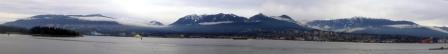


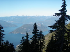 Mid September, the family had planned and hoped to camp at the Frosty trail race and enjoy a last late season camping trip...but circumstances saw us throwing a birthday party for a freshly minted teenager and hauling dirt for the never ending backyard project...
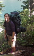 Friday night, Wendy Montgomery confirmed that she'll join us and we quickly figured out a menu and a packing plan to avoid hauling up two of everything. I was in charge of dinner, Wendy took on chocolate and coffee. Which worked out great, since my stash of chocolate miraculously disappeared.
 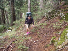 After what seemed an eternity of steep uphill along a rushing river (Deeks Creek), countless waterfalls and millions of mushrooms, the trail emerged at Deeks Lake and into some sunshine. I was hoping that my crowd would have waited for me, but I only heard a brief, "there you are" in the distance and continued alone along the lake. My water bladder nozzle was leaking and stopping the cold water from dripping on me was becoming very aggravating. I tried to enjoy the marvelous views of the mountain ranges around Deeks Lake but was too caught up feeling miserable and lonely.
 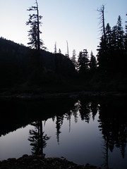 t was hard to get going in the morning. Every thing was frozen solid and only a cup of hot coffee finally got us in gear. Wendy and Ean decided to attempt humble looking Wettin Peak to the west of our idyllic spot. EJPowderhound and JoJo and I packed up and then explored the shoreline. Down at the water the sun was blazing and tempted EJPowderhound and me to a brisk dip in the ice cold water. Brr, very refreshing.
 It’s not an imposing peak at all, rather a rise on a ridge-line below Hat Mountain. But it's a named peak in the Baggers Challenge. All of the other peaks in the area were either well buried in snow and inaccessible to a dude in shorts and running shoes, or I'd bagged them already. So my friend Wendy and I set off on a little bushwhacking expedition we figured would be as simple as pie.
  Mallory, if you recall, may have been the first person to ascend Mount Everest way back in 1924. What would Mallory have done if he were in the same pickle I was in? The similarities are amazing. We were both bagging peaks. The stakes were high. We'd probably been separated from our climbing partners and we were most probably well out of our comfort zones. Mallory may have bagged Everest. Then again, he may not have. His freeze-dried bones were found a few hundred meters below the summit in 1999.
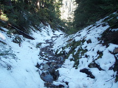 Needless to say, I made it out of there and back in one piece. Was it fate, blind luck or the ghost of Mallory that prompted me to drop down a different chute?
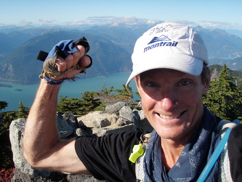 I think I have Bagger's Fever. The symptoms have been particularly acute this past week:
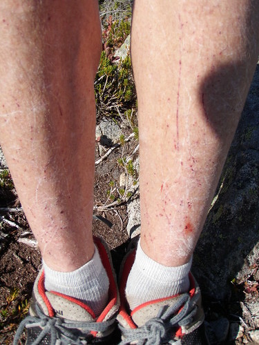 Bagger's Shins. What baggers get when bushwhacking.
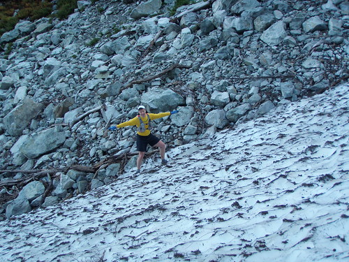 Wednesday. Pack according to
 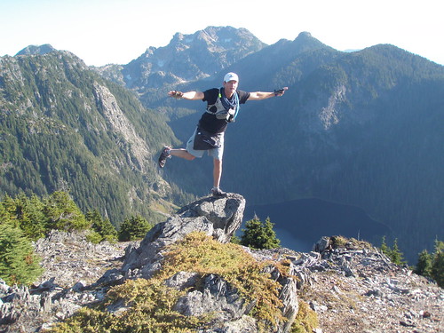 Thursday. Continue to run along a ridge to nowhere. No exit to Wigwam Inn to be found. Given we're en route for Squamish, decide to double back. Route-finding a nightmare with headlamps in the dark. Decide to hunker-down around 02:00. Make a comfy bed of cedar boughs and tuck in under a space blanket. A lot colder than the night before on SFU pub patio! (CENSORED.) Decide to head down to Seymour reservoir at 04:00. Try the cell at Dickens #2 (renamed Brokeback Mountain) just before dawn. Works! Learn that loved ones have called NS Search and Rescue around midnight. Chopper arrives at 07:00 and takes us back to car, both home by 08:15: total time of 24 hrs, of which 22 hours on the run. Eat all leftovers from BBQ I missed last night. Catch up on email, make some calls and haul a couple dozen wheelbarrows of dirt into my backyard. Bagged 10 peaks in past 24 hours, so pass on the opportunity to go for an evening run.
 Sunday.
  Sunday 2 August 2009... a date that will go down in the record books for my buddy Rick and me.
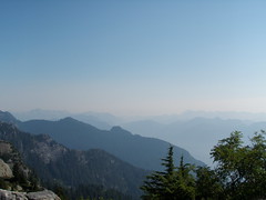 Some history: About 5 years ago, it came to be known that the Indian Arm Trail had never been bagged by a runner (e.g. run from start to finish.) At the time, Rick and I were on a rampage of bagging some of the longer hikes in the lower mainland such as Lynn Lake and Colosseum and being
 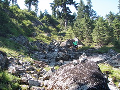 Some geography: there is a very popular hiking trail that goes from the Mount Seymour parking area to
 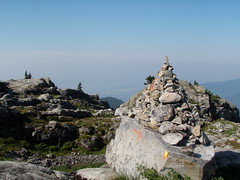 Now, Rick and I don't take the Bagger Challenge lightly. Rick was careful to document our route on his GPS and I took photos with my new bombproof Olympus camera at the summit marker of each peak we bagged. Since Rick had programmed in the coordinates of several geocaches, we also shook a few bushes and turned over a few stones en route. By 10:30, we arrived at the summit of Mount Seymour.
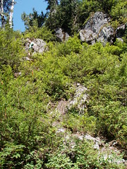 Literally and figuratively, things went downhill from there. The trail was more of a gopher path that dropped precipitously down the side of the mountain. While there was an occasional bit of surveyor tape on the ground or a stone marker, they were very hard to spot. We spent a good bit of time route finding.
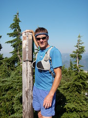 Needless to say, our slog up the peak was slow and more than a tad treacherous. We crawled on all fours and pulled ourselves up the side of the spire by holding onto the roots of bushes. But we made it. Then discovered that Runner Peak was made up of several peaks and the one we were on appeared to be the lowest of the bunch.
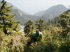 The gopher trail looked like a super highway in comparison to what we'd come from, but was not any easier to follow on the way back. Rick followed a piece of tape. It had probably fallen off a bush and been carried down the slope in a rain storm. Needless to say, it was a "falsie" and we almost got our asses kicked yet again. Now 5 hours into it, we were beginning to think we might not make it home for dinner. It was way hotter than the weatherperson on the radio said it would be this fine afternoon. I began to wonder whether I'd be drinking a cool beer or my own pee first.

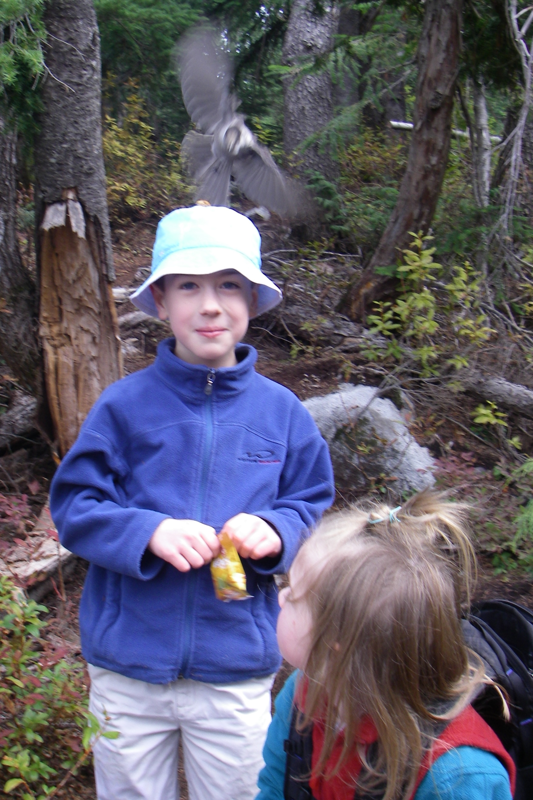
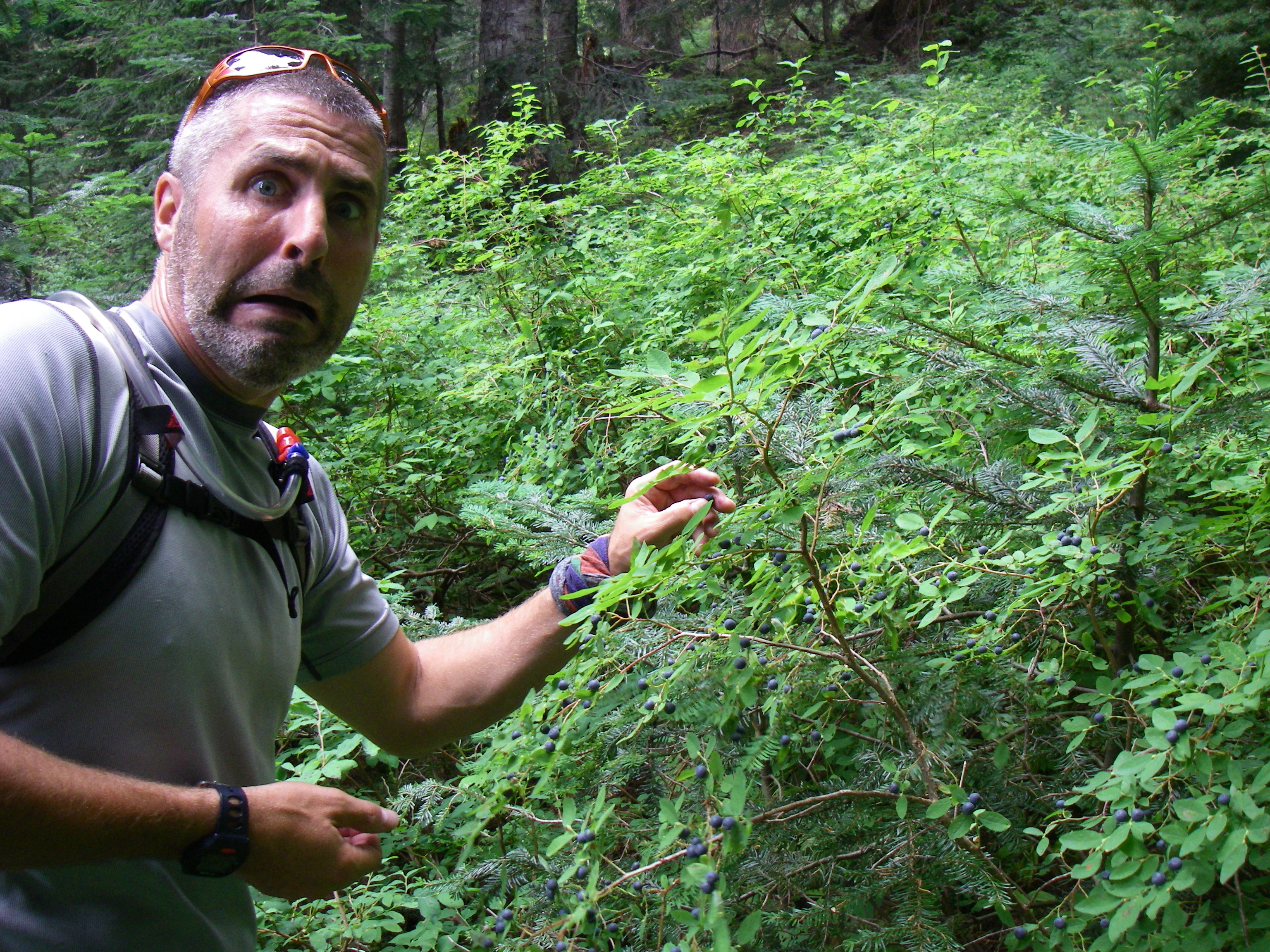

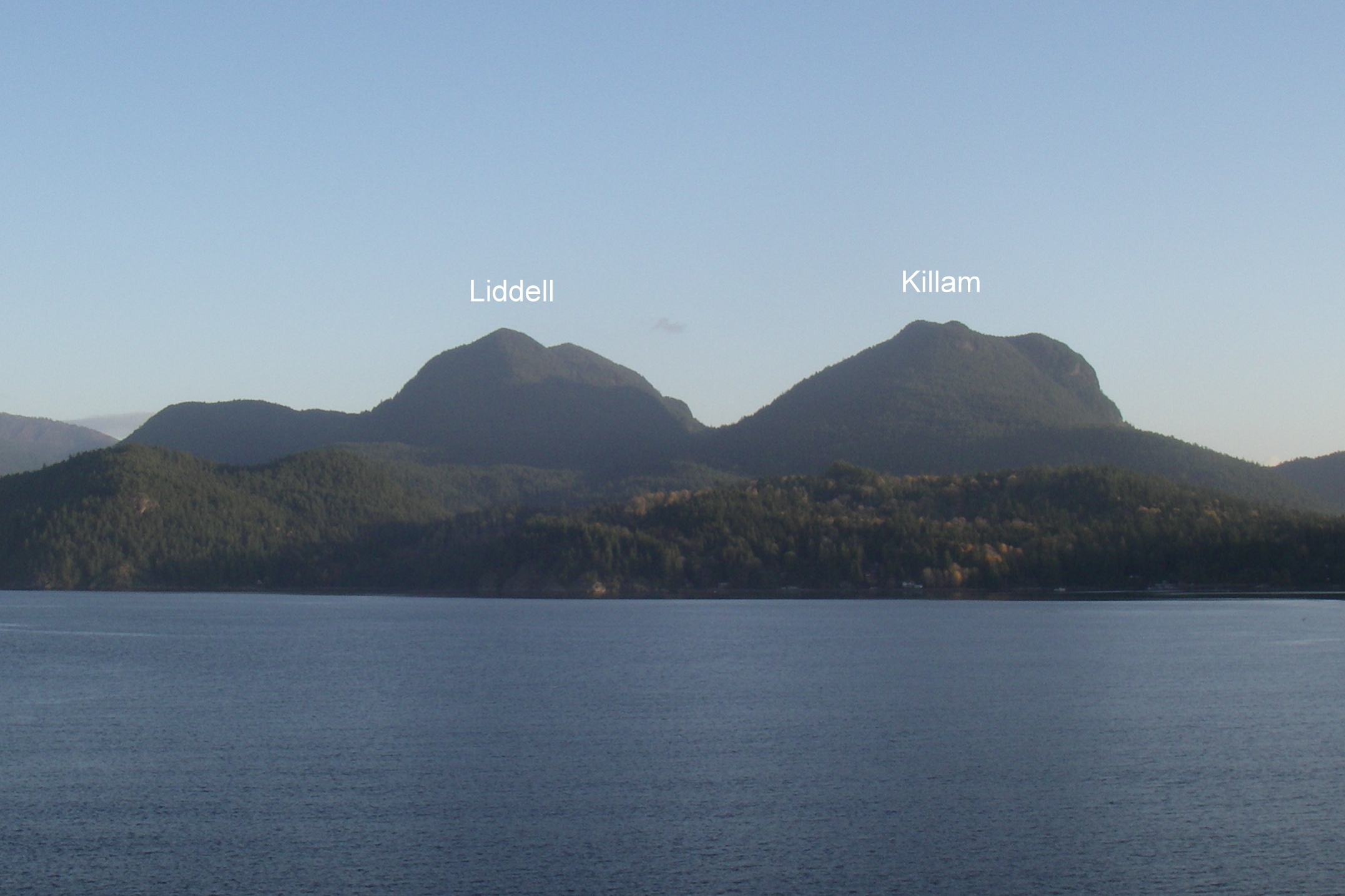
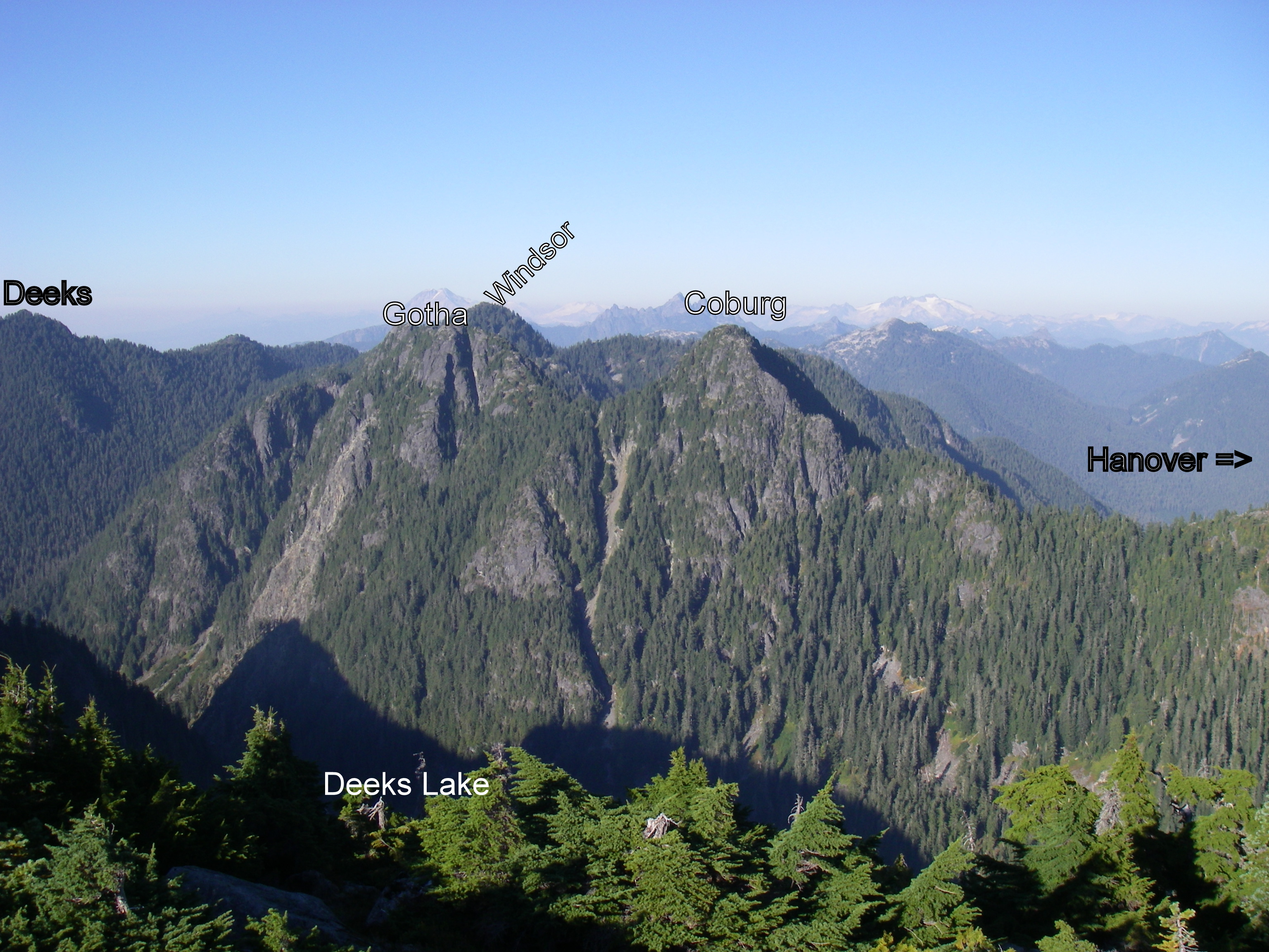
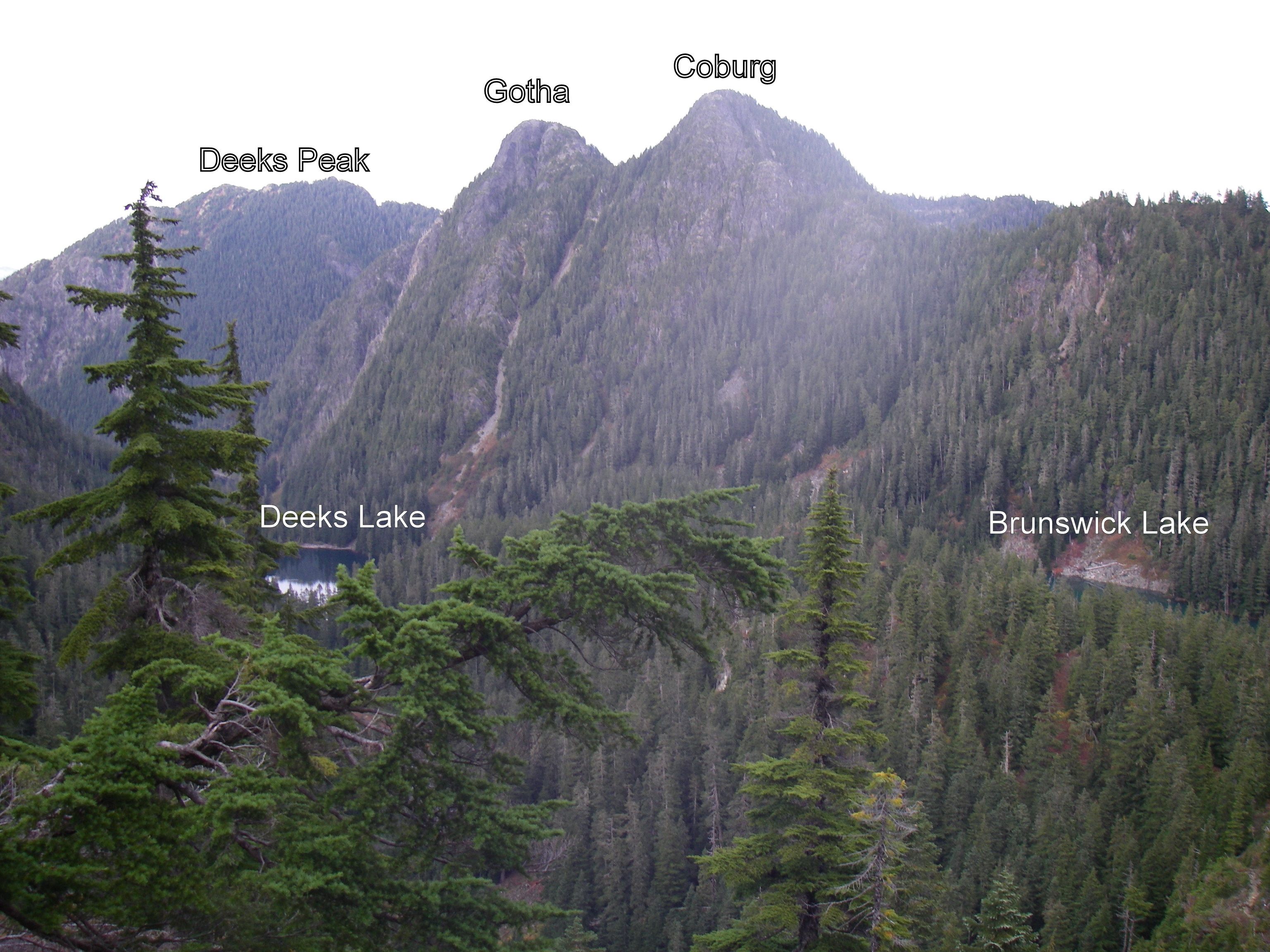
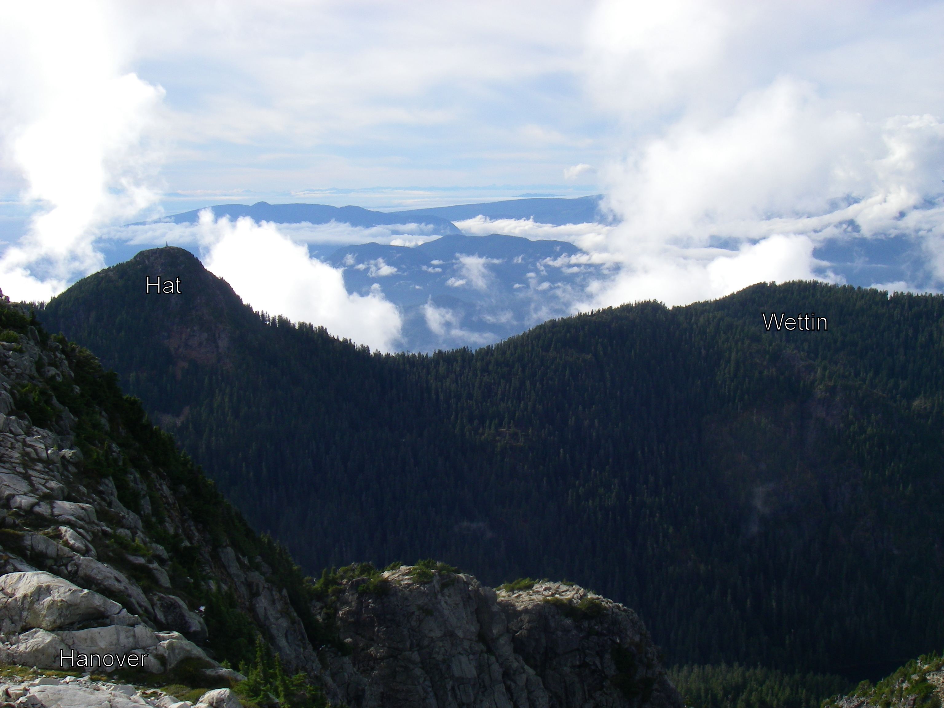
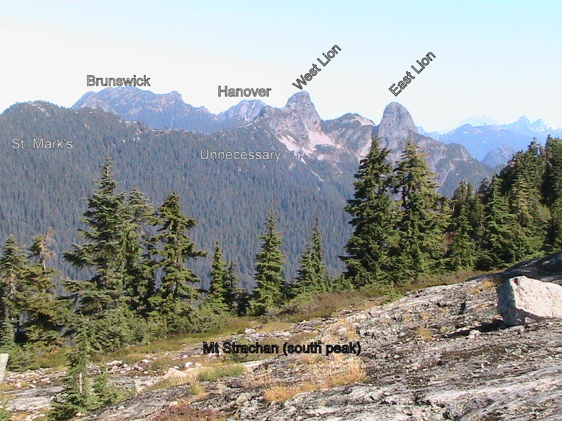
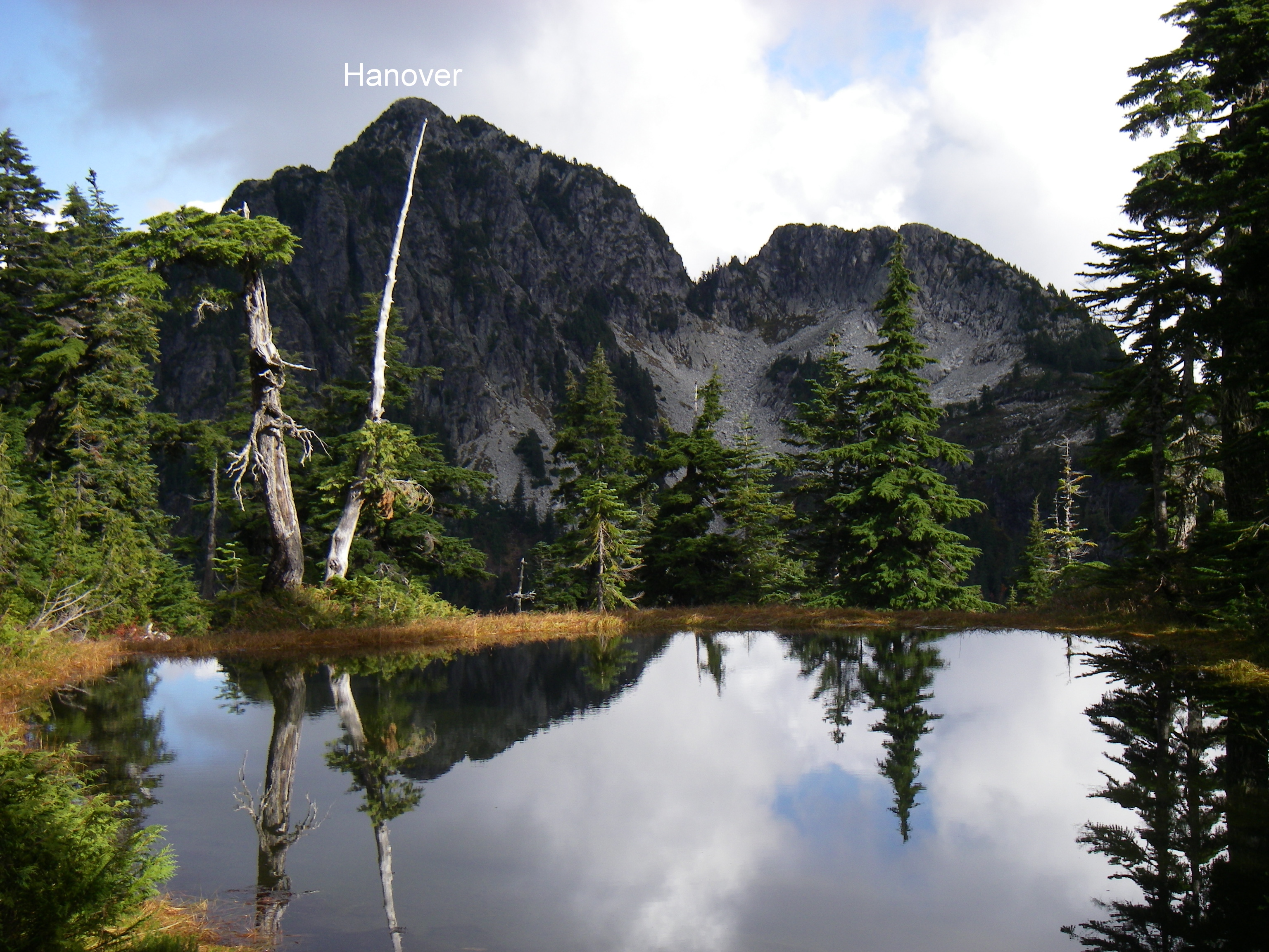
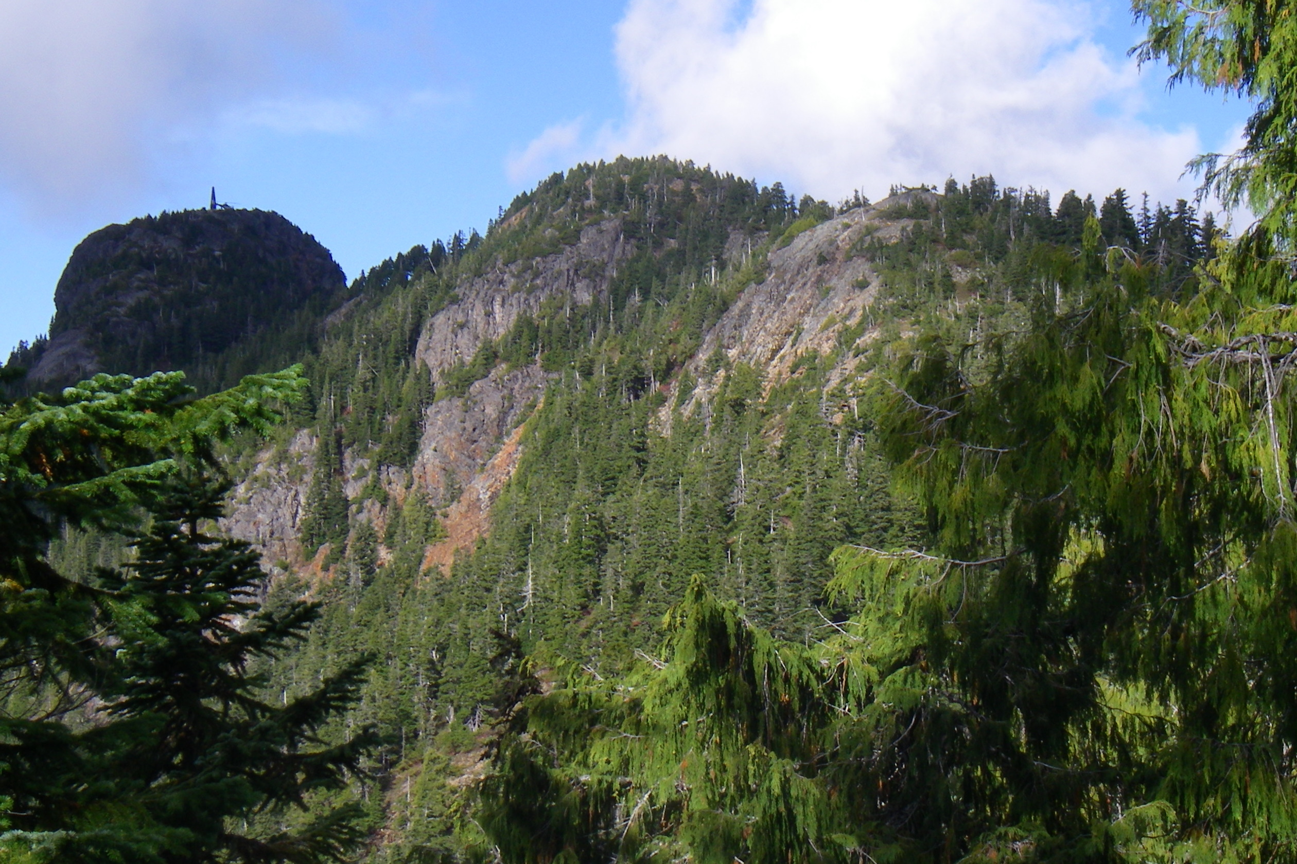
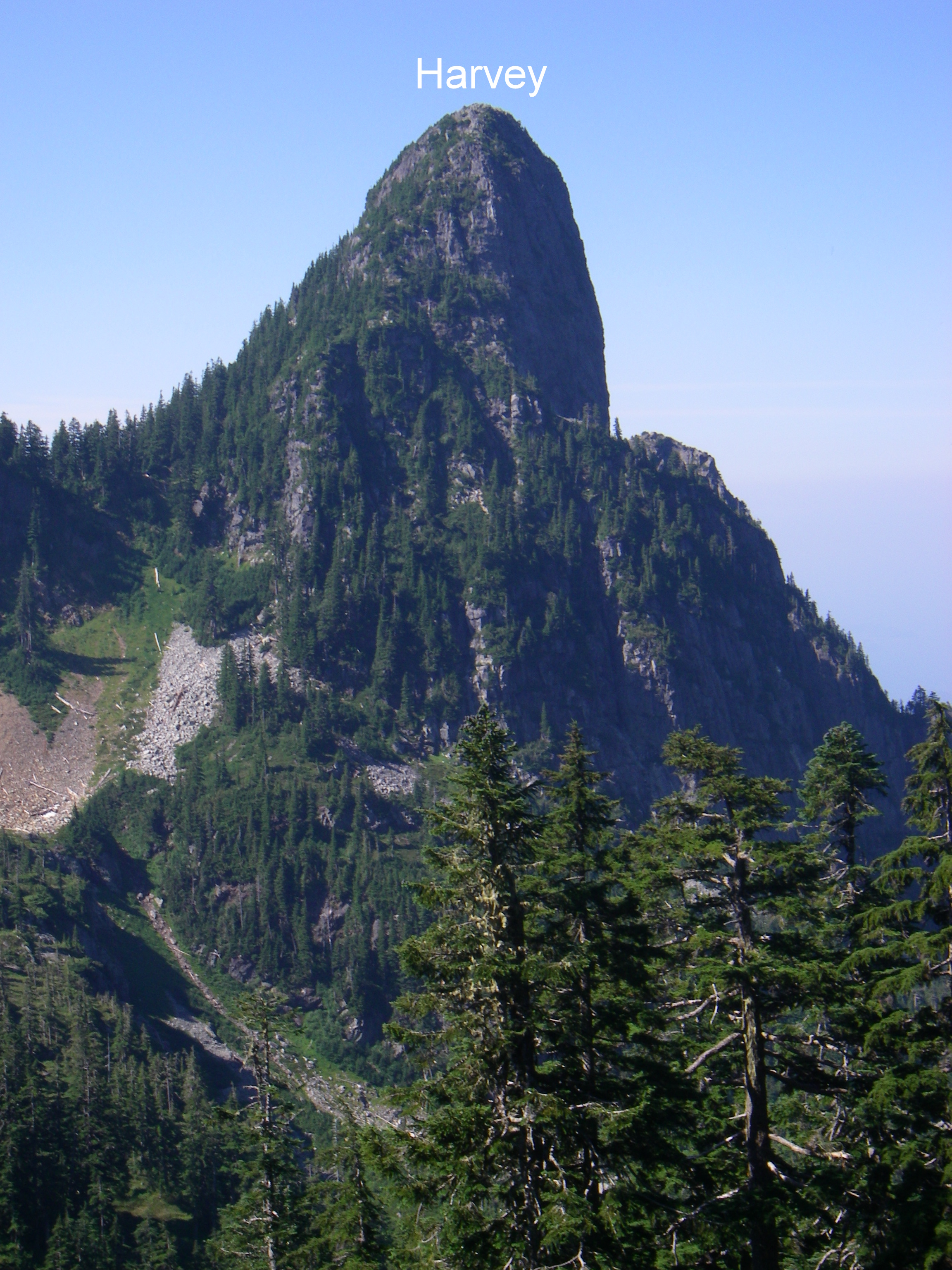
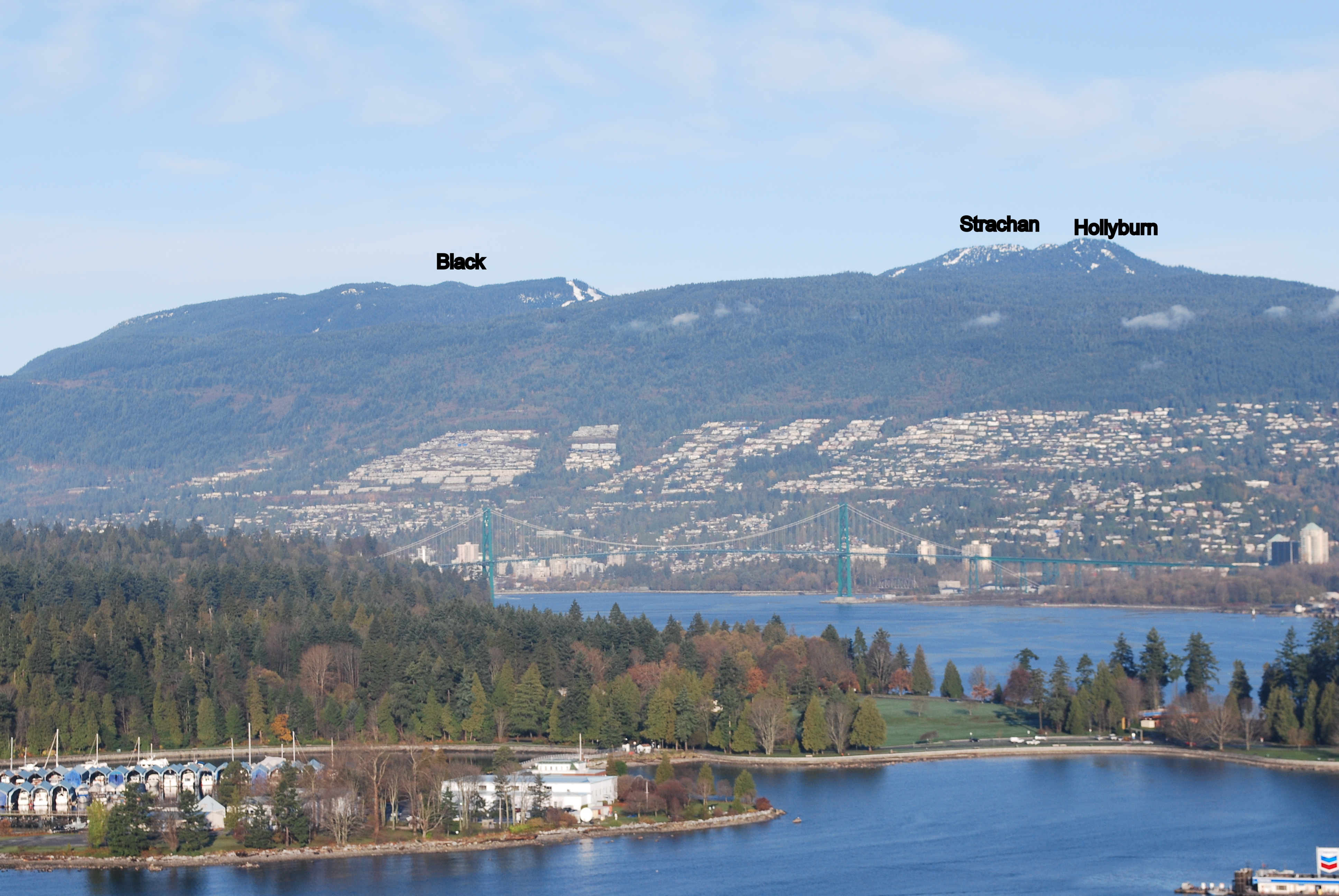
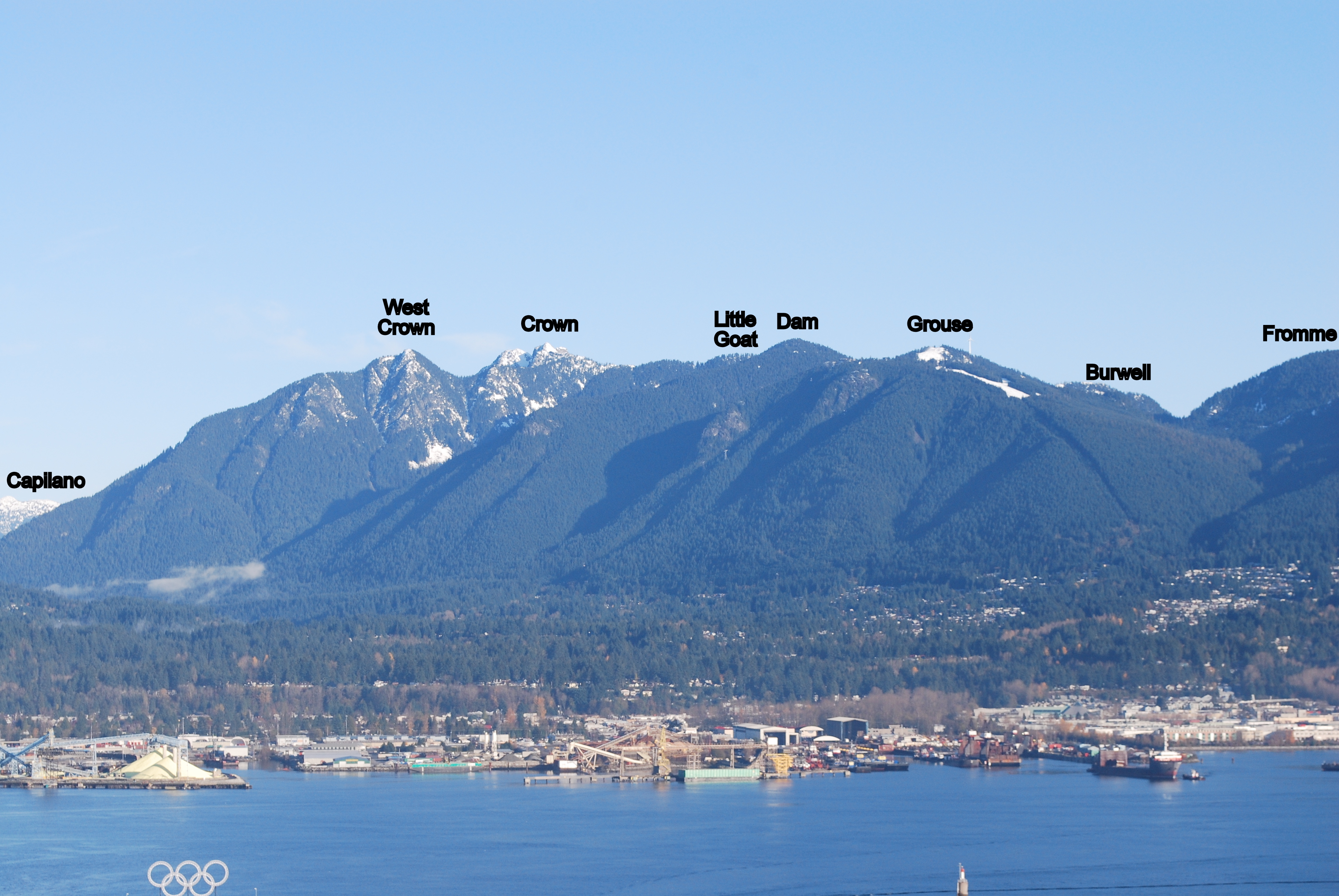
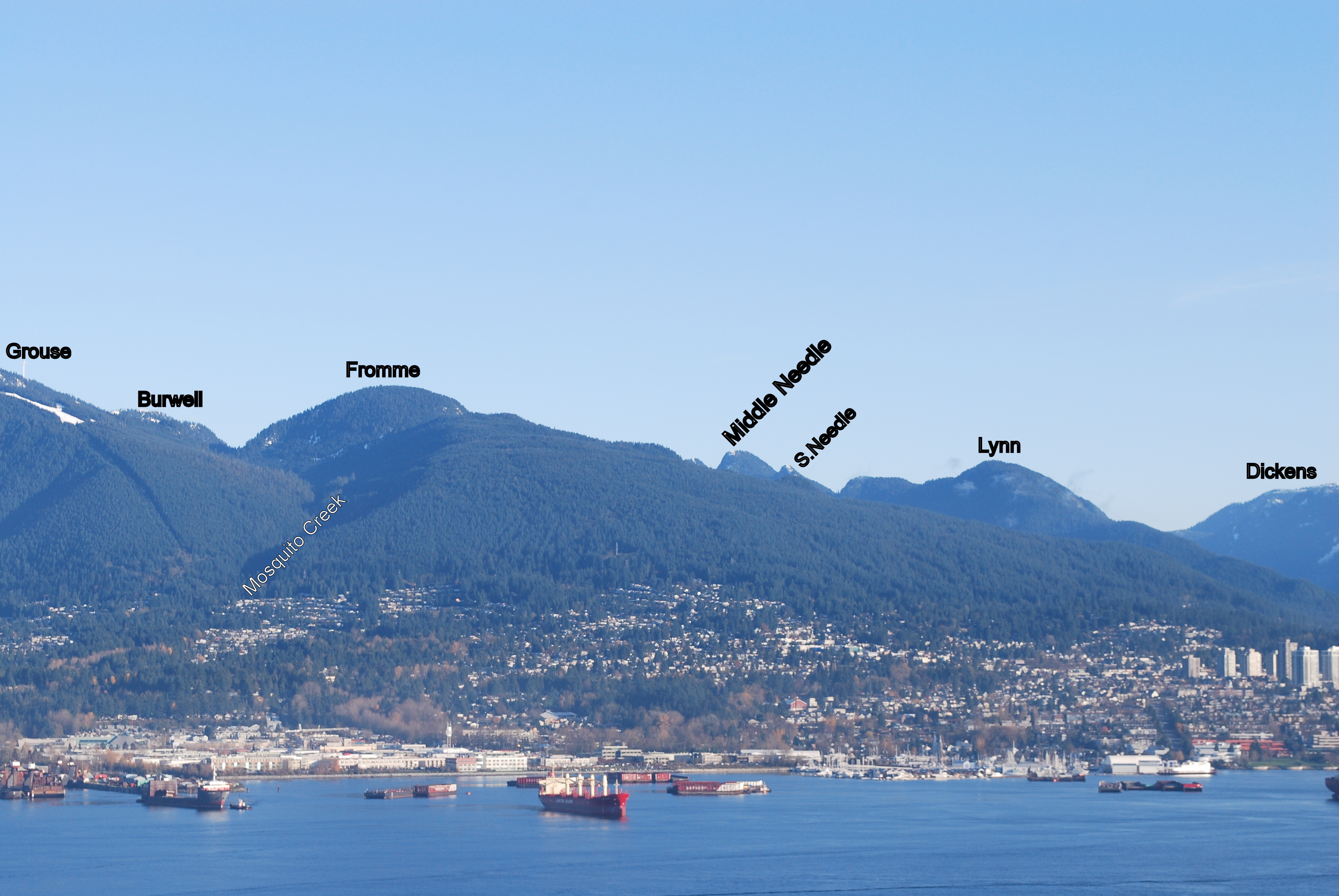
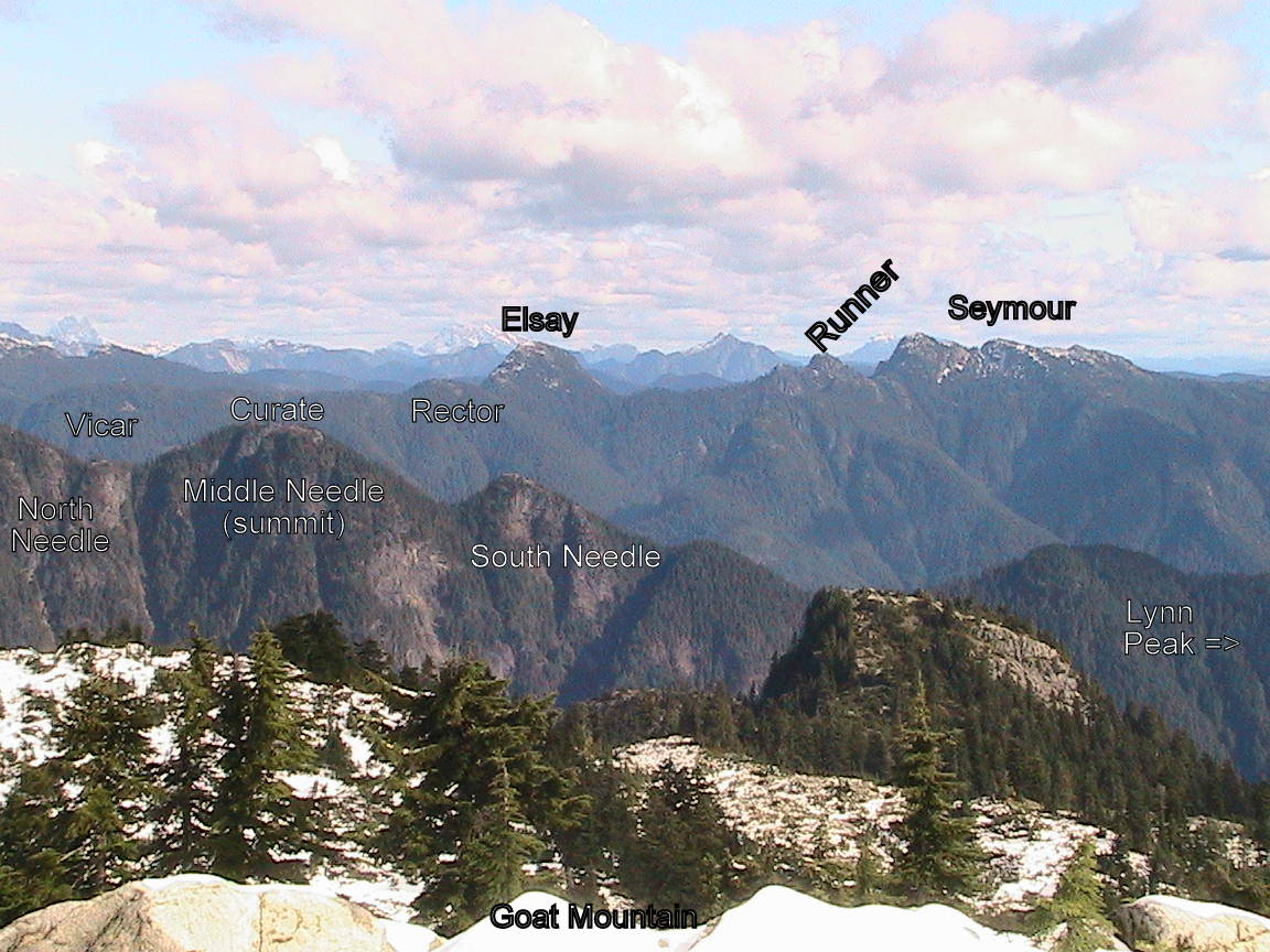
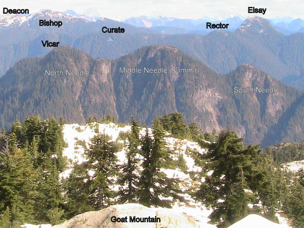
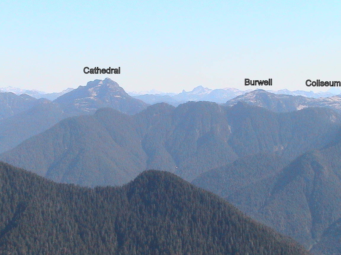
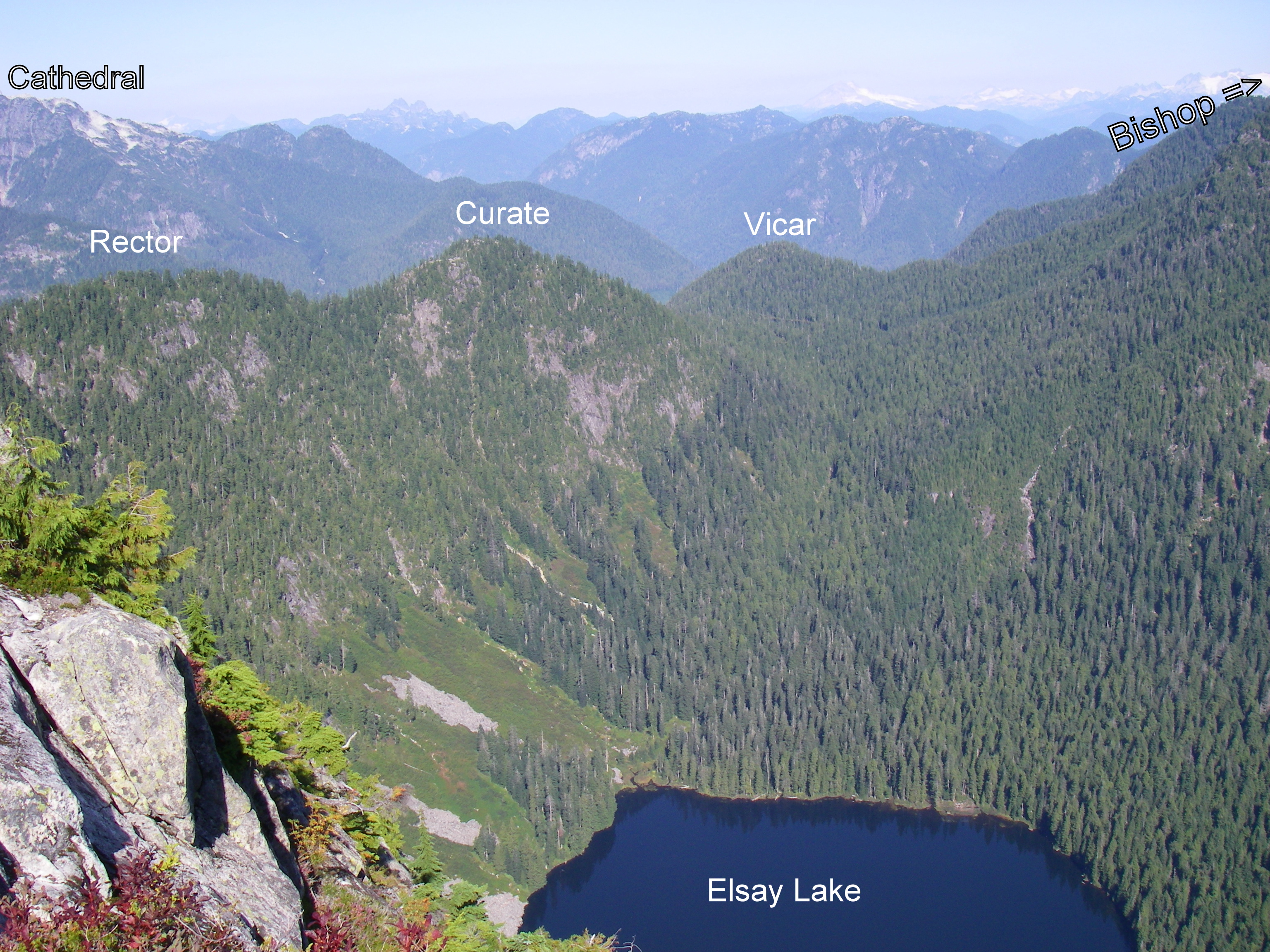
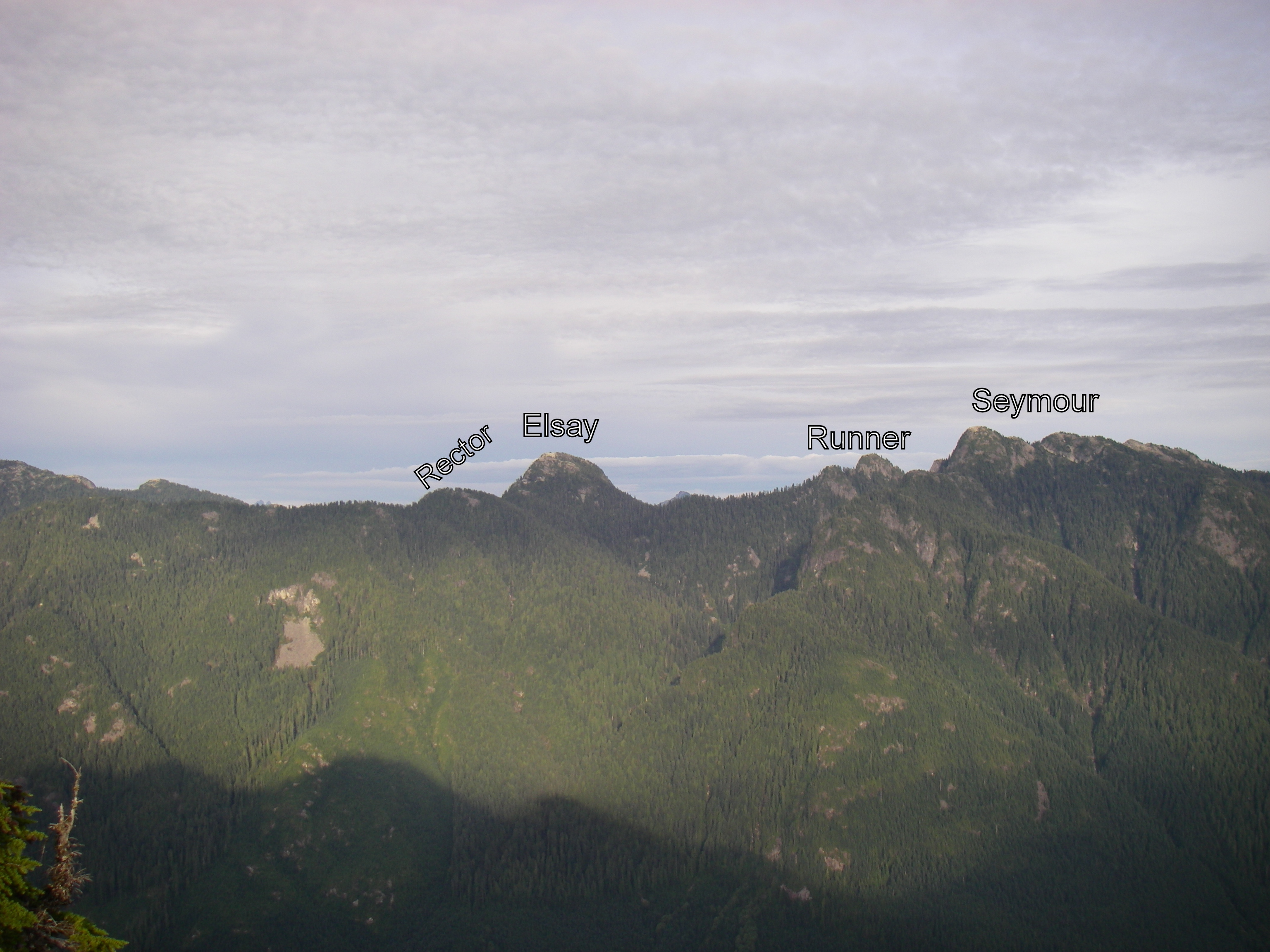
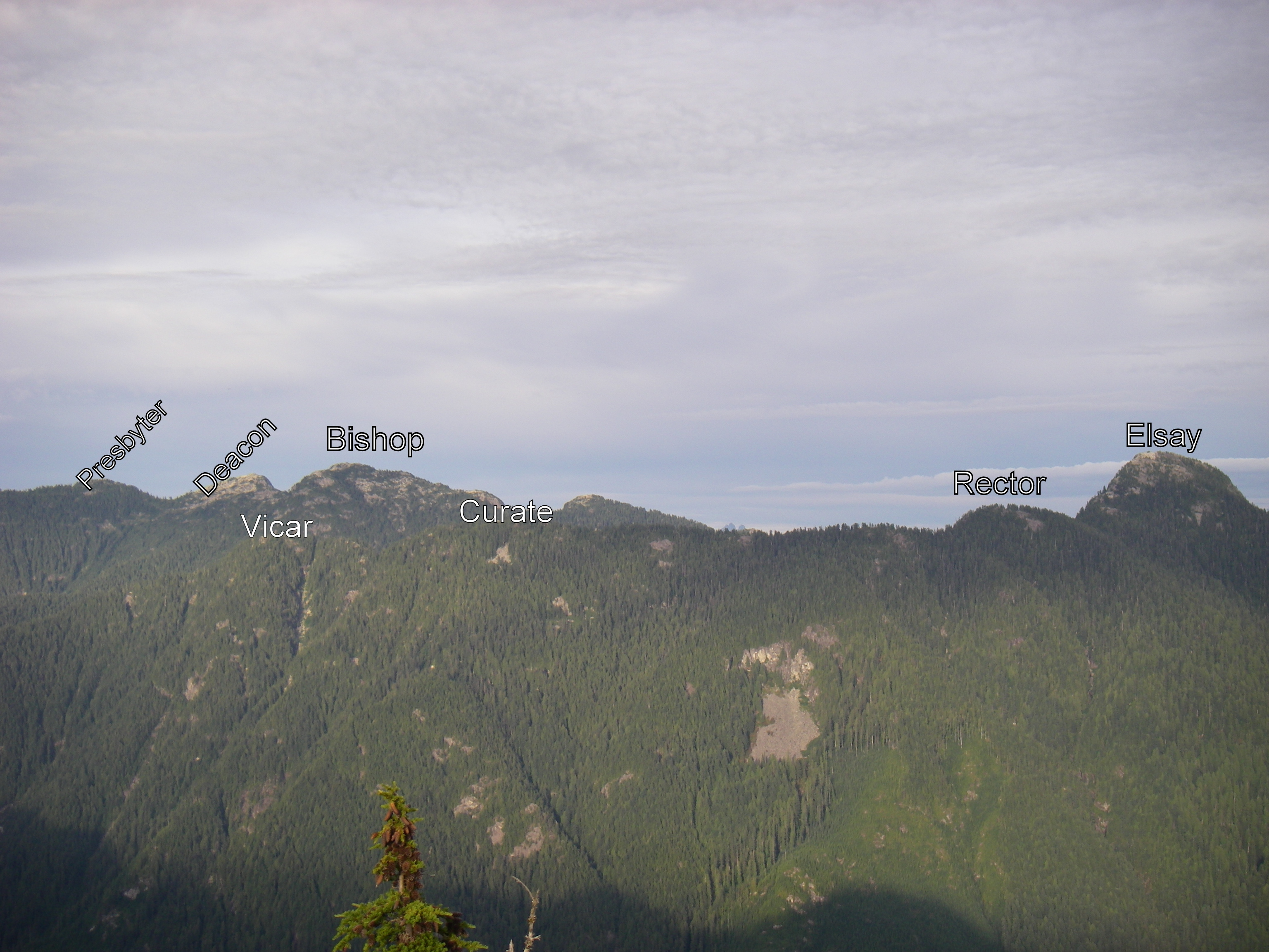
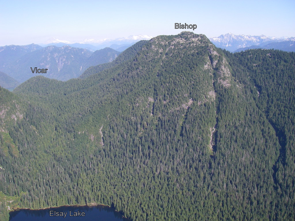