Running the Flores Island Wild Side Trail
Runnable shell-strewn beaches alongside old growth forest and past bloody battlesites
David Crerar
June 2008
Most of us already know the west coast of Vancouver Island, particularly the Pacific Rim National Park, as a trail-running paradise. On June 3, 2008 I discovered an extension of that paradise, on the 28K out-and-back beachside Wild Side Trail, on the south shore of Flores Island, about one hour northwest of Tofino by water taxi.
Despite its location, it is readily and cheaply accessible from Tofino: throughout the day, water taxis scurry back and forth between Marktosis/Ahousaht (the two towns of Flores Island) and Tofino at the bargain price of $16 each way (in contrast to the approximately $100 a head paid the weekend before for a shorter water taxi trip to the North Coast Trail trailhead from Port Hardy; to be fair, the $16 taxis must be significantly subsidized by the Federal Government).
The trail consists of some eight sandy beaches, all of them runnable, interspersed with brief interior trail runs, again, all very runnable. The run culminates in the most spectacular beach of all, Cow Bay. An additional 8K (return) can be added by running up Mt. Flores (860m) from Cow Bay. For ultra-marathon purists looking to round out the additional distance, apparently there are additional trails heading southwest from Cow Bay to Siwash Cove (but be prepared to bushwhack), or various interior logging roads. Or just savour an additional out-and-back along Cow Bay’s spectacular 4K sweep.
The trail is easy, flat, well-groomed, and well-marked. It would lend itself well to a solo run, or an adventure with a non-running significant other. While easily done in a day, a multi-day sojourn would be a very pleasant holiday. You will likely have the entire trail, or at least an entire golden beach, to yourselves.
When I had mentioned to two Tofino locals in the tourist trade that I planned to visit Ahousaht for the trail, their faces visibly blanched and both told me that I shouldn’t go because it was “dangerous” (their words). I am happy to report that while Ahousaht isn’t Kitsilano, all of the townsfolk I met were very friendly, and based on my limited experience, the warnings were wholly unwarranted.
The adventure starts at the Tofino Government Dock at the foot of First Street. The Ahousaht Pride water-taxi departs Tofino daily at 10:30am and 4pm (and back from Marktosis/Ahousaht at 8:30am and 1pm). This schedule would not provide enough time for the run, so I called other Ahousaht water taxis. During school months the Rocky Pass (1-888-726-8427) taxi usually leaves at 7:45am to shuttle teachers to the Island, returning at 3:45pm; this was the option I took. At the end of the day, I arrived back to Marktosis with 45 minutes to spare. The band office kindly radioed various water taxis; we discovered another taxi was heading back early, at 3pm, so I hopped on that one – the point is that despite its semi-remote location, a bit of digging can probably net you a full day on the island, without having to personally charter a boat.
The water taxi (piloted by Bill from Ahousaht : “Laundry bill, phone bill – however you want to remember it”) travels past the volcanic cones on Meares Island and Cat Face Mountain, and past countless coves and rocky islands and promontories, before landing at Marktosis (Maaktushs), the main town of Flores Island, nestled within a cove within Matilda Inlet, at the southeast corner of the island. A few houses south of the main dock is the band office, in a two-story reddish wooden building, where one stops to check in and to buy the $20 trail permit.
The town ends four or five houses to the south. The main road out soon forks: take the smaller, left, road. Soon you come to the “Walk the Wild Side” trail sign, slightly obscured by the scotch broom which lines the first half-kilometre of the trail, at times forming a narrow arch. A heavy storm had soaked Clayoquot sound the night before, and within 10 seconds I was wholly drenched from the foliage. At the trailhead, two large piles of bear scat greeted me (although no further evidence of bruins was seen).
A boardwalk path travels over a boggy section known as 7a7ukwnak (“It has a lake”). A sign indicates was a significant site of the fourteen-year Ahousaht -Otosaht conflict in the early 19th century, during which the Vargas Island-dwelling Ahousaht defeated the Otosaht people resident on Flores. Such signs are found throughout the trail, adding an element of drama and at times chills to the run. In addition to a brief description of the historic significance of each site, they all feature aboriginal designs carved by Stanley Sam Sr., an Ahousaht elder, and painted by his son, Hutch Sam.
The boardwalk in this section is typical of the boardwalks in the trail: cut whimsically in undulating and uneven shapes, in contrast to the Parks Canada standard widths. Despite the constant showers and omnipresent moss, the boardwalks were, surprisingly, not terribly slippery.
The boardwalk leads to a brief forest interlude and the first beach, where legend dictates a giant octopus resides. The receding tide left hundreds of juvenile octopi, looking like little lumps of flesh from a horror movie, strewn over this beach. The beach is also known as Stinking Beach, and it lived up to its name. At this beach I was joined by two local friendly dogs who tagged along for the next 3K or so.
A brief forest interlude features more whimsical boardwalks and a sign recognizing the trail construction by members of the Ahousaht Band and the Western Canada Wilderness Committee, before exiting onto the first beach of Whitesand Cove. In the sand dunes above the beach, there is a wolf-warning sign and an outhouse. As is typical of all beaches on the trail, the headlands extend into the sea as chains of small islands. Bald eagles soar overhead. Sandpipers skitter along the shore, pecking for food. The beaches are strewn with giant Washington clams, impressive Lewis’s Moonsnails, and countless other shells.
A trail located halfway down Whitesand Bay leads to the town of Ahousaht, by way of the Ahousaht warm spring, at the southern tip of Matilda Inlet. There is apparently a concrete pool for bathing in these tepid springs.
At 5K the trail proper continues inland, along the “Trail of Tears”, again a site of bloody encounters during the Ahousaht-Otosaht war. If the tides permit, it is better to avoid this boggy stretch and stick to the beach which, like the other beaches, offers beautiful runnable sand. The best part of the Trail of Tears is the sign at the start of this stretch, under a giant cedar, marking “Katkwuuwis”, which apparently translates as “Cut People’s Heads Off”, again, a historical reference to the war. As I ran the trail, bowing down to avoid windfall and bushes, I occasionally thought that I’d look up to become the next decapitated victim.
A wide creek exits at about 6K, to the west of Kutcous Point. A rough trail travels through the forest on the east side of the creek. Alternatively, it is possible to scramble along the creek shore. Both routes end at a metal bridge which marks the end of the Trail of Tears section.
On the west side of the bridge the loud drone of a hummingbird flitting among the salal punctured the air. This creek crossing was the site of the fiercest battle of the Ahousaht-Otosaht war, with many deaths at this spot. A sign proclaims that at this site “Keltsomaht war chief Tl’ihisim, a man named Wiittlaakinish and a man named 7aya7aktl’, wounded an Otsosaht sharpshooter ‘Tlihuumalhni’”. Alternative routes go southwest around the peninsula or northwest over land. The northwest route immediately takes you through a rooty tree cave and as I passed through I hoped that I would not meet the vengeful spirit of the Otsosaht sharpshooter.
At the next beach, again beautiful, is a shelter that appeared to be inhabited. At this point I made the mistake of skipping the beach trail exit halfway down the beach, as marked by hanging buoys. Instead, I scrambled along the headlands, resulting in the discovery of a two beautiful tiny coves between the headlands, but leading to an hour-long scramble over the oft-slippery rocks with a few bushwhacks along bear trails. Eventually I punched out at a creek at the east terminus of the spectacular Cow Bay. The proper trail, as I discovered on the return, is a pleasant forest trail crossing the creek over a felled sitka spruce log bridge.
The Cow Bay waters are clear, the surf loud, and the views stunning. The cove is dotted with rocky islands. Cow Bay is apparently an important feeding ground for gray whales, although I saw none. Here I saw the only other people on the trail, who had decided to camp for a few days at this paradise, just west of the wooden hull of a shipwrecked boat.
The run along the perfectly-curved bay, over sand of perfect consistency, was euphoric. At the end a short trail travels up a narrow gully through the headland, leading to another lovely beach. At the end of that beach the trail continues up Mt. Flores. That trail, like the Wild Side Trail, is at first well marked, with flagging and blazes. Unfortunately, the twisting trail, coupled with deadfall, and the thick spring undergrowth, eventually made that trail impossible to follow. With an eye to the time of the return water-taxi, and the fact that the clouds made views impossible from Mt. Flores, I pulled the plug at about 18K, at a log covered in tempting oyster mushrooms. No sooner had I done so, but I lost the trail again, leading to a half-hour bushwhack in which my legs were slashed by the undergrowth. Before hitting the beach again, I lost the trail a second time. Let my haplessness forewarn you that a GPS would be advised for this section (although it is not necessary for the Wild Side Trail proper).
Massive old-growth cedars and hemlocks festoon the Mt. Flores hike, along with the entire Wild Side Trail (particularly along the Kutcous Point Creek).
Given a conservative allotment of time, I was able to walk back for much of the return trip, savouring the beauty of the beaches, and the ingenuity of the trail-builders. Out of nowhere, the sun came up, recasting the grey of the beaches on the out-run into a golden return.
Background materials
o Philip Stone’s Coastal Hikes has a detailed write-up of the hike, as well as excellent write-ups of 12 other coastal hikes: http://www.wildisle.ca/
o Stanley Sam Jr., Ahousaht Wild Side Heritage Trail Guidebook (Western Canada Wilderness Committee, 1997; out of print)
o John Kimantas’s The Wild Coast, Volume 1 is a superb and encyclopedic survey of every explorable nook and cranny on the north and west coasts of Vancouver Island
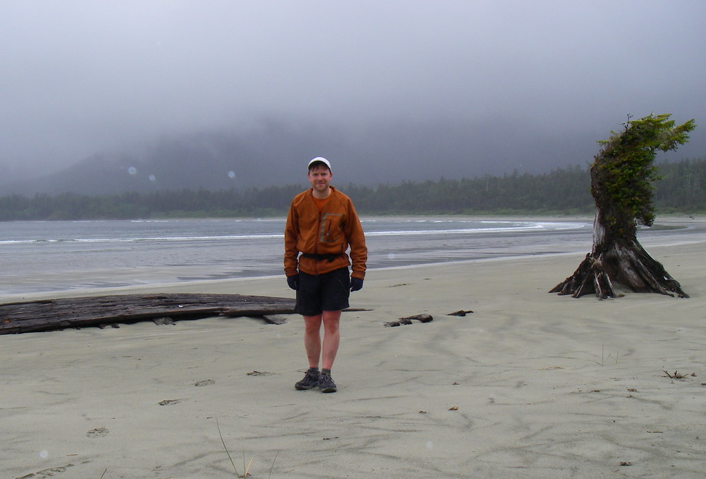
Photographs
http://www.flickr.com/photos/8661048@N07/sets/72157605505672737/


