A peak baggers delight! That's what! Bill's Great Peak Ascent is changing. This year, instead of the same old route from the Gazebo in the LSCR up to the peak of Grouse Mountain, I'm completely changing the event. You'll still go to the top of Grouse Mountain (at a minimum) but that's about the only similarity. You're going to be able to bag anywhere from 1 to 5 peaks in a single sweep! That's right! Here's the basic plan:
Bronze (1 peak): Grouse (GRO)
Silver (2 peaks): Grouse (GRO); Dam (DAM)
Gold (3 peaks): Grouse (GRO); Dam (DAM); Little Goat (LIL)
Platinum (4 peaks): Grouse (GRO); Dam (DAM); Little Goat (LIL); Goat (GOA)
Double Platinum (5 peaks): Grouse (GRO); Dam (DAM); Little Goat (LIL); Goat (GOA); Fromme (FRO)
The start/finish will be the Grouse Mountain parking lot for all levels. You don't absolutely have to do the peaks in the indicated order but it will make it more fun if you do as you'll get to see others in our group more if you do.
I'll provide detailed routes and distances in a bit but this is the basic idea.
When and Where?
Sunday, 28 July 2013 - 07:30 start (4th Sunday in July)
Start / finish at the Grouse Mountain parking lot at the top of Capilano Rd/Nancy Greene Way in North Vancouver British Columbia, CANADA
To keep hassles on the morning of the run to a minimum and allow the host to participate as well we ask to please sign up for both, the club membership and the event online and in advance.
This is a Club Fat Ass (CFA) event, so we adhere to CFA event management guidelines and privacy policy.
Please complete the whole form. Your personal information is needed to
make sure I spell your name right in the results and so I can contact
you... or your next of kin! The other information helps me to plan any
aid or post-event activities. Please help me to host a safer, better
event by registering early and by notifying me if you can't make it.
I'm constantly looking for ways to improve, so please share your
thoughts or questions with me in the Suggestion Box below. After you
click on "submit" below, your registration details will be
confirmed.
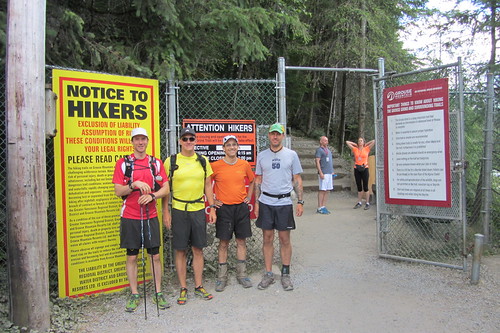
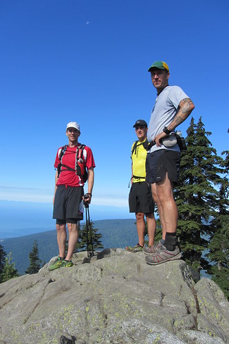
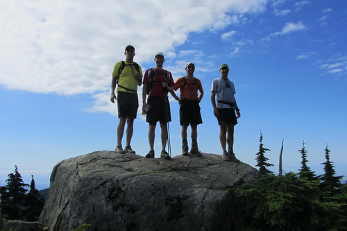
L to R: Spencer Sheinin; Matt Colpitts; Bill Dagg; Andy Healey Starter photo - 28 July 2013
Report:
I don't know if it was because of the new "bagger" format or some other reasons (it'd be good to hear people's thoughts) but, with a low registration count, some last-minute cancellations, and one no-show, we had a small turn-out of only 3 registrants and myself for this year's, 10th edition, of Bill's Great Peak Ascent. On the plus side, the four who did participate were all relatively evenly paced so it meant we could tackle the peaks together.
Andy, Matt, Spencer and myself left the Grouse Parking Lot somewhere around 7:45 am. The weather conditions were perfect -- sunny and comfortable. The trip up the BCMC was the typical grunt but uneventful with not too many others on the trail as it was still fairly early (in spite of a surprisingly full parking lot at the bottom for the time of day). Everyone took it relatively easy as we all knew we had plenty of climbing yet to do, reaching the Chalet Bug Fest in about 55 minutes.
Not wanting to linger too much in the bug clouds, we headed fairly directly to the peak of Grouse after a quick water top-up at the Chalet. We quickly made our way through the deserted Grouse Resort area away from the Chalet to the base of the peak and the big warning sign about the dangerous route (a road!) to the peak. In spite of the warning, we decided to risk it and bagged our first peak in 1:09.
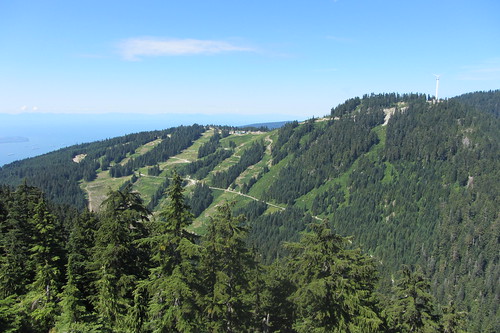
Grouse Mountain
Quick photos and mutual congrats and we were off towards Dam Mountain. Instead of going back down the "treacherous" road, we opted for Andy's suggestion to take a path on the left immediately before the "Eye in the Sky". This proved to be a great choice with some nice steep trail descents that dropped us out right before the "Dam Mountain, 800m" trail sign, cutting out a lot of boring road running.
Up the switchbacks we headed and, on the 3rd meeting with the green water pipe, headed straight uphill towards Dam. As I'd discovered earlier in the week, for some reason, all of the trail signs beyond that first Dam Mountain one at the bottom have been removed. I imagine Parks removes them for the winter but it's well past the time that I would have expected them to be returned. At any rate, we knew where we were going so it wasn't a concern -- for us (more on this in a minute). A quick ascent past the mud field and heli-pad brought us to the peak of Dam Mountain in 1:32.
Dam Mountain
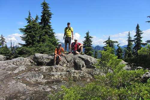
More congrats. More quick photos. Second peak all to ourselves. Off to Little Goat. After a fun descent to the Alpine Trail junction and very quickly back onto the Ridge Trail (again, no sign posts), we quickly reached the peak of Little Goat, the easiest peak on route, in 1:46. While standing around congratulating ourselves and taking the obligatory photos, we heard a couple of female "Hello? Hello? We're trying to get to Goat Mountain." voices coming from somewhere not too far below us. Damsels in distress!! To the rescue! We told them to stay put and we'd be there shortly.
After no more than a couple of minutes, we found them (Christine? & Heather -- one of them recognized me from Pacific Road Runners) on the trail heading up towards Little Goat -- away from Goat. With all of the sign posts absent, it seems they'd made a left when they should have made a right and were slightly off course. Telling them we too were on our way to Goat, we got them back onto the correct trail and to the Goat - Crown junction. Figuring we'd drop them, we headed off to the peak of Goat. Turns out they weren't any slouches themselves as they pretty much made to the peak (via a slightly shorter route) at the same time. Total time to Goat ~2:10.
Goat Mountain
Having the ladies at the peak turned out to be to our advantage as it made a group shot easy. For reasons known only to her, Heather decided both front and back shots were important. So, in case you were wondering about the photos … We had a few quick snacks while the ladies retreated to one of the several other areas on the peak because, in their words "We didn't want to share our muffins." Huh? What? Being gentlemen, we decided to leave that one alone and headed off.
By this time, everyone was feeling good and ready from some more adventurous running. Instead of heading back on the Alpine Trail to the Grouse Resort area, we opted for a more direct but much less traveled route between Thunderbird ridge and Mount Fromme via Pipeline Pass. Andy had done this route before (in the opposite direction) and I'd been eyeballing it on the North Shore Trail Map and figured we'd never get better conditions that this to give it a go.
The route off of Thunderbird Ridge starts with a steep decent on an overgrown but still easy-to-follow trail down to Barrier Creek. According to Andy, this is the direction to go as the climb in the opposite direction is significant . Anyway, going down was great fun. After the creek crossing, there's a small boulder field you have to make your way through and then a not too steep climb up the valley on the back side of Fromme following the course of an old pipeline still visible from time-to-time underfoot.
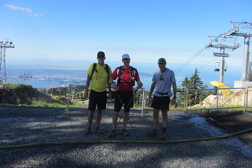
At the top of the pass, Andy, now running out of time, took the right fork out to Mountain Highway while the remaining 3 of us headed left up the now steeper route on the north side of Fromme. This eventually brought us out to a side-trail to Senate Peak (North Fromme), clearly only a couple of minutes off of the main route. We quickly made our way to the rocky peak for a well-earned break. If you've never gone to Senate peak, I highly recommend it. It's at most 10 minutes north of the main, slightly higher, south peak but the views on a good day are far better. This includes a really good perspective on Mountain Highway heading up the side of Grouse you don't normally get.
Mountain Highway and Grouse Mountain from Senate Peak (N. Fromme)
Leaving Senate we made a quick down and up to the true peak of Fromme for a total travelling time (excluding stops) of 3:50. This completed our 5 peak sweep!
Mount Fromme
After a fast and smooth descent on Bill's Trail (not mine) to Mountain Highway immediately south of the Quarry, we parted company as Spencer and Matt wanted to get some more distance in for Matt's Cascade Crest training while I headed the more direct route down Per Gynt, Executioner, Dreamweaver and the BP returning back to the Grouse Parking lot for a total running time of 5:23 (including time stopped while I cursed my 2nd wasp sting of the week -- around Mackay Creek).
Thanks to all the participants. A great way to spend a sunny summer day. Hopefully, next year we'll get even more to enjoy the adventure!
Photos: A slideshow of images will be posted posted below. If you have photos of the run that you would like to share, please upload them to Flickr, add to the CFA Flickr group and tag with BillsGreatPeak2013 BillsGreatPeak ClubFatAssEvents ClubFatAssEvents2013. They will automatically appear in the slideshow. If you need help please refer to http://www.clubfatass.com/help/general#include_photos and the Flickr help pages.
Photos: A slideshow of images will be posted posted below. If you have photos of the run that you would like to share, please upload them to Flickr, add to the CFA Flickr group and tag with BillsGreatPeak2012 BillsGreatPeak ClubFatAssEvents ClubFatAssEvents2012. They will automatically appear in the slideshow. If you need help please refer to http://www.clubfatass.com/help/general#include_photos and the Flickr help pages.
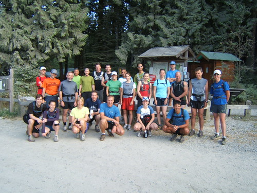
20 starters (plus late arrival Baldwin) turned out for the 8th edition of Bill’s Great Peak Ascent on a perfect July day – not too hot; not too cold. With the weather we’ve had so far this year, being too hot wasn’t much of a risk but too cold (and wet) definitely was. We had a good mix of Ascent veterans and first-timers this year making it our 2nd best turn-out ever. Thanks everyone for coming out!
Personally, I had a great adventure with Action Jackson as we scoped out a route up Mt. Fromme as a possible alternative for next year’s event. One thing is certain. We will need a different route down than what we took after losing the trail quickly and bush-whacking our way down, eventually coming out to Mountain Highway about 500m south of where we intended to be. The route up was great though so we’re ½ way there. After our escape to Mountain Highway, we continued up to Grouse Mountain, meeting new-comers Nicola and Reza on their way down.
Speaking of Nicola, congratulations are in order for her longest (trail?) run ever! Her previous longest run was a couple of times running the Baden-Powell trail from Lynn Canyon to Deep Cove. Well done!
Also worthy of note: Ryan Conroy set a new course record with a blistering time of 2:40. I think that’s about 15 minutes faster than the previous record set in the first year of the event!
11 participants made it to the post-race event at Mosquito Creek Grill in North Vancouver where, as always, we were treated to a free beer and great brunch food. Also, as in most years, nobody went home empty-handed in the free swag department – everyone got something including subscriptions to Trail Runner Magazine, water bottles, headwear and a shirt. A special thank you to all of our sponsors and Sibylle for organizing the swag.
Wildlife sightings for us included a black bear ½ way up the switchbacks on Grouse and a grizzly just below the peak (might have been in a cage) and a bazillion tourists on Grouse. I know it’s hard to imagine there were that many tourists but it’s true! I counted.
I know I said this last year but look for a modified course next year. At least some of the groundwork is now done.
Thanks again to everyone for coming out.
Post Event Survey. Please give us your feedback via this brief survey: http://www.clubfatass.com/events/BillsGreatPeak/posteventsurvey
Photos: A slideshow of images will be posted posted below. If you have photos of the run that you would like to share, please upload them to Flickr, add to the CFA Flickr group and tag with BillsGreatPeak2011 BillsGreatPeak ClubFatAssEvents ClubFatAssEvents2011. They will automatically appear in the slideshow. If you need help please refer to http://www.clubfatass.com/help/general#include_photos and the Flickr help pages.
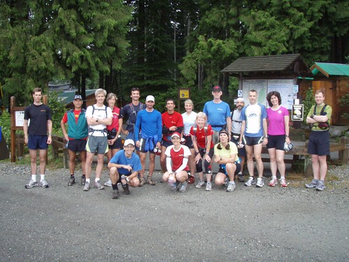
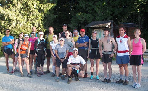
Report: A beautiful day greeted the participants of the 7th annual Bill's Great Peak Ascent. 15 participants and myself started at the Rice Lake parking lot in the Lower Seymour Conservation Reserve (LSCR) shortly after 7:30 am. Custom routes seemed to be the choice of the day as several participants opted to avoid the long run down Mountain Highway in favour of some of the many mountain biking trails in the area. Time for a change, perhaps? Look for some official course modifications next year. Several others, including myself, took shorter routes, turning around at the quarry or top of St. George's trail.
The post-race event at the Mosquito Creek Grill included the usual free beer courtesy of the Grill and tons of swag -- nobody left empty handed.
Special thanks to Pamela for hauling up my camera and taking many of the route photos.
Thanks to all for participating and hope to see you next year a new and improved course.
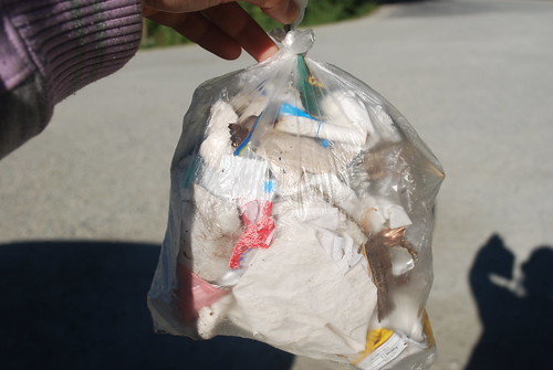
Bill Dagg Photo above: Jess's Bag 'o Trash
Post Event Survey. Please give us your feedback via this brief survey: http://www.clubfatass.com/events/BillsGreatPeak/posteventsurvey
Photos: A slideshow of images is posted below. If you have photos of the run that you would like to share, please upload them to Flickr, add to the CFA Flickr group and tag with BillsGreatPeak2010 BillsGreatPeak ClubFatAssEvents ClubFatAssEvents2010. They will automatically appear in the slideshow. If you need help please refer to http://www.clubfatass.com/help/general#include_photos and the Flickr help pages.
Sitting here with Des, Ray and Jess at the Mosquito Creek Grill, I thought I’d be a little more pro-active than last year and actually get a jump on the report.We’ll see how successful I am at finishing this and getting it posted (I set the bar pretty low last year).
(next day … )
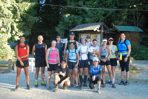
Sixteen participants (including me) showed up for the 6th running of Bill’s Great Peak Ascent on a sunny and fairly warm (some might say hot) day.For the second time in this event’s history, the peak of Grouse itself was fenced off.Some runners turned around at that point while others found alternate routes to the top.
In true CFA fashion, many participants, including myself, ran custom routes, some opting to not do the full climb to the top while others opted to avoid parts of Mountain Highway on the way down by taking Seventh Secret.
It seems that Des’s secret formula to Point Series victory is no longer being lost on his competitors as several others have taken up the garbage collection habit.Craig was even seen to be hauling a full garbage bag up the hill to Grouse (some claim he brought from home but, without proof, we’ll have to assume this was not the case ).Nice job influencing the others Des!
As always, the post-run event was held at the Mosquito Creek Grill where everyone enjoyed their complimentary beer and excellent service.Many thanks to the Grill for supporting our club!As with last year, there was enough swag for everyone to go home with something, including Trail Runner Magazine subscriptions, high-tech shirts and an assortment of other goodies, compliments of Kintec Footlabs
Thanks to everyone for coming out and hope to see you again next year.
Post Event Survey. Please give us your feedback via this brief survey: http://www.clubfatass.com/events/BillsGreatPeak/posteventsurvey
Photos: A slideshow of images is posted here. If you have photos of the run that you would like to share, please upload them to Flickr, add to the CFA Flickr group and tag with BillsGreatPeak2009, BillsGreatPeak and ClubFatAssEvents. They will automatically appear in the slideshow. If you need help please refer to http://www.clubfatass.com/help/general#include_photos and the Flickr help pages.
Results
First Name
Last Name
Age
Event
Time at top
Time
Points
Curb
Ivanic
40-49
32km
2:10
3:47
2
Ean
Jackson
50-59
32km
2:10
3:47
2 (+1 garbage)
Ray
Levasseur
50-59
32km
2:02
3:50
2
John
Machray
50-59
32km
4:25
1
Kirsten
Ramage
40-49
32km
4:25
2
Gord
Thompson
30-39
32km
4:47
2
Paul
Cubbon
40-49
~42km
2:10
4:20
2
Desmond
Mott
50-59
29km*
1:47
3:17
2 (+1 garbage)
Tim
Wiens
40-49
29km*
3:17
2
Monty
Watts
30-39
28km+
3:42
2
Craig
Moore
40-49
28km+
4:40
2 (+1 garbage)
laddie
hannam
40-49
15km$
2:19
2
Jess
Bassil
20-29
15km$
2:43
2
Maureen
Wiens
40-49
15km$
2:43
2
Sibylle
Tinsel
40-49
15km$
2:43
2
Bill
Dagg
40-49
14km#
1:54
2 (+2 host)
Dave
Berg
40-49
DNS
-1
Gilles
Barbeau
50-59
DNS
-1
* = to fence at base of Peak
+ = down Seventh Secret
$ = to top of St. George's, then down Mountain Highway
More photos are posted here. If you have photos of the day you'd like to share please post them to Flickr, tag with BillsGreatPeakAscent and BillsGreatPeakAscent2007. If you also add them to the Club Fat Ass Flickr Group your photo will automatically show int he "Members in Action" section to the left.
Please also take a moment to complete the post event survey here.
First Name
Last Name
City/Town
Event
Time to top
Total time
Points
Tim
Wiens
Vancouver
32 km
1:55
3:23
2
John
Neels
Vancouver
32 km
1:56
3:23
2
Desmond
Mott
n.van
32 km
2:01
3:38
2
Stephen
Blyth
north vancouver
32 km
2:05
3:40
1
Rea
Blyth
north vancouver
32 km
2:05
3:40
1
Jodi
Isenor
Halifax
32 km
2:23
3:51
1
Carlos
Castillo
Victoria
32 km
2:24
4:19
1 pt for garbage
3
Doug
MacKay
North Vancouver
32 km
2:24
4:19
2
Kathy
Banks
Vancouver
32 km
3:00
4:50
1
Sibylle
Tinsel
North Vancouver
32 km
3:07
5:08
2
Cheryl
Johnson
Pitt Meadows
32 km
3:07
5:08
2
Dave
Crerar
North Vancouver
28 km
1:58
3:21
returned via St.George's
1
Curb
Ivanic
Vancouver
28 km
1:55
3:29
returned via St.George's
2
Maureen
Wiens
Vancouver
16 km
2:55
2
Rob
Jones
North Vancouver
15 km
1:56
one way to top
2
Bill
Dagg
Vancouver
quarry
2:15
3
Laddie
Hannam
North Vancouver
quarry
1:22
2:23
1
Berglind
Hafsteinsdottir
North Vancouver
quarry
1:22
2:23
2
Well, as noted by Sibylle, the 4th edition of Bill’s Great Peak Ascent turned out to be a soggy affair.Nevertheless, that didn’t stop 18 runners from giving it a go under very un-July-like weather.Dave Crerar even commented on how nice it was to run in the rain and the surreal effect running up Mountain Highway not being able to see 2 metres in front of you.Glad you enjoyed it Dave, my sentiments weren't quite the same.
11 of the starters ultimately opted for the official 32 km route (thanks to Tim Wiens for GPSing the route today – we now know how long it really is!) while Dave (involuntarily) and Curb (voluntarily) ended up doing an out-and-back following the same route down as up.Others, myself included, opted for shorter variations on the route.
For the second year in a row we had a black bear sighting (no points for the bear, though, as it didn’t pre-register).The only other wildlife of note was the usual assortment of Mountain Bikers heading up as we were heading down.
Most of the runners also seemed to figure they were entitled to a free beer for their efforts as we had a large turn-out (14 of the 18) afterwards at the Mosquito Creek Grill for a few colds ones, food and general cheer.
Amongst the goodies doled out as draw prizes were two Trail Runner Magazine subscriptions, the usual assortment of great Kinesys products, and a water bottle and nice jacket courtesy of North Shore Athletics.
Thanks to all who participated and, of course, to our sponsors. Hope to see you all again next year.
What would be a good day to run from the RiceLake parking lot to the top of GrouseMountain and back?I’ve got it!Let’s do it on the hottest day of the year!
So how was it … It’s hot!Damn hot!
Either trail runners don’t pay attention to forecasts or they’re simply just missing a screw or two (one doesn’t necessarily preclude the other) as a record 19 runners toed the line for the third annual “Bill’s Great Peak Ascent” at 7:30am this past Saturday – a day that was forecast to have a high of 36C.Fortunately, we were given a temporary reprieve as a high overcast kept the temperature somewhat under control for most of the ascent.
Ultimately, the heat did take a toll, though, as there were no record times this year, due in part to the time necessary to completely douse ourselves in every available water source.Some, apparently, didn’t do enough dousing as this was also a record year for route customizations within 1 km of the finish line – Bob, on target to finish well ahead of the pack decided to go off-route after crossing the Pipe Bridge on the return trip (we’re talking about 300 m from the finish here folks).Instead, he ended up finishing second behind yours truly, whom he found nearly passed out on the bench at the finish line.Similarly, Patrick went off-route within 1 km of the end and decided to test out the mud depth in the swamps in the Varley Trail section while trying to get back on track.He ultimately finished 4th behind Desmond.
Of the other 30 km participants, Rob and Kim ended up running pretty much solo.
For the remaining four 30 km runners (John, Karl, Gilles, and Elke) it seems there was also some possibly heat-induced confusion about what point to tag up on indicating the end of the “up” section so, Elke (being Elke) concluded the best option was to “tag up” on each of the other three runs hind sections.From all accounts, there were no complaints.
In the custom distance group, Tim, opting for a point-to-point up, smoked everyone to the peak.Ann went most of the way up, turning around at the Chalet, while Baldwin, Amy, and Laddie chose mid-range customizations.That left a group of four (Sybille, Maureen, Claudia, Gary) who opted for a tamer out-and-back to the St. George’s Bench.Kathy, after arriving late, chose another customization.
Notable nature sightings included a young black bear on GrouseMountain, a (probably) Spotted Owl on St. George’s Trail, and a rabid chipmunk on Mountain Highway.
A great turnout at the Mosquito Creek Grill, no doubt aided by the prospect of a free beer for each participant, followed the event.Amongst the goodies doled out as draw prizes were two Trail Runner Magazine subscriptions, the usual assortment of great Kinesys products, and a water bottle, bottle and holder, and running cap courtesy of North Shore Athletics.
Thanks to all who participated and, of course, to our sponsors.Hope to see you all again next year.
This past Saturday marked the second running of “Bill’s Great Peak Ascent” (those with a keen eye might notice a subtle name change from last year’s event – don’t ask) and, unlike last year when we were stopped short of our target by a chain link fence at the base of the last climb up Grouse Mountain, we were able to complete the full route.The 15 runners who took on the course this year were greeted with cool, near-ideal running conditions (a good contrast to last year’s heat).The cooler temperatures, coupled with the fact that there were no views to be had because of a sogged-in peak, seems to have agreed with the runners too as, even though no-one broke 3 hours, when you account for the time needed actually getting to the peak, the fastest times this year are comparable or faster than last year.Doesn’t matter anyway -- this year’s times are the ones that matter for the record book.
First across the line in 3:02 were Tracy “T-Factor” Wakaluk and Scott “The Gazelle” Riddell (bare with me, I’m winging it with some of the nicknames here).I couldn’t quite see them at the finish but I suspect Tracy probably threw out an elbow right near the end and finished just ahead of Scott.The only repeat offender from last year (apart from myself) was Doug “If you’re not bleeding, you’re not trying hard enough” Mackay who took almost 40 minutes off of his last year’s time in spite of a Mountain Highway wipe-out on the return trip.
Other notable mentions included two international guests: Doug MacLean, from Seattle, who decided (involuntarily) that the route was too short and should go over the Lynn Canyon Suspension Bridge instead; and, Lee Adourian, from Boston, the current Club Fat Ass record-holder for earliest event registration – he registered for this event in October of last year!
We had a finish line aid station this year too!Generously set up by Steven Lamothe who had planned to run the event.Unfortunately, he was unable to find a babysitter and so, instead, set up a spread for the runners at the finish line.Thanks Steven.
Also, present at the start/finish were Kate La Plante and Less Lee showing their wares as representatives for XS Energy, Trim Advantage, and Nutrilite Sports Nutrition Products.Kate gave an overview of the product line and provided a sample package to be given out at the post-event get-together.Thanks guys!
The post-event get-together had a relatively low turn-out this year but that didn’t seem to be getting in the way of anyone enjoying the free pint of beer generously offered, once again, by the Mosquito Creek Bar & Grill.Lee Adourian was the lucky recipient of the XS Energy prize pack and Doug MacKay got himself a year’s subscription to Trail Runner Magazine.Thanks again to our sponsors for their contributions.
The inaugural running of "Bill's Grouse Peak Ascent" is now in the books. Seventeen runners, mostly from North Vancouver but one from as far away as Whitby, Ontario and ranging in age from 19 to 55, took up the challenge of running the approximately 30km route from the Lower Seymour Conservation Reserve (LSCR) to the peak of Grouse Mountain (and back) on what was a beautiful, at times rather warm, Saturday, July 24th. Perhaps it was the temptation of a free beer at the post-race event at the Mosquito Creek Bar & Grill or, maybe it was the prospect of being lucky enough to win one of the great KINeSYS draw prizes to be given out at the post-race event that brought them out but, whatever the reason, they came, they ran and they conquered (well, almost -- read on).
A pre-race survey showed that most of the participants were already familiar with most of the route and at least one of those who wasn't familiar had taken the pre-caution of printing himself out the detailed route description off of the Club Fat Ass website. That was a good sign. No-one would be getting lost or off-course today. Unfortunately, I neglected to account for the "Jackson Factor" as Ean was too busy talking to his running companions to notice the St. George's Trail bench and passed by an important right-hand turn. As nice as Mosquito Creek is, it wasn't exactly where they were supposed to be so they had to backtrack to the bench to rejoin the event. Next year, I'm thinking of a yellow jersey for Ean -- not as an indication of the current leader -- but as a warning to others!
The plan was to wind our way up Mountain Highway to the Grouse Mountain Chalet and then, from there, take the 10-15 minute jaunt up to the peak of Grouse. Unfortunately, those plans were foiled when, just past the Grizzly Bear pen, all were forced to a sudden stop. The entire peak area was fenced off with "Do not enter. Construction Area" signs. A few tried to find back ways up but to no avail. The fencing was complete. No peak today.
At the turn-around point, 19 year old Mark Klaver decided he'd being hanging around with the old folks long enough and put on his after burners, heading off down Mountain Highway and finishing the event in what proved to be the fastest time of the day in 2:54. Wendy Montgomery was the first female and second runner across the line 10 minutes after that.
Eleven participants partook in the post-race event at the Mosquito Creek Bar & Grill, enjoying one free beer each courtesy the Grill, great food, great service, and lots of camaraderie.
Thank you to all participants, sponsors, and the amazing Sibylle Tinsel and Ean Jackson for all of their hard work with Club Fat Ass, making my job, as event host, incredibly easy.
Next year's event will be on Saturday, July 23rd, 2005. And remember, because we couldn't actually get to the peak this year, all course records are still up for grabs!
North Shore Athletics: Thanks for the drawprizes. NSA is also offering you 10% off any regularly priced inventory when you mention in the store that you are a Club Fat Ass member.
KINeSYS: Thanks for the assortment of body and sun care products to keep all participants protected from the elements.
If you'd like to support Bill's Great Peak Ascent and our guests in some way, we'd love to have you onboard. At the very least, we can promise you a place on this Thank You page! Please contact us with your thoughts on how you'd like to participate.
I've never done a trail run before. Is this a good place to start?
A:
It's a toughie, but if you can run a 1/2 marathon on the road and are comfortable carrying your own food and water, you should be good (It's about 35 kilometers from start to finish.)
Q:
Do I need to print off course instructions and bring them with me?
A:
We recommend you do so unless you are very familiar with the trails on Grouse Mountain.
Q:
What if I get lost?
A:
You shouldn't get lost if you bring directions! If you do feel you are lost, ask a mountain biker or just turn around and follow the same road you came up.
Q:
What if I have to heed the call of nature.
A:
There are portable washrooms near the start and at the top of Grouse Mountain. If you have to go while on the trail, be discreet, do your business at least 10 meters from the trail and bury anything solid at least 10 cm deep.
Q:
What should I bring on race day?
A:
Whatever you figure you will need given the weather, your physical fitness on the day and your plans for after the run.
Distance. If in doubt, take it easy. If you have a credit card with you, there is a bail out opportunity at the Grouse Mountain Chalet via the tram ($5 + plus a Taxi back to the LSCR) -- or just turn around as the return trip is almost entirely downhill
Fitness. The route out is mostly uphill and can be a real character-builder. Take it easy. If in doubt, slow down. It's not a disgrace to walk portions either -- few will run the whole distance.
Après run. Consider getting together for a bite and some fluids at the finisher party.
Q:
I am supposed to be self-sufficient because there is no aid provided. Can I get a friend to come out and give me food and drink along the route?
A:
Absolutely! In fact, it would be nice if your friend were to help everyone. See aid stations and crew for some thoughts. If you bring money, you can get a bite to eat at the Chalet if you're feeling desperate.
Q:
Where can I park?
A:
Parking may be an issue as they are building a water filtration plant near the start and this is a popular place on weekends. Try to car pool. Try to arrive as early as possible.
Arrive at the Grouse Mountain gravel parking lot. Free parking in the gravel lot. Not so elsewhere.
Check-in.
07:20
Welcome and final briefing
07:25
Photo
07:30
Start
??
First finisher
??
Post event celebration -- TBD
How to get to the start
Take Capilano Road in North Vancouver towards Grouse Mountain as far as you can go.
What to Bring?
Bring your own food. There is water at the start and at the Grouse Chalet. Other than that, there's nothing.
Bring your own official timing system if you care about time (a watch will do, even if the second hand doesn't work.) There will be a pen and paper to record your peaks and times.
Bring a change of clothes for afterward
Notes
this event is not sponsored, sanctioned, permitted or anything else that would qualify it as an official event
expect rain, some mud, some old friends and maybe some new
Ed: This is old and needs to be brought up-to-date. I believe the height of Grouse Mountain is unchanged though.
Grouse Mountain towers 1,250m (4,100') above the city of Vancouver. Rice Lake is in the Lower Seymour Conservation Reserve (LSCR) not far above sea level. The challenge of Bill's Great Peak Ascent is to have a good time getting from Rice Lake to the peak of Vancouver and back!
The run is held entirely on trails that range from beginner-friendly to technical. It has been designed to be a great training opportunity for the 67K STORMY trail run in Squamish in mid-August as well as a fun event in itself. On a clear day, you can expect awesome views of Vancouver, the Fraser Valley and Mount Baker, Washington.
If you are not familiar with the course, please print the course description and bring them along to the start. The course will not be marked. For a printer friendly version, please scroll to the bottom of this page and follow the link.
Go through the Chalet or around the right side to the front.
Follow the paved path from the front of the Chalet heading towards the "Birds in Motion" exhibit.
Go past the exhibit on your right and follow the gravel road around the right-hand side of the peak towards the "Eye in the Sky" (the wind turbine). Ignore the ridiculous "Hiking is not Recommended" warning sign. It's a road!
Go past the turbine another 100 m or so to the top of the left chairlift.
PEAK 1: Grouse Mountain. Congratulations! There's your first bag of the day!
Bronze Event Only (skip this section for other events)
LEG 4 (30 - 60 min): Grouse Chalet - Grouse Parking Lot
Go back through or around the Chalet.
Down BCMC back to the start.
Note: Please don't go down the Grouse Grind -- too many people and treacherous at times.
BRONZE distance: ~8.0 km
Silver, Gold, Platinum and Double Platinum Events
4.0
LEG 3: Grouse Mountain - Dam Mountain
From the peak of Grouse, head back down the road you came up.
At the base of the peak (~800m), before returnnig to the paved pathways, go right on the gravel road heading north.
After ~600m, you should see a sign that says "Dam Mountain 800m".
You'll cross paths with a green water pipe 3 times (twice overhead; once under foot). At the 3rd encounter, follow the green pipe uphill.
Follow the main trail uphill (you should go through a boggy area and by a heli-pad). At the heli-pad, the main trail continues on the east side of the meadowy area.
Very shortly, you'll top out at an exposed rocky area.
PEAK 2: Dam Mountain. Yay! There's two!
Silver Event Only (skip this section for other events)
5.8
LEG 4: Dam Mountain - Grouse Chalet
Retrace your steps (mostly -- don't go back up to the peak of Grouse) back to the Chalet.
8.1
LEG 5 (30 - 60 min): Grouse Chalet - Grouse Parking Lot
Go back through or around the Chalet.
Down BCMC back to the start.
Note: Please don't go down the Grouse Grind -- too many people and treacherous at times.
SILVER distance: ~10.6 km
Gold, Platinum and Double Platinum Events
5.8
LEG 5: Dam Mountain - Little Goat Mountain
Continue on the trail down the north-east side of Dam Mountain (roughly opposite the direction you came from). Note: There are lots of little spur trails here and there. Be sure to stick to the most well-travelled route.
After 300 - 400m, you will arrive at a trail junction with a large wire-wrapped rock pile. These rock piles are bases for trail signs which, for whatever reason, were absent at the time of this writing. Go left (if the sign is present, this will be the direction indicated for Goat Mountain).
After less than 100m you'll come to another junction. Go left again. This is the Ridge Trail.
Follow the trail for ~1.2km.
Just before a drop into an open meadow, there will be a small spur trail to the right. Go right onto the spur trail.
Follow the trail ~50m to the high point. There's a slash in a tree here with "L. Goat" and "1320m" written in felt pen.
PEAK 3: Little Goat Mountain. There's three! It doesn't get easier than that. That's the easy ones out of the way!
Gold Event Only (skip this section for other events)
6.5
LEG 6: Little Goat Mountain - Grouse Chalet
Return on the spur trail back the ~50m to the junction with Ridge Trail.
Turn right and go down into the small meadow.
Turn right again at the far side of the meadow.
After ~100m of downhill, you'll arrive at another junction.
Turn right (if the trail sign is present, it will indicate this as the direction opposite to Goat Mountain). This is Alpine Trail.
Follow Alpine Trail to the Zip Lines.
Immediately before the Zip Lines, take the trail to the right.
Before long, you will come to the green pipe where you earlier went uphill to Dam Mountain.
Continue down the trail/road back to the Chalet.
9.9
LEG 7 (30 - 60 min): Grouse Chalet - Grouse Parking Lot
Go back through or around the Chalet.
Down BCMC back to the start.
Note: Please don't go down the Grouse Grind -- too many people and treacherous at times.
GOLD distance: ~12.4 km
Platinum and Double Platinum Events
6.5
LEG 6: Little Goat Mountain - Goat Mountain
Return on the spur trail back the ~50m to the junction with Ridge Trail.
Turn right and go down into the small meadow.
Turn right again at the far side of the meadow.
After ~100m of downhill, you'll arrive at another junction.
Turn sharp left (if the trail sign is present, it will indicate this as the direction to Goat Mountain). This is Alpine Trail.
After ~100m you'll come downhill to a Y junction. Go straight. This is trail to Goat Mountain. The other trail is to Crown Mountain (not part of today's set and much more challenging).
Follow the marked trail ~800m to the peak of Goat Mountain. Expect some significant climbs on this route!
PEAK 4: Goat Mountain. That's the most challenging mountain in the set. Well done!
7.5
LEG 7: Goat Mountain - Grouse Chalet
Return on Goat Mountain Trail back to the junction with the Alpine Trail (the Y intersection).
Go left on Alpine Trail.
Follow Alpine Trail to the Zip Lines.
Immediately before the Zip Lines, take the trail to the right.
Before long, you will come to the green pipe where you earlier went uphill to Dam Mountain.
Continue down the trail/road back to the Chalet.
Platinum Event Only (skip this section for Double Platinum event)
11.7
LEG 8 (30 - 60 min): Grouse Chalet - Grouse Parking Lot
Go back through or around the Chalet.
Down BCMC back to the start.
Note: Please don't go down the Grouse Grind -- too many people and treacherous at times.
PLATINUM distance: ~14.2 km
Double Platinum Event
11.7
LEG 8: Grouse Chalet - Mount Fromme
TBD
All Events
Finish – Grouse Mountain gravel parking lot. Whooee! You’re done! Stretch. Yammer for awhile. Time to go celebrate your accomplishment (see below).
Celebrate. See Agenda for details. Family and friends are welcome!
Bill's Great Ascent - Confirmation Page
The following people are registered for this event:
1) Allison Tai 2) Spencer Sheinin 3) Andy Healey 4) Sibylle Tinsel 5) Matt Colpitts 6) Paul Schrimpf
I welcome your comments, criticisms, feedback and
questions.
Please be sure to read the the Agenda and FAQ section of this website
first, as this is where I've tried to answer the most frequently asked
questions.
bill Dagg - Your CFA Event Host
Post Event Survey - Bills Great Peak Ascent
Please take a moment to share your thoughts about the Club Fat Ass event you recently participated in. Your feedback will help your Event Host to refine their event next year.
This is an anonymous, confidential survey (as long as you are not logged in to the website) so please feel free to offer constructive criticism about any aspect of the event in the comment box.

 Report: A beautiful day greeted the participants of the 7th annual Bill's Great Peak Ascent. 15 participants and myself started at the Rice Lake parking lot in the Lower Seymour Conservation Reserve (LSCR) shortly after 7:30 am. Custom routes seemed to be the choice of the day as several participants opted to avoid the long run down Mountain Highway in favour of some of the many mountain biking trails in the area. Time for a change, perhaps? Look for some official course modifications next year. Several others, including myself, took shorter routes, turning around at the quarry or top of St. George's trail.
 )
)