Vancouver Skyline XTC (X-country Trail Challenge)
What?
- A trail run with a twist that explores some of the most scenic areas of Vancouver's famous North Shore mountains
-
25K "Up", 25K "Down", 50K "Up and Down" and "Roll Your Own" custom distance options to suit all abilities
(Please note for 2013: Because of a trail washout about 2km from the turn around at the Cypress Lookout parking lot, the option this year will be 46km Up and Down, and any custom distances as an out and back. The Up start is not available, not is the 25km Up or 25km Down option. - Approximately 3,000m (9,000') of elevation change over the 50K course on moderate to challenging trails
When and Where?
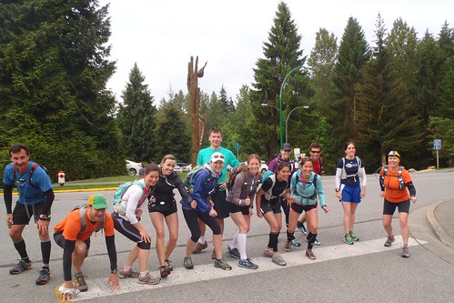
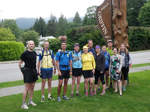
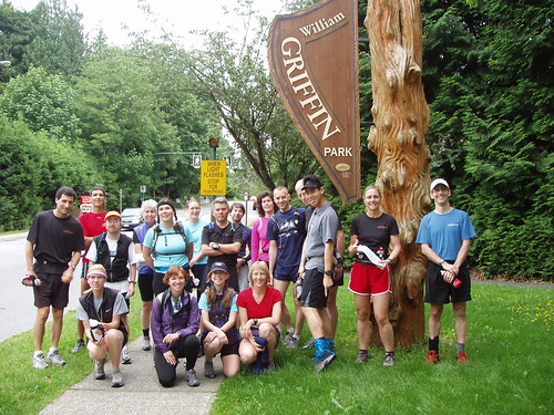
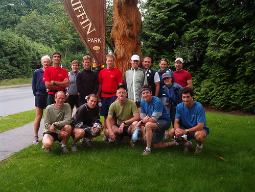
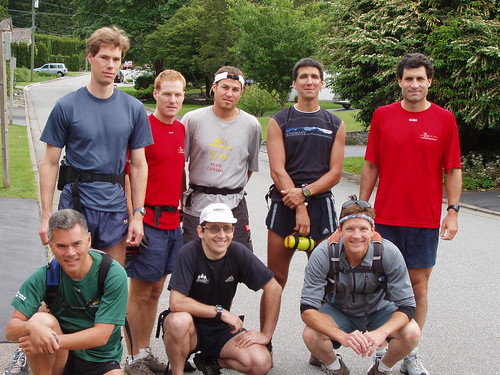
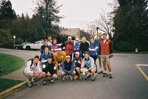
- Saturday 8 June 2013 (2nd Saturday in June) - 08:00 start
- All participants meet at the Griffin Rec Centre to check in
- See agenda for details on how to get there and course description
Who is registered?
- Check out who is registered here.
How Much?
- Free for Club Fat Ass members (check out current membership fees and benefits here)
- To keep hassles on the morning of the run to a minimum and allow the host to participate with you, please sign up for both your Club membership and the XTC event online and in advance.
Event Registration - XTC
Thank you for registering online and in advance.
This is a Club Fat Ass (CFA) event, so we adhere to CFA event management guidelines and privacy policy.
Please complete the whole form. Your personal information is needed to
make sure I spell your name right in the results and so I can contact
you... or your next of kin! The other information helps me to plan any
aid or post-event activities. Please help me to host a safer, better
event by registering early and by notifying me if you can't make it.
I'm constantly looking for ways to improve, so please share your
thoughts or questions with me in the Suggestion Box below. After you
click on "submit" below, your registration details will be
confirmed.
Wendy Montgomery
Your Club Fat Ass Event Host
Agenda
|
Saturday 8 June 2013 |
|
| 06:30? | Get up. Check the weather. Pack your course descriptions |
| 07:40 | Arrive at Griffin Rec Center, 851 West Queens Road, North Vancouver (#1 on map. Westview exit off #1) |
| 07:55 | Starter photos |
| 08:00 | Start - 25K "Up", 50K "Up and Down" or Roll Your Own distance: |
|
(Please note for 2013: Because of a trail washout about 2km from the turn around at the Cypress Lookout parking lot, the option this year will be 46km Up and Down, and any custom distances as an out and back. The Up start is not available, not is the 25km Up or 25km Down option. 25K "down" and "Out-and-Back" drive to respective starts. (Quarry Picnic Area, Cypress Mountain, West Vancouver: #2 on map. 9k switchback, Cypress Bowl Road or Cleveland Dam parking lot, North Vancouver #3 on map. Capilano Road.) |
|
| 10:30 | First finishers (25K) |
| 12:45 | First finishers (50K) |
| 14:30 | First to pick up a free beer at finisher party! (Mosquito Creek Bar & Grill in Westview Mall at #1 and Westview just around the corner from the Griffin Gym finish) |
| 17:00 | First to go to bed |
What to Bring?
- Aid. (Course description, food, water, electrolyte drink, bug spray, bear bells, suntan cream, rain jacket, gloves, etc. As an experienced trail runner, you know what you need to be self-sufficient on the trails.) If you expect and are prepared for no external aid, you may be pleasantly surprised... but do not count on it!
- Official timing system. (A watch will do, even if the second hand doesn't work. You are responsible for submitting your finish time if you want to go down in the results)
- Change of clothes. (Bring soap, a towel and bathing suit if you plan to go for a hot tub or steam at Griffin Gym afterwards.)
- Crew. Yes, your family and friends are most welcome to come along to feed and encourage you! See course description for Reference Points where they might meet you
Pre- and Post-Event
- parking, showers and change facilities (07:00 to 16:00) are available at Griffin Recreation Center, the start and finish of the event. Parking is free. There is a pool, sauna, hot tub and steam room at the gym. Entry is $4.50 (less for just a shower)
- runners, volunteers and adult friends are encouraged to meet afterwards for brunch and beverages at the Mosquito Creek Bar & Grill. We'll recognize the great accomplishments of the day, share war stories, photos, gather stats and otherwise chill out.
- Sorry, pub license means no kids
Other Notes
- please read the FAQ (Frequently Asked Questions)
- please, please, please do not drop litter on the trail. (Consider picking it up if you find any. There may be a prize for your efforts)
- this event is not sponsored, sanctioned, permitted or anything else that would qualify it as an official event. It's a party!
- be sure to bring a copy of the course directions for the event you are attempting. (For 50K, bring Up and Down.) We recommend you put them in a baggie so they don't turn to mush.
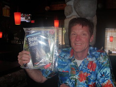
- expect baking sun, freezing rain, lots of mud, bears, some old friends and maybe some new
Course
(Please note for 2013: Because of a trail washout about 2km from the turn around at the Cypress Lookout parking lot, the option this year will be 46km Up and Down, and any custom distances as an out and back. The Up start is not available, not is the 25km Up or 25km Down option)
The XTC route has been designed for 25K "Up", 25K "Down", 25K "Out-and-Back", 50K "Up and Down" and "Roll Your Own" custom distance options... so there is a run distance to suit everyone!
While a lot of the course is quite well marked with Trans-Canada trail, Baden Powell and other trail signs, the XTC doesn't follow any particular trail for its entire length. Be sure to print out the appropriate course description ("Up" or "Down" or both) at the link below and bring it with you on event day in a plastic baggie to protect it. Better yet, train on the course, bring the map and the directions to make sure you don't get lost! For an overview map click here. You can find an elevation profile here. Please note, that you will not be able to navigate with just the map, you need the course descriptions (see below). Runners are assumed to be self-supporting, but we encourage friends and family to come out and crew. All Reference Points noted on the course description are accessible by car.
We really don't want you to get lost. Local trail gurus have gone over this course many times to make sure distances and descriptions are impeccable. Despite our best efforts, a landmark may have changed or our descriptions may not be crystal clear to you. Please give us your feedback so we can improve. Point out any errors to your Event Host at the finisher party and you get a free beer!
Please link to the appropriate course description below. (Those who want to roll their own distance, please use the "Up" description and plan to run out and back.)
| Attachment | Size |
|---|---|
| XTC map.pdf | 1.42 MB |
| XTC Skyline Elevation Profile.pdf | 559.55 KB |
XTC Up Course
If you are running the 50km distance, make sure you also print out the Down description. Please scroll down to the bottom of this page and click on printer-friendly version to get a nice printout.
|
Fast |
Up - Course Description |
km |
|
|
Reference Point - |
|
|
|
Start. |
0.0 |
|
|
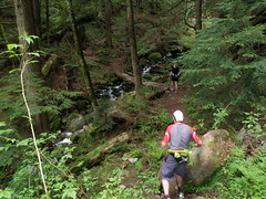
1. Mosquito Creek. This section takes you straight up the side of a mountain from the city to the edge of civilization. |
|
|
|
- run north (toward mountains) to end of |
|
|
|
- In about 1.5K, pass under wooden bridge ( |
|
|
|
- after 10m, path veers left and almost disappears. Zigzag up steep canyon wall. When you reach the road ( |
|
|
|
Reference Point – |
2.9 |
|
|
2. The Dogleg. This nasty out-and-back section gives you a chance to see everyone in the event. If weather permits, take in some spectacular panoramas of the city below and |
|
|
|
- Go right and pass through orange metal gate. Continue steep uphill. Stay left on main road at rock "5053" address cairn and again near top when you pass a private driveway. Just after pavement ends, look for trail to the right marked Baden Powell. Take steep, rocky trail downhill |
|
|
|
- just before shed, turn sharply left along dirt path. Pass above houses with green and orange metal roofs, then downhill. Cross bridge over Mosquito Creek. |
3.8 |
|
|
- on far side of bridge, follow wide dirt/gravel access road. Big green water tanks are on your left. At yellow gate, take small deeply-eroded path on left up steep embankment and stay right under power lines. Go underneath the tower of power, then right onto wide trail under power lines |
|
|
|
- follow wide trail under power lines as it snakes eastward toward the horizon. You will pass through a grey metal gate. Cross paved driveway (4350 St. Mary's Avenue) and continue on smaller trail directly opposite. Count three (3) towers from here! |
|
|
|
- you will pass directly under a tower of power then head steeply downhill on narrow, rocky trail. If you are lucky, you will see |
6.5 |
|
|
- follow trail under power lines back uphill, then cross over paved driveway and go through grey metal gate at 4350 St. Mary's Avenue. On a clear day, you can make out a thin straight line of a trail above the houses on the horizon. (The Crunch.) |
|
|
|
- follow gravel trail under power lines back to canyon edge. Go underneath the tower of power and onto small, steep trail. (Do NOT follow |
9.2 |
|
|
- go right, then left and uphill on rocky trail. Pass orange then green roofed houses on your left. At junction with driveway, turn immediately right and go up steep, rocky path. When trail opens into wide, overgrown gravel road, go left. Follow road downhill to 2 orange metal gates framing a parking area. |
|
|
08:45 |
Reference Point – |
10.1 |
|
|
3. Grouse View. This fast section takes you under power lines to |
|
|
|
- continue straight through parking area, past the orange metal gate and downhill under power lines. (Do NOT follow paved road!) You will pass over 2 small bridges above a dry dam |
|
|
|
- continue straight and under power lines. Pass through an orange metal gate into gravel parking area. Stay left along lower road next to fence and pass through a maintenance area. At yellow metal gate next to paved road, turn left |
11.4 |
|
|
- follow |
12.6 |
|
|
Reference Point - |
13.5 |
|
|
4. The Capilano Loop. Get up close and intimate with a magnificent rainforest canyon. |
|
|
|
- take road to your left immediately after fountain and before information board. It will snake downhill and away from the dam. Pass a big concrete block building on your right. Stay on main road about 75m, then take first trail downhill to your right. (Note metal snorkel-shaped pipe opposite trail entrance.) |
|
|
|
- trail goes steeply downhill over wooden steps and through a grove of ancient old growth trees. You will pass over several small bridges. Just before the paved road, take trail right. When trail reaches traffic circle at fish hatchery, follow road to right then go straight onto trail between picnic gazebo and information board |
|
|
|
- keep river on your right as you go down the canyon. Pass picnic gazebo. Go up and down wooden bridge ramp. (Do NOT cross river!) Go right and on trail next to river. Pass Cable Pool lookout. Continue uphill and close to canyon edge on Coho Loop trail. |
|
|
|
- at "T" intersection (Pipeline Trail), turn right and steeply downhill over |
|
|
|
- stay right at small stone wall and go over little footbridge. River is now on your right as you make your way back up the canyon. Stay on main trail past bridge. (Do NOT cross bridge to fish hatchery!) At next intersection, go left and uphill on steep, narrow switchback. (Giant Fir trail.) Note 2 huge |
|
|
|
- take small trail on right (don't drop down to gravel trail). 500 year old Grandpa Capilano is behind the cedar fence in front of you. Be sure to give him your regards, as he brings good luck! Trail goes up steep set of wooden stairs. At the top, go right onto wide gravel road. You are now on the Trans-Canada Trail (TCT) . |
|
|
|
- with canyon on your right, continue uphill on road until clearing just before Cleveland Dam. Turn left and uphill on wide gravel access road. Stay on this road until it ends at a high fence. Go left and follow trail to paved road |
17.5 |
|
|
- at pavement ( |
|
|
|
5. The Crunch. Viewed from the air, the course from here to the Picnic Area traces a straight line across |
|
|
|
- cross a little bridge and a flat section, then head uphill with a park on your right. Carefully cross |
|
|
|
- climb a steep bit. Carefully cross |
|
|
|
- Take steep stairs in front of you. Carefully cross |
|
|
09:30 |
Reference Point - |
18.2 |
|
|
- continue uphill on steep, narrow trail under telephone lines. At top of wooden steps, trail will veer right into the forest. At first trail intersection, go left over the little bridge and head back toward telephone lines. Cross swampy area on corduroy then a little wooden bridge over Hadden Creek. |
|
|
|
- At "T" junction with wide, rocky trail ( |
|
|
|
6. Canyon Crawl. Welcome to just about every size and quality of trail you can imagine...with a net uphill grade. While the steepest climb is behind you, you will continue uphill for the most part crossing many bridges over many canyons. |
|
|
|
- cross several small canyons and many bridges of varying sizes and states of repair. |
|
|
|
- stay straight at sign for Incline Railway trail. Note Viewpoint #10 as you approach Brother's Canyon. At |
19.9 |
|
|
- At top of canyon, go right and uphill into the woods. At junction with Brothers Creek trail, stay straight. Cross a long stretch of corduroy just before reaching the telephone lines |
|
|
|
- trail drops into a fairly wide fire road. Turn right and uphill back to telephone lines where you come to an opening at edge of Lawson Canyon. Immediately as you head back into the forest, you will see a trail fork with the Baden Powell trail going steeply uphill and the Skyline Trail going left. Go left onto Skyline Trail. There is a steep downhill section into the canyon and an old bridge |
20.3 |
|
|
- as you come out of the canyon, enter a nasty section of roots, rocks and mud. Beware the slippery old corduroy just before you get back to the telephone lines. |
|
|
|
- follow rough single track trail under the lines. Expect wet shoes if it has rained recently. Pass first by Lower Brewis trail, then further up, Upper Brewis as you continue under telephone lines. Cross a deep canyon |
|
|
|
- enjoy a nice stretch of trail in the woods. Look for remnants of an old forest fire. Cross canyon with 2 bridges |
22.5 |
|
|
- in next stretch of forest, trail goes around a huge overturned stump then over tiny bridge with 3 slats before regaining the telephone lines. Drop down into small canyon |
22.7 |
|
|
- regain telephone lines a while, then cross canyon with 2 bridges. |
|
|
|
- back to telephone lines, then a shallow canyon with a new bridge. |
|
|
|
- back to telephone lines and single-track. The trail widens and improves markedly. Crank it up. The Picnic Area isn't far! |
23.3 |
|
|
- at the large |
|
|
|
Reference Point - Picnic Area. The Rotary Bluff cairn. |
25.0 |
XTC Down Course
Please scroll down to the bottom of this page and click on printer-friendly version to get a nice printout. If you are running the 50km distance, make sure you also print out the Up description.
|
Fast |
|
km |
|
|
Reference Point - Picnic Area - Start / Midpoint / Finish |
|
|
|
Start. The Rotary Bluff cairn. |
0.0 |
|
|
1. Canyon Crawl. Welcome to just about every size and quality of trail you can imagine. You will be running downhill on the TransCanada Trail (TCT) for the most part, crossing many bridges and canyons |
|
|
|
- go clockwise around parking loop toward paved road. At yellow gate and Trans Canada Trail sign, turn right and under the telephone lines |
|
|
|
- follow a wide, fairly smooth, undulating section of fire road. The trail will go uphill into the woods on the left at the edge of a canyon |
1.7 |
|
|
- nice section of trail in the woods with soft footing. Drop down into a shallow canyon with a bridge |
|
|
|
- climb out of canyon and regain the power lines. Single track trail is rough and will be wet if there has been rain in the past week. Watch for slippery rocks and wood! |
|
|
|
- as you near the next canyon, note the little wooden cross-shaped trail marker (Forks Trail) on your left. Go past it and then left and uphill before the canyon. (If you are heading downhill away from the telephone lines, go back!) |
2.5 |
|
|
- duck into the forest then drop down to a new bridge over a small creek |
|
|
|
- go back to telephone lines and downhill, then into woods and over double bridge |
2.9 |
|
|
- return to telephone lines, traverse a section of woods then cross a bridge |
|
|
|
- duck in an out of the woods. Cross a tiny bridge, then dodge around a huge, overturned stump. Pass through a deep canyon with 2 old bridges |
3.5 |
|
|
- nice section of trail through an area where it looks like there was a fire a long time ago. Drop down into a deep canyon with an old, mossy bridge. |
3.7 |
|
|
- return to telephone lines. Continue past Upper Brewis Trail on your left, then further down trail, continue straight under telephone lines past Lower Brewis on your right. There's a short, nasty bit of slippery wooden corduroy, then take go into the woods on a muddy, rooty and rocky bit of trail that ends at a steep canyon with a bridge |
|
|
|
- there will be a "T" intersection at the top of the canyon with a sign indicating Baden Powell Trail. Go right |
4.7 |
|
|
- follow wide rocky road downhill and away from canyon for about 90m. (Caution! Don't miss this turn!) Turn left onto TCT/Baden Powell Trail |
|
|
|
- trail comes back to telephone lines, then enters the woods to the left. At junction with Brothers Creek trail, stay right and downhill. Drop down steep stairs, cross Brothers Creek bridge. Check out the falls! |
5.1 |
|
|
- very steep climb out of |
|
|
|
- cross several small bridges, some over creeks and some over little gullies in the woods |
|
|
|
2. The Crunch. This relatively short, but steep section takes you straight downhill along the Trans |
|
|
|
- at junction with Brothers Creek fire road, go right and downhill. Go left onto little bridge at Hadden Creek, over some corduroy under telephone lines and back into woods. |
|
|
|
- cross small bridge and stay right and downhill |
|
|
|
- descend steep section of narrow trail and stair steps under lines as you drop down to road |
|
|
|
Reference Point - |
6.8 |
|
|
- carefully cross |
|
|
|
- carefully cross |
|
|
|
- carefully cross |
|
|
|
- at pavement ( |
|
|
|
3. The Capilano Loop. Get up close and intimate with a magnificent rainforest canyon. |
|
|
|
- the trail continues in about 60m at a gravel driveway on your right. Note cedar hedge and wooden retaining wall. |
7.5 |
|
|
- run next to tall metal fence (GVRD watershed). At the large dirt road, go right and follow it downhill. You will reach a clearing before the dam where several roads converge. Take the wide road at the edge of the canyon downhill to your right. |
|
|
|
- continue downhill a good way with canyon to your left. Turn left onto Giant Fir trail. There is a steep staircase. Pass Grandpa Capilano, a 500-year old tree behind the cedar fence |
|
|
|
- go left at first trail after Grandpa Capilano. (Not down stairs to gravel path!) Pass by 2 huge old growth trees then drop down on steep, narrow switchback to a large trail. Go right and follow trail next to canyon wall with river to your left. Pass bridge. (Do not cross to fish hatchery!) Cross small footbridge then stay left. Take pipeline bridge over |
|
|
|
- 10m up from the far side of bridge, turn left onto Coho Loop trail. There will be a clearing in the trail with a big section of a tree. Stay right and uphill. Go up some stairs. Stay close to the canyon edge as you pass by Cable Pool lookout and bridge. (Don't cross bridge!) |
|
|
|
- go up, then down bridge ramp. Go straight passing picnic gazebo on your right to paved road at Capilano fish hatchery |
|
|
|
- cross the paved road as if you were going to the fish hatchery. Rejoin trail that starts with a small bridge. In about 10m, turn left and uphill onto a wider trail with lots of wooden steps through mossy trees. At the wide dirt road, turn left. (Note metal snorkel opposite.) |
|
|
|
- follow this road uphill. Pass a large concrete block structure on your left. Continue uphill and to the right when you see Cleveland Dam. |
|
|
|
Reference Point - |
11.5 |
|
|
4. Grouse View. This section takes you uphill from Cleveland Dam to the base of |
|
|
|
- take stairs opposite fountain. Cut through parking lot and run uphill on |
12.8 |
|
|
- continue next to fence. Go through the orange metal gate and take wide gravel trail under power lines. You will cross 2 bridges over a dry dam. Continue uphill under power lines |
14:0 |
|
|
Reference Point – |
14.9 |
|
|
5. The Dogleg. This nasty out-and-back section gives you a chance to others in the race. If weather permits, take in some spectacular panoramas of the city below and |
|
|
|
- go through yellow metal gate at parking area. Keep uphill through another orange gate. |
|
|
|
- stay left on main road at rock "5053" address cairn and again near top when you pass a private driveway. Just after pavement ends, look for trail to the right marked Baden Powell. Take steep, rocky trail downhill to driveway and green-roofed shed |
|
|
|
- just before shed, turn sharply left along dirt path. Pass above houses with green and orange metal roofs, then downhill. Cross bridge over Mosquito Creek. |
15.8 |
|
|
- on far side of bridge, follow wide dirt/gravel access road. Big green water tanks are on your left. At yellow gate, take small deeply-eroded path on left up steep embankment and stay right under power lines. Go underneath the tower of power, then right onto wide trail under power lines |
|
|
|
- follow wide trail under power lines as it snakes eastward toward the horizon. You will pass through a grey metal gate. Cross paved driveway (4350 St. Mary's Avenue) and continue on smaller trail directly opposite. Start counting three (3) towers here! |
|
|
|
- you will pass directly under a tower of power then head steeply downhill on narrow, rocky trail. If you are lucky, you will see |
18.5 |
|
|
- follow trail under power lines back uphill, then cross over paved driveway and go through grey metal gate at 4350 St. Mary's Avenue. On a clear day, you can make out a thin straight line of a trail above the houses on the horizon. (The Crunch.) |
|
|
|
- follow gravel trail under power lines back to canyon edge. Go underneath the tower of power and onto small, steep trail. (Do NOT follow |
21.2 |
|
|
- go right, then left and uphill on rocky trail. Pass orange then green roofed houses on your left. At junction with driveway, turn immediately right and go up steep, rocky path. When trail opens into wide, overgrown gravel road, go left. Follow road downhill to 2 orange metal gates framing a parking area. |
|
|
|
Reference Point – |
22.1 |
|
|
6. Mosquito Creek. This section takes you straight down the side of a mountain from the edge of civilization into the city |
|
|
|
- Go sharply left and descend paved |
|
|
|
- take steep, nasty trail down to river then go right and downhill with river to your left. Gravel trail widens as you gain speed. Pass under the bridge at |
|
|
|
- follow trail downhill to a footbridge and dam to your left. Go slightly right then downhill keeping spillway to your left. |
|
|
|
- Stay left at next trail junction following trail downhill through woods. Go over a small bridge. Trail opens into |
|
|
10:00 |
Reference Point - |
25.0 |
Results - XTC
2013 - Year 11 - XTC

8 June 2013 - 7 Starters
Wendy Montgomery
Post Event Survey - Please take a moment to give us your feedback here.
Results: Please send us your times.
| First Name | Last Name | City | Event | Points | Time |
|---|---|---|---|---|---|
| Doris | Leong | Vancouver | 50km | 2 | 7:25 |
| Eric | Rannaud | Vancouver | 50km | 2 | 7:25 |
| Wendy | Montgomery | North Vancouver | Roll Your Own | 2+2** | ? |
| Paul | Cubbon | North Vancouver | Roll Your Own | 1 | ? |
| Mike | Kuiack | Vancouver | Roll Your Own 20km | 1 | 2:04 |
| Ean | Jackson | North Vancouver | Roll Your Own 20km | 2 | 2:04 |
| Sibylle | Tinsel | North Vancouver | Roll Your Own 12km | 2+1* | 1:33 |
2012 - Year 10 - XTC Results
9 June 2012 - 14 Starters
Wendy Montgomery
Post Event Survey - Please take a moment to give us your feedback here.
Results: Please send us your times.
| First Name | Last Name | City | Event | Points | Time |
|---|---|---|---|---|---|
| Andy | Healey | Vancouver | 50K | 2 | 6:38 |
| Sasha | Brown | North Vancouver | 50K | 1 | |
| Jessica | Glowacki | Vancouver | 50K | 2 | |
| Dana | Samis | North Vancouver | 50K | 2 | |
| Jackie | Zimmerman | Calgary | Roll Your Own 42.5K | 2 | 7:49:00 |
| Mike | Zimmerman | Calgary | Roll Your Own 42.5K | 2 | 7:49:00 |
| Curb | Ivanic | Vancouver | Roll Your Own 40k | 1 | 5:00 |
| Astrid | Bonter | Vancouver | Roll Your Own | 1 | |
| Pamela | Keck | North Vancouver | Roll Your Own | 1 | |
| Mike | Kuiack | Vancouver | Roll Your Own 24km | 1 | 2:55 |
| Helen | Tilley | White Rock | Roll Your Own | 1 | |
| Wendy | Montgomery | North Vancouver | Roll Your Own 16km | 2+2** | 02:15 |
| Sibylle | Tinsel | North Vancouver | Roll Your Own 16km | 2+1* | 03:00 |
| Ean | Jackson | North Vancouver | Roll Your Own 5km | 2 |
2011 - Year 9 - XTC Results
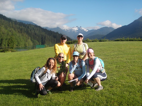
11 June 2011 - 12 Starters/12 Finishers
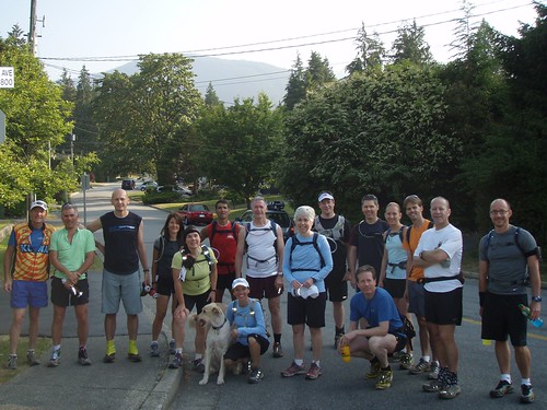
 An enthusiastic group of fat asses assembled at the Griffin rec center parking lot just before 8:00 this morning. It immediately struck me that we indeed are a special breed of runner. Mike, who seems normal enough at first glance, was wearing Hoka platform runners. Katie, at the other end of the shoe scale, had on a pair of new Vibram 5 finger foot-gloves. Several of my running companions asked me where the 5 KG brass pig was that I took with me on a 25K leg of the course last year. Katie was wearing her party dress. We must have been quite a sight for the patrons of the rec center weight room!
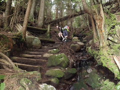
 That's about when I saw the first big, hairy, black ass to my immediate left.
 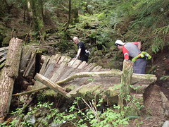 hen I saw the cubby bear sitting on a fence at just about my head-height.
 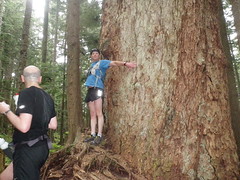 Why is it that the last bit of trail before the Cypress picnic area seemed longer this year? When we arrived at our destination, our group was welcomed by Des who greeted us with, "What took you guys so long?"
Post Event Survey - Please take a moment to give us your feedback here.
Results:
| Points | First Name | Last Name | City | Event | Time |
|---|---|---|---|---|---|
| 1 | Jim | Swadling | North Vancouver | 42km - custom | 5:20 |
| 1 | Michael | McNamara | Bellingham | 30km - Custom | 4:02 |
| 2 + 1* | desmond | mott | north vancouver | 25km - Up | 3:01 |
| 1 | Paul | Cubbon | N Van | 25km - Up | 4:01 |
| 2+1* +2** | Ean | Jackson | North Vancouver | 25K - Up | 4:01 |
| 2 | Robert | Westendorp | Vancouver | 25K - Up | 4:03 |
| 1 | Katie | Longworth | North Vancouver! | 25K - Up | |
| 2 | Dario | Herrera | New Westminster | 67km - custom | ? |
| 2 | Pamela | Keck | North Vancouver | 18km - custom | 2:30 |
| 1 | Helen | Tilley | White Rock | 18km - custom | 2:30 |
| 2 | Killaine | Sharman | North Vancouver | 15km - custom | 2:30 |
| 2+1* | Sibylle | Tinsel | North Vancouver | 15km - custom | 2:40 |
| 2 | Stacy | Otter | Bellingham | 0 | DNS |
2010 - Year 8 - XTC Results

12 June 2010 - 26 Starters/26 Finishers
 After weeks and weeks of rain and cool temperatures, those who showed up for the 8th annual XTC were treated to blue skies and pleasant temperatures. Given the Cypress Picnic area (25K turnaround) was closed for renos, several participants opted to run out and back from Cleveland Dam. Most, however opted for the 50K. Many thanks, Des, for stashing water for everyone at the turnaround.
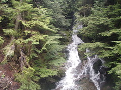
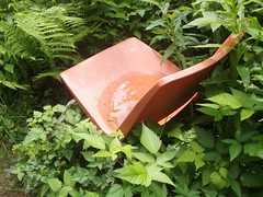 Our discussion turned to how the teapot came to be next to the trail? Then there was the red chair. How and why was it sitting next to the trail? When we arrived at the slippery bridge, a group of returning runners had opted to wade through the creek rather than risk sliding into it! Thanks to Guy, Killaine and I got a ride back at 25K and was able to get in a bit of yardwork as the 50K runners enjoyed their run home.
Post Event Survey - Please take a moment to give us your feedback here. You can find Scott's blog post on his XTC run here.
Results:
| First Name | Last Name | City | Event | Points | Time |
|---|---|---|---|---|---|
| David | Papineau | Vancouver | 50K | 2 + 1* | 05:36 |
| Tim | Wiens | Vancouver | 50K | 2 | 05:36 |
| desmond | mott | north vancouver | 50K | 2 + 1* | 6:35 |
| Dario | Herrera | New Westminster | 50K | 2 | 06:06 |
| David | Crerar | North Vancouver | 50K | 2 | 06:09 |
| Scott | McMurtrey | Pullman | 50K | 2 | 06:26 |
| Sadie | The Ultra Dog | 50K | 06:26 | ||
| Bill | Dagg | Vancouver | 50K | 2 + 1* | 06:42 |
| Jess | Dagg | Vancouver | custom 49K | 2 + 1* | 10:00 |
| Kelly | Corday | Vancouver | custom 46K | 2 +1* | 9:30 |
| Michael | McNamara | Bellingham | custom 44K (no second dogleg) | 2 | 07:15 |
| Jonathan | Weresch | Vancouver | custom 44K (no second dogleg) | 2 | 07:15 |
| Lishe | O'Kiely | Vancouver | custom 37K | 2 | 5:45 |
| Elizabeth | Tod | West Vancouver | custom 37K | 2 | 5:45 |
| Killaine | Sharman | 25K - Up | 1 | 03:33 | |
| Ean | Jackson | North Vancouver | 25K - Up | 2 + 2** + 1* | 03:38 |
| Piggy Porker | 25K - Up | 03:38 | |||
| Gilles | Barbeau | Vancouver | 25K - Down | 2 | 03:53 |
| John | Machray | North Vancouver | 25K - Down | 1 | 03:53 |
| David | Montgomery | Custom - 24K | 1 | 05:04 | |
| Rachel | Fouladi | Burnaby | Custom - 24K | 2 + 1* | 05:19 |
| Jackie | Montgomery | Vancouver | Custom - 24K | 2 + 1* | 05:19 |
| Sibylle | Tinsel | North Vancouver | Custom - 24K | 2 + 1* | 05:19 |
| Jessica | Glowacki | Vancouver | Custom - 20K | 2 | 3:30 |
| Pamela | Keck | North Vancouver | Custom - 20K | 2 | 3:30 |
| Helen | Tilley | White Rock | Custom - 20K | 2 | 3:30 |
2009 - Year 7 - XTC Results
13 June 2009 - 18 Starters/18 Finishers
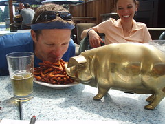 Everyone was in great spirits as we counted down to the start at Griffin Gym in North Vancouver... start of the 25K up and 50K events. Several folks immediately jumped in my car and we rushed toward the Cypress Mountain start of the 25K "down" event. "Stop!", came the cry, "Garage sale!!" So, we stopped to check it out. As the 4 of us headed back to the car with a 1-liter beer mug (25-cents) and a kite ($2), I swore I saw the golden piggy wink at me. "Hey guys... our new mascot!" And so it came to be that Club Fat Ass acquired the golden porker ($4)!
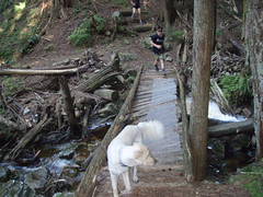 The Skyline Trail section of the XTC follows a ramrod straight telephone line across the side of Cypress Mountain. The trail itself is anything but ramrod straight, however, as it zigs and zags into the forest and dips down into about a dozen canyons. Each canyon has a waterfall and a refreshingly cool breeze. One of these days I am going to go for a dip in Brother's Creek...
PS Have any post race comment? Please post them below.
Photos: A slideshow of photos can be found here (coming soon). Photos added to the Flickr CFA group and tagged with XTC2009 XTC and ClubFatAssEvents will automatically be added to this slideshow.
Report: Coming soon
Post Event Survey - Please take a moment to give us your feedback here.
Results
| First Name | Last Name | Event | Points | Time |
| Paul | Cubbon | 50K | 2 | 6:09 |
| Jason | Oliver | 50K | 2 | 6:13 |
| desmond | mott | 50K | 3* | 6:17 |
| scott | donatelli | 50K | 2 | 7:17 |
| Jessica | Glowacki | 50K | 2 | 7:37 |
| Dave | Smith | 50K | 2 | 7:37 |
| Gord | Thompson | 50K | 2 | 7:42 |
| Gilles | Barbeau | 25K - Up | 1 | 4:23 |
| Craig | Moore | 25K - Up | 3* | 4:23 |
| Claudia | Bullington | 25K - Up | 3* | 5:25 |
| Sibylle | Tinsel | 25K - Up | 3* | 5:25 |
| Patricia | Barry | 25K - Up | 2 | 5:27 |
| Steve | Deller | 25K - Down | 1 | 4:00 |
| Christina | Pow | 25K - Down | 1 | 4:00 |
| Rick | Arikado | Roll Your Own | 1 | 5:01 (40K) |
| Penny | Jakobsen | Roll Your Own | 2 | 5:02 (38K) |
| Ean | Jackson | down without dogleg | 4** | 2:54 |
| Erik | J | down without dogleg | 2:54 | |
| *garbage P ** EH point |
2008 - Year 6 - XTC Results

A slideshow of photos can be found here.Photos added to the Flickr CFA group and tagged with XTC2008 will automatically be added to this slideshow. If anybody has a start photo, please send to me and I'll post here.
My race report? Well, I didn't run far due to an injury, so I missed most of the action. what I can report on, however, is that it was a great day for a run with friends... at least those who took pity on my sorry, fat ass and ran with me at the back of the pack.
There was the requisite whining about the "dogleg" section by Run Rik and a handful of others. Nobody crossed a bear because it had been so cold of late that they all slept in. The bushes under the telephone lines on the Canyon Crawl section, which normally almost overgrow the trail, were not a problem at all as they were stunted.
Everyone who ran the section near the Cypress picnic area got muddy shoes as some sort of tractor had been through recently and tore up the undergrowth. Penny fell and got a boo-boo on her knee... I hope she heals in time to knacker it again during the Knee Knacker 50K next month.
A special "Congrats!" to Jonathan who ran his first ultra at the XTC. Thanks to Kintec, Trail Runner magazine and the Mosquito Creek Grill for the prizes and rehydration libations.
| First Name | Last Name | Home Town | Event | Time | Points |
| Mark | Lesack | surrey | 50K | 5:25 | 1 |
| David | Crerar | North Vancouver | 50K | 5:53 | 3 |
| Rob | Ruff | Surrey | 50K | 5:53 | 2 |
| Desmond | mott | north vancouver | 50K | 5:58 | 3 |
| Paul | Cubbon | N Van | 50K | 6:27 | 3 |
| Gord | Thompson | Coquitlam | 50K | 7:13 | 2 |
| Monty | Watts | North Vancouver | 50K | 7:13 | 2 |
| Jonathan | Weresch | Vancouver | 50K | 7:28 | 2 |
| Darin | Joseph | Brackendale | 50K | ||
| Michael | spagnut | vancouver | 50K | ||
| Doug | MacKay | North Vancouver | 42.8K | 6:05 | 2 |
| Ann | Taylor | North Vancouver | 40K | 5:23 | 2 |
| Penny | Jakobsen | North Van | 40K | 5:23 | 2 |
| Ellie | Greenwood | Vancouver | 33.9K | 3:30 | 2 |
| Reg | Hornsby | Chilliwack | 32K | 5:23 | 1 |
| Rick | Arikado | Vancouver | 32.5K | 4:45 | 1 |
| Bill | Dagg | Vancouver | 25K - Up | 2:48 | 2 |
| Tony | Brooks | North Vancouver | 25K - Up | 3:09 | 2 |
| Fiona | Black | North Vancouver | 25K - Down | 2:45 | 2 |
| Jim | Hatch | North Van | 25k - Down |
2:45 | 1 |
| Gottfried | grosser | n vancouver | 25K | 3:15 | 2 |
| Killaine | sharman | north van | 22K | 3:00 | 2 |
| Amy | MacArthur | Burnaby | 22K | 3:00 | 2 |
| Wendy | Montgomery | Brackendale | 13K | 1:25 | 2 |
| Ean | Jackson | north vancouver | 12K | 1:25 | 3 |
| Gilles | Barbeau | Vancouver | -1 |
2007 - Year 5 - XTC Results

The weatherman lied. True, he promised some precipitation in the early afternoon. The first drops fell, however, as the shutter closed on the starter photo.
It's a well known fact that I am not crazy about running in the rain. The prospect of running for 6 hours in the rain, I admit, did not excite me. The weatherman has been wrong in the past, I thought. Maybe this will blow over and the sun will come out in an hour or so? Funny how none of the other runners seemed much to care.
The "Up" and "Roll Your Own" starters quickly broke into pace groups as we settled into our respective rhythms in the Mosquito Creek leg of the XTC. I found myself running with Pano, a talented runner who was attempting his first ultra today. We barely noticed the steep uphill or the increasing intensity of the rain as we chatted about heart rate training and what makes ultras different from shorter races.
At the tip of the Dogleg section, our conversation changed to how miserable the narrow, rocky creek bed was to run. Worse today, the bushes that encroached on the trail were saturated with water. Passing through them released big gobs of spray that soaked the passerby and filled their shoes with water. Ah, but it builds, character, I thought as I clenched my teeth, sucked it up and thought of Rick Arikado (who loves this section of trail more than any other) and Mark Fearman (who would have enjoyed it were he not in Sydney, Australia today.) What a difference a week makes. Why this time last Saturday it was 30C, dry as a bone and sunny for the Vancouver 100...and today I was already regretting that I didn't pack gloves and my winter gear!
Pano and I managed to briefly catch Doug and Angus at the Cleveland Dam fountain. We had barely started into the Capilano Loop section of the XTC when we ran into the "Down" runners (those who started at the upper end of the 25K route.) Perfect timimg! Pano and I warned of wet bushes ahead. Pete Stace-Smith and the Coquitlam crew smiled knowingly as they cautioned us that a similar fate awaited us in the Canyon Crawl section. We exchanged high 5's and continued in our respective directions.
The boys in the black CFA t-shirts eluded us on the big climb from Capilano Canyon up the side of Cypress Mountain, but we managed to catch Angus as he began to run out of gas (gotta work on that 2 1/2 hour low, brother Angus!) and Doug, who figured it was time to head home for the hot tub. By now, water had accumulated to the point where the trail appeared to be but a series of slippery islands in a sea of mud. Then we received the present the "Down" runners had promised: a 300m stretch of trail that had grown in with chest high ferns and bushes, each one saturated with water!
The wind picked up. It was foggy and the rain was coming in on a 45-degree angle. We reached the turnaround as Rob Ruff headed back down the trail. John McGrath, who was happy as a clam in his warm truck, beckoned us to join Desmond in the back seat and call it a day at 25K. I saw Pete's distinctive Norco truck and justified in my mind that I would also save him a trip up the mountain if I drove his truck back to the Griffin Gym start. Alas, I didn't have his key. Pano handed me a spare t-shirt and a bruised apricot as he slugged back a can of boost. We soldiered on.
Oddly enough, since the conditions couldn't get much worse, we started to notice the amazing fragrance of the bushes we slogged thorough and how the trail was lined with fat, juicy orange and red salmonberries. Pano and I paused briefly to marvel at the 500-year old Grandpa Capilano and watch a group of kayakers negotiate a crazy section of white water in the canyon. Before we knew it, we were back at the Cleveland Dam water fountain. We could almost smell the barn.
Ah... but we were not yet at the barn! The slog up Nancy Green Way and across the base of Grouse Mountain took the stuffing out of Pano. I was starting to freeze. With 10K of the Dogleg and straight shot down to the start remaining, I reluctantly left Pano to walk it in. (He finished. He then went home to bed.)
I was late for the finisher party. One cool lager led to another as we traded war stories. The girls doing the "Up" course managed to pick up a bunch of trash and avoided the worst of the rain. Unfortunately, Pete's camera was out of juice, so there is no starter photo for the "Down" group.
Thanks to Trail Runner Magazine and North Shore Athletics, just about everyone at the party got a recognition award of some kind. Thanks to the Mosquito Creek Grill, all participants and crew were treated to a cool one. Congrats to Pano for completing his fist ultra, Rob Ruff for winning his first ultra and congrats to all who challenged the course and the weather in the 2007 XTC!
Ean Jackson
Host of the XTC
 Click on an image for a slideshow of all photos of the event.
 Photo left: Documentary evidence that Lorraine earned bonus points for collecting trash
Photo right: Des and Angus heading for the Tower of Power on the infamous Dogleg section
Results
17 Starters / 17 Finishers
| Last Name | First Name | City/Town | Event |
Points |
Time |
| Ruff | Rob | Surrey | 50K | 2 | 6:21 |
| Ean | Jackson | North Vancouver | 50k | 3 | 6:41 |
| Skrivanos | Pano | North Vancouver | 50K | 2 | 7:09 |
| Lee | Baldwin | Burnaby | 35K | 2 | 5:20 |
| MacKay | Doug | North Vancouver | 32K - Roll your Own | 2+1 | 4:23 |
| Mott | desmond | n.vancouver | 25K Up | 2 | 3:10 |
| Angus | McLellan | Vancouver | 25K Up | 1 | ? |
| Daoust | Dan | Coquitlam | 25K Down | 2 | 3:25 |
| Gallant | Rhonda | Port Moody | 25K Down | 2 | 3:25 |
| Madsen | Sonja | Port Coquitlam | 25K Down | 2 | 3:25 |
| Stace-Smith | Peter | Coquitlam | 25K Down | 2 | 3:25 |
| Ulriksen | Todd | Maple Ridge | 25K Down | 1 | 3:25 |
| Van Gaalen | Peter | Coquitlam | 25K Down | 2 | 3:25 |
| Barry | Patricia | Vancouver | 15K - Roll your Own | 2+1 | 2:17 |
| Sibylle | Tinsel | North Vancouver | 15K - Roll your Own | 2+1 | 2:17 |
| Suomi | Lorraine | North Vancouver | 15K - Roll your Own | 1+1 | 2:17 |
| Jensen | Karl | North Vancouver | 3K - Walking Wounded | 1 | 0:30 |
| John | McGrath | North Vancouver | crew | 1 | |
| Sawchuk | Darren | Maple Ridge | 25K Down | -1 | DNS |
2006 - Year 4 - XTC Results
Thinking back over the past 4 runnings of the Vancouver Skyline XTC, I tried to come up with some thoughts about what was special or unique about this year. It didn't monsoon, nor was it hot and dry. None of the participants got hopelessly lost. Nobody got hurt. There were no bear sightings or earthquakes. Everything went well and everyone had a good run... what more could we ask for?
For the first time in the history of the XTC, we started exactly on time. The 20-odd runners aiming to run the "up" route soon broke into pace groups and started to peel layers on the challenging, but runnable Mosquito Creek section.
The nice thing about this event and this course is that there is little competitive stress and the course can be easily adjusted on the fly to accommodate a hangover, hard training week or for that matter, lack of training. While the main pack headed off on the infamous Dogleg section, a small group made an executive decision to shorten their run from 25K to 18K. Meanwhile, Desmond from Richmond lost his course description and also unintentionally deviated from the main route, while Rick Arikado kept to the course but cursed his old nemesis, the Dogleg.
The solitude of the trails was interrupted on the Grouse View section of the run. As the Fat Asses ran downhill to Cleveland Dam, the last of the Seek the Peak runners were soldiering uphill. There were high 5s and shouts of encouragement as running friends briefly crossed paths.
Once through the winding trails of the Capilano Canyon and on to the TransCanada Trail, the map route is a straight shot of only 8K. Easy, right? Not! While the map is accurate, the trail climbs and descends dozens of canyons and crosses innumerable little creeks with slippery little bridges as it contours around Cypress Mountain. (Check out the maps and trail profiles with thanks to Rick and Tim.)
Ah, the solitude of the trail. As Tim Weins charged down the trail in the lead, he enthusiastically wished a, "Great day, eh?" to a pair of hikers he approached from behind. The first almost had a coronary from fright and the second a coronary from laughing at her friend. With Desmond Mott close behind, Tim continued to storm toward the 25K turnaround.
While the majority of XTC runners progressed uphill, my kids and I were doing the "down" course. There had been a lot of brush cleaning done under the telephone lines recently, so we were spared having to wade through the chest-high salmonberry bushes as in previous years. We passed the time calling out "soaker!" every time one of us stepped in a creek, spongy moss or mud hole.
Feeling his legs after completing the Vancouver 100 only a week earlier, Bill Dagg begged a few stale chocolate Easter eggs off my kids. They worked a miracle and, rejuvenated, he continued to chase Elke down the trail toward the 25K endpoint. While most of us regrouped and headed home to clean up, Desmond Mott ran back to the start and a place in the record books as the only person to complete the 50K "up and down" version of the XTC this year.Thanks to the Mosquito Creek Grill, North Shore Athletics, KINeSYS and Trail Runner magazine, everyone who came to the finisher party enjoyed a free beer and went home with a draw prize.
Congrats to everyone who participated in and supported the XTC this year!
Ean Jackson
Host of the Vancouver Skyline XTC
| First Name | Last Name | Event | Points | Time |
| Desmond | Mott | 50K | 2 | 6:22 |
| Rick | Arikado | 42.8 | 2 | 5:56 |
| Elke | Bauer | 25K Up | 2 | 3:35 |
| Tim | Wiens | 25K Up | 2 | 2:57 |
| Doug | MacKay | 25K Up | 1 | 3:10 |
| Baldwin | Lee | 25K Up | 2 | 3:28 |
| KIm | Taylor | 25K Up | 2 | 3:28 |
| Bill | Dagg | 25K Up | 2 | 3:35 |
| Michelle | Fredette | Roll your Own | 2 | 1:37 |
| Maureen | Wiens | Roll your Own | 1 | 2:30 |
| Caroline | Lepard | Roll your Own | 1 | 2:50 |
| Ryan | Reilly | Roll your Own | 1 | 2:50 |
| Andy | Nicol | Roll your Own | 2 | 3:00 |
| Desmond | Stephens | Roll your Own | 2 | 3:00 |
| Claudia | Bullington | Roll your Own (17.8km) | 2 | 3:37 |
| Michele | Sherstan | Roll Your Own (17.8km) | 2 | 3:37 |
| Sibylle | Tinsel | Roll Your Own (17.8km) | 2 | 3:37 |
| Ean | Jackson | 7.5km | 3 | 2:00 |
| Johanna | Jackson | 7.5km | 2 | 2:00 |
| Erik | Jackson | 7.5km | 2 | 2:00 |
| Mark | Grist | 0 | -1 | DNS |
| Dom | Repta | 0 | -1 | DNS |

2005 - Year 3
2005 - Fourth Vancouver Skyline XTC
Those who have run the XTC several times will look back at 2005 as being the year of the "big rain". Environment Canada called for a sunny morning with 30% chance of showers in the afternoon, however we had barely hit the trail when the first big drops fell. By the time we had reached the top of Mosquito Creek, the rain was falling so hard you could barely see the person in front of you!
The field of 17 runners soon broke up into 3 main packs: The elite field led by the Repta brothers, Terry Lewis, Jim Mandelli, Andy Nichol and Mark Pedlow, the Lepard family and those who thought they didn't need course instructions.
At the lead, Jim went ass-over-teakettle on a slippery log and wacked his knee. Wader decided to fall off a bridge and into a rushing creek. The salmonberry bushes along the Trans-Canada Trail were full of ripe berries, but also hadn't yet been trimmed since last summer, so the lead boys had the opportunity to hone their bushwhacking skills.
Kristine kept up with the boys until the steep climb up Cypress Mountain. While only a few minutes back from the lead pack at the junction with the Hollyburn Chute, she zigged instead of zagged and ended up running past her Mom who was participating in a 5-Peaks race.
Congrats to Wade Repta and Desmond Mott who both completed the full 50K...and to Tim Lepard who won the prize for picking up the most trash along the Trans-Canada Trail.
As we settled down on the outdoor patio to enjoy a cool pint and some nachos at the post-run get-together, the sun came out. Many thanks to Kelly and Krystal at the Mosquito Creek Grill and congrats to all who participated. See you in 2006!
Ean Jackson
Host of the XTC
| Name | City/Town | Time / Distance | |
| 50K | |||
| Wade | Repta | Vancouver | 6:04 |
| Desmond | Mott | North Vancouver | 6:04 |
| 25K Up | |||
| Ryan | Reilly | North Vancouver | 4:00 |
| Caroline | Lepard | North Vancouver | 4:00 |
| Tim | Lepard | West vancouver | 4:00 |
| Custom | |||
| Mark | Pedlow | North Vancouver | 5:20 - 42 |
| Dom | Repta | Vancouver | 5:20 - 42 |
| Terry | Lewis | North Vancouver | 5:20 - 42K |
| Jim | Mandelli | North Vancouver | 5:00 - 41K |
| Doug | MacKay | North Vancouver | 4:33 - 40K |
| Kristine | Chambers | Vancouver | 3:23 - 17K |
| Holly | Freeland | West Vancouver | 3:23 - 28K |
| Richard | Ernst | West Vancouver | 3:23 - 28K |
| Andy | Nicol | Vancouver | 3:00 - 25K |
| Sue | Nicholson | North Vancouver | 2:00 - 16K |
| Ean | Jackson | North Vancouver | 1:26 - 13K |
| Gabbi | Kwan | North Vancouver | 0:52 - 5.8K |
17 starters
17 finishers


The XTC was first held in 2003 as an alternative training run for those who didn't get into the Diez Vista 50K. It was moved from an early spring date to an early summer date to accommodate a gap in the local ultramarathon race schedule.
Please follow the links below for results from previous years.
2004 - Year 2
12 June 2004: Front: Rick Arikado, Bill Dagg, Ean Jackson Back: Rob Jones, Wade Repta, Dom Repta, Desmond Mott, Andy NicolMissing: Doug Kier (did 'down' course)
|
|
Name |
Event |
Home town |
Finish Time |
|
1 |
Rob Jones |
25K Up |
North Vancouver |
2:51 |
|
1 |
Bill Dagg |
50K |
Vancouver |
5:18 |
|
2 |
Wade Repta |
50K |
Vancouver |
5:50 |
|
2 |
Ean Jackson |
50K |
North Vancouver |
5:50 |
| Dom Repta | C - 43K | Vancouver | 4:45 | |
|
Rick Arikado |
C - 43K |
Vancouver |
5:21 |
|
| Desmond Mott | C - 40K | North Vancouver | 5:00 | |
|
Andy Nicol |
C - 23K |
Vancouver |
2:25 |
|
| Doug Kier | C - 20K | North Vancouver | 2:05 |
9 starters, 9 finishers
2003 - Year 1 - June

Front: Ean Jackson, Scott Riddell; Back: Jim Hatch, Rick Arikado, Sean Finucane, Wendy Montgomery, Brian Bjornson, Rich Rawling
Based on feedback from earlier in the year, the second Saturday of June was chosen as an annual date that addressed a hole in the competitive running agenda in British Columbia. The XTC also became affiliated with Club Fat Ass.
|
| Name | Event | Home town | Finish Time |
| 1 | Wendy Montgomery | 50K | North Vancouver | 5:03 |
| 2 | Jim Hatch | 50K | North Vancouver | 5:35 |
| 1 | Rich Rawling | 25K Up | West Vancouver | 2:21 |
| 2 | Scott Riddell | 25K Up | North Vancouver | 2:29 |
| 3 | Ean Jackson | 25K Up | North Vancouver | 2:38 |
| 4 | Rick Arikado | 25K Up | Vancouver | 2:48 |
| 1 | Sean Finucane | 25K Down | Vancouver | 3:15 |
| 1 | Brian Bjornson | custom | North Vancouver | 2:15 |
8 starters, 8 finishers
2003 - Year 1 - April
12 April 2003 - The First Running
The inaugural Vancouver Skyline XTC was held on 12 April 2003. Participation was by invitation only to make sure any bugs were worked out of the course and the pre- and post-event venues. Our post-event survey revealed that the course was runable, but a bit tougher than anticipated.
| Name | Event | Home town | Finish Time | |
| 1 | Jim Swadling | 50K | North Vancouver | 4:50 |
| 2 | Andy Nicol | 50K | Vancouver, BC | 5:14 |
| 2 | Ean Jackson | 50K | North Vancouver, BC | 5:14 |
| 3 | Wendy Montgomery | 50K | North Vancouver | 5:22 |
| 4 | Scott Riddell | 50K | North Vancouver, BC | 5:41 |
| 5 | Ann Taylor | 50K | North Vancouver | 6:05 |
| 1 | Pat Barry | 25K Up | Vancouver | 4:33 |
| 1 | Sibylle Tinsel | 25K Up | North Vancouver | 4:33 |
| 1 | Gavin Tansley | custom | Burnaby, BC | 4:40 |
| 2 | Kendell Dickinson | custom | Vancouver, BC | 4:23 |
| 3 | Kelly Wilcox | custom | Vancouver, BC | 4:20 |
| 4 | Dave Cressman | custom | Vancouver, BC | 3:46 |
| 5 | Rainy Kent | custom | Burnaby, BC | 3:30 |
| 6 | Jim Hatch | custom | North Vancouver | 3:15 |
| 7 | Andrea Cobham | custom | Vancouver | 2:55 |
| 8 | Kirby Patton | custom | Vancouver | 2:55 |
| 9 | Kevin Thomson | custom | Vancouver | 2:55 |
17 starters, 17 finishers
Background
The Route
The Vancouver Skyline XTC run course was designed by experienced trail runners to showcase the very best features of Vancouver's North Shore mountains... from a runner's perspective. Participants can expect to hear rushing water as a constant companion as they traverse canyons and streams. If the weather is good, expect to take in some of the most spectacular city and mountain panoramas in the lower mainland of British Columbia. Salmon and bald eagle sightings are commonplace. The trail is also home to black bear.
The route has been carefully selected to offer a wide variety of terrain. Footing ranges from pavement to crushed gravel to mossy roots, rocks and sections of old 'corduroy' logging road. Expect wet feet. While there are a few technical sections, top competitors will find the course is almost entirely 'runable.'
Participants are offered the option of competing in a 25 kilometer "Up", a 25 kilometer "Down", a 50 kilometer "Up and Down" or a "Roll your own" custom-distance run. The "Up", the 50K and the custom-distance runs climb from Griffin Gym in North Vancouver to the Quarry picnic area in Cypress Provincial Park. The "Down" run starts at the picnic area and ends at the gym.
A significant section of the course is held on the TransCanada Trail, the longest hiking trail in the world, on the anniversary of the TCT's founding. One of Canada's largest and most popular ultra-distance trail race, the Knee Knackering North Shore Trail Run, also shares part of the XTC route. While the Baden Powell, Skyline and various Capilano Canyon trails have been in the hearts and minds of local trail runners for years, the XTC is the first trail running event to be held on this course.
2012 is the 10th anniversary of the Vancouver Skyline XTC. After founding and managing the event for 9 years, Ean Jackson has passed the baton to Wendy Montgomery. Wendy is one of a handful of Canadian women to have earned the coveted Western States silver buckle. She has participated in several Canadian National 100K run teams and founded Wendy's Get Your Fat Ass Off the Couch, a popular CFA trail run on Vancouver's north shore.
The Differences
The objective of the organizers is to challenge both mind and body of the runner... and to leave minimum impact on the environment.
Most road races and trail events are clearly marked by race officials with fluorescent cones, surveyor tape or lime along the race course. Most races have 'aid' stations, where runners can access food and water provided by the organizers. With the benefit of aid and course marking, competitors can focus on putting their heads down and running.
The philosophy of the Vancouver XTC is to emphasize the journey rather than the destination. Self-reliance and low impact are key. There is no 'official' aid or trail marking provided by organizers of the Vancouver Skyline XTC. 'Crewing' by family or friends is encouraged as long as crew members offer the same support to others in the race.
Participants download from the Internet directions based on natural and physical landmarks. As with orienteering, runners who pause frequently to consult the written directions have the opportunity to catch faster runners who go off the trail. Runners who have trained on the course have a distinct competitive advantage. Detailed questions and clarifications are provided in the FAQ.
Past Participants and Results
Thanks!
Our hope is to make this event totally self-supporting. In other words, do all of the organization beforehand and also participate. This would be an impossible dream without a lot of behind the scenes help.
Contact us if you'd like to support the Vancouver XTC in some way, we'd love to have you onboard. At the very least, we can promise you a place on this Thanks page!
Many thanks to:
|
Kintec: Thanks for the draw prizes! Kintec is also offering you 10% off any regularly priced inventory. All you have to do is mention you're a Club Fat Ass member when you pay for your purchases. |
|
|
TrailRunner: Thank you for the 2 gift subscriptions to your popular magazine as draw prizes. Also for offering members of Club Fat Ass a special discounted subscription price |
|
| KINeSYS: Thanks for the assortment of body and sun care products to keep all participants protected from the elements. |
|
Mosquito Creek Bar & Grill - Kelly and Lucie Nielson
Show up to the post-run get-together and tell the hostess you're a Fat Ass. Owners Kelly and Lucie have promised to buy you a beer! There may even be some other prizes.
Rick Arikado
Rick is our official cartographer and current XTC record holder for running the farthest off-course. Thanks for the great map, Rick. Hopefully you won't need it next time!
Sibylle Tinsel - Club Fat Ass - www.ClubFatAss.com
Club Fat Ass helps the race with web hosting, online registration and coaches us on how to host a safe, fun, environmentally-friendly event.
Volunteers
Believe it or not, it takes a lot of time and hard work to put on a free, loosely-organized event. Many thanks to everyone who helped refine, measure and pre-run the course, all who offered feedback on the course description and advice for improving the event. While we promise no aid, thank you in advance to our family members, friends and other event supporters who came out on race day with a few surprises.
FAQ
Q: I've never done a trail run before. Is this a good place to start?
Q: Can I run less than 25K or more than 50K?
● ~ 6K - Griffin gym to Skyline reference point and back
● ~13K - Griffin Gym, the Dogleg and back
● ~27K - Griffin gym, the Dogleg, Grouse View to Cleveland Dam reference point and back
If you want to run more than 50K, you will get special recognition as a certified glutton for punishment. We strongly recommend you have a pacer for any distance over 50K and that you carry a cell phone so you can call someone to pick you up, if necessary
Q: How tough is the course?
Q: Do I really need to print off the course instructions and bring them with me?
Q: This event is free, but for Club Fat Ass members only. How do I get into the club?
Q: Can I wait until the last minute and join at the start?
Q: It's a free world. What's to stop me from just running the course.
Q: What if I get lost?
Q: Do I get credit for any time I spend off-course?
Q: Couldn't you mark the course like just about every other running race I've ever been in? It's a pain to pause and read instructions.
Q: What is the 'Rule of the Trail'?
Q: What if I have to heed the call of nature.
Q: What should I bring on race day?
Q: I am supposed to be self-sufficient because there is no aid provided. Can I get a friend to come out and give me food and drink along the route?
Q: Can I bring my friends and family to the finisher party even if they didn't run or volunteer?
Q: If I choose to run a 25K, how do I get back to my starting point?
A: Best to check-in with someone who is running the opposite 25K to you so one of you can drive the other's car back. You can either ask if someone can give you a ride as a comment on the event page or, if you're signed up as a Club member, you can contact another member directly.
Q: Are there any trophies, prizes or other hardware or freebies?
Q: How accurate is the course marking?
Q: When will the 'official' results be available?
Q: I love the Trans Canada Trail. How do I buy a piece of it?
Confirmation Page - XTC
The following people are registered for this event:No one has registered yet.
Contact - XTC
Event Home | Registration | Agenda | Course | Results
Background | Thanks! | FAQ | Contact
I welcome your comments, criticisms, feedback and
questions.
Please be sure to read the the Agenda and FAQ section of this website
first, as this is where I've tried to answer the most frequently asked
questions.
Wendy Montgomery - Your CFA Event Host
Post Event Survey - XTC
Please take a moment to share your thoughts about the Club Fat Ass event you recently participated in. Your feedback will help your Event Host to refine their event next year.
This is an anonymous, confidential survey (as long as you are not logged in to the website) so please feel free to offer constructive criticism about any aspect of the event in the comment box.