What:
We'll run from Spanish Banks east concession to Pacific Spirit Park and back for ~15km (middle third of the New Year's Day Fat Ass 50 Run course)
Agenda:
Meet on Saturday December 18th at 8:15am Spanish Banks East concession, which is shown by the green arrow on this map 49.276298,-123.2.
We'll start running at 8:30am sharp.
We'll run to Pacific Spirit Regional Park and back. 7.7 km each way for total of 15.4km. Ideally, we'll run as a group, or break into two groups to suit desired paces.
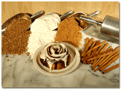
Bonus: The first five people who sign up, show up, and join me afterwards at Grounds for Coffee (2565 Alma Street @ 10th Ave) will win a free cinny bun.
Registration:
Registration is free for members and non-members alike. Please register here.
Whining is not allowed. You are responsible for your own well being and safety and should be self sufficient.
Please read the Release of All Claims. By participating in this event you agree to the terms of the Release of All Claims.
Backgrounder:
I had already reserved this day to run the Galbraith Mountain Tour in Bellingham, and since that event is cancelled this year, I would like to use the time to gear up for the New Year's Day event. This is a familiarization run for the middle 15km of the run portion of the Vancouver New Year's Day Fat Ass 50 Run and Freeze Your Fat Ass Swim. I did not make it to this section of the course last year, having turned back at Kits Pool. If I make it this far in 2011, I'd like to have a better idea of where to go.
The Course: Dirt trails that range from rooty and muddy to wheelchair-accessible.
- at the end of the parking lot, look both ways before you
cross the paved road into a ravine. Go right and uphill on the
trail.
- take Admirality Trail west parallel to beach along the
escarpment to the end
- go left (south) on Salish Trail. There's a long, tough
uphill. Go past school on left to Chancellor Blvd. Cross street
and reenter Salish Trail directly opposite
- continue along Salish Trail past UBC golf course (on left) to
University Blvd. Cross street and take Cleveland Trail (the one
on the left, nearest the golf course)
- continue straight on Cleveland Trail to the park offices (some
trailers) at 16th Avenue.
- Cross street and turn right (toward UBC) following trail next
to woods. Rejoin Salish Trail on left after about 400m
- continue along Salish to t-intersection (Powerline trail.)
This is where a lot of folks get lost. Turn left and go 125m
uphill
- rejoin Salish trail on right, then continue on Salish to
junction with Clinton trail and a clearing with a garbage can
and wooden bench. Go right, then left and along trail next to
the paved roadway (SW Marine Drive).
- continue about 700m parallel to road to the park sign
(Southwest Marine Drive, Comosun Street and 41st Avenue.)
Turnaround point: Southwest Marine/41st/Comosun.


Comments
We're In!
Ground for Coffee are my FAVOURITE!!! Bill and I will be there.
Cheers,
Jess
We're NOT in now
Hey Reagan,
Bill is injured and my usual running friend that I want to train with can't make this particular run, so I will be changing my plans and skip out on this run and the cinny bun.
See you possibly for the New Year's day run!
Dave and I are in!
Hi Reagan and Jess, Dave and I are coming out for this. Jess, you're always welcome to run with us if you haven't made other plans.
See you Saturday. Jackie
Would love to join you
Spanish Banks East or Spanish Banks West
Hi Reagan!
Is that the concession at Spanish Banks East or the concession at Spanish Banks West?
http://vancouver.ca/Parks/rec/beaches/spanishbank.htm
It is not labelled on the parks map, but I think Spanish Banks West concession is the building at : 49.277525,-123.222759
The Spanish Bank East concession is labelled (I think even correctly) at: 49.276298,-123.214965
Very tempting to be one of the the first five to register for this flash!
Absolute cheers!!!
We'll start at Spanish Banks East concession
We'll start at Spanish Bank East concession at which is the green arrow on this map 49.276298,-123.2 .
Hi Rachel, I beat you to it
Hi Rachel,
 . Reagan might correct me on this, but I assume we meet at the last concession, just before we veer off onto the trails in Pacific Spirit Park.
I beat you to it
Always good to check with the host ;)
... and to be careful not to assume ... (see Reagan's note: definitely not the last concession building). West actually may even be closed at this time of year...
Probably won't be able to make it to the cinny-fest... as tempting as it is... ;)
Good that you picked that
Good that you picked that up, Rachel. I actually worked backwards from the course description to assume the west parking lot. I might be mistaken, but I think we cross the road after the west concession and the description thus should read in the beginning: "follow the gravel bike path to the next concession (Spanish Bank West). End the end of the parking lot west of the concession cross Marine Drive and join the trail into the ravine..." I am not 100% sure and leave this up to Reagan to adjust.